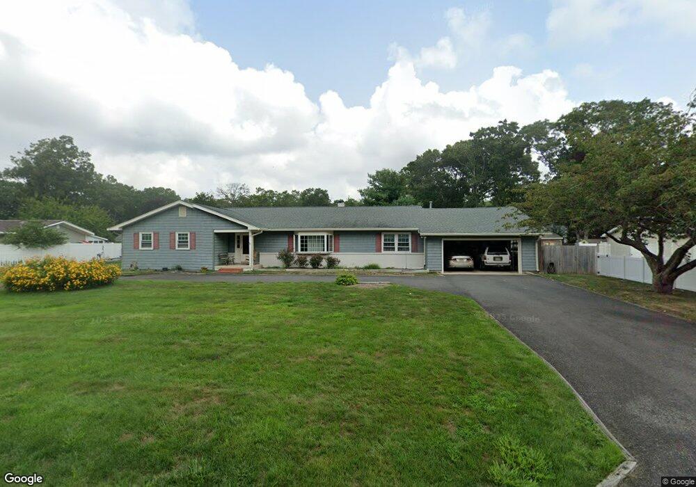
14 Timberlea Ln Cape May Court House, NJ 08210
Estimated Value: $478,362 - $623,000
--
Bed
--
Bath
2,379
Sq Ft
$231/Sq Ft
Est. Value
About This Home
This home is located at 14 Timberlea Ln, Cape May Court House, NJ 08210 and is currently estimated at $548,841, approximately $230 per square foot. 14 Timberlea Ln is a home located in Cape May County with nearby schools including Middle Township Elementary No. 1, Middle Township Elementary No. 2, and Middle Township Middle School.
Ownership History
Date
Name
Owned For
Owner Type
Purchase Details
Closed on
Jul 15, 1998
Sold by
Beresford David
Bought by
Murphy Francis X and Murphy Mary T
Current Estimated Value
Home Financials for this Owner
Home Financials are based on the most recent Mortgage that was taken out on this home.
Original Mortgage
$75,000
Outstanding Balance
$15,322
Interest Rate
6.98%
Estimated Equity
$533,519
Purchase Details
Closed on
Apr 29, 1991
Sold by
Macgibeny Michelle
Bought by
Fagan Suzanne
Purchase Details
Closed on
Apr 12, 1991
Sold by
Lauriello Joseph
Bought by
Macgibeny Michelle
Purchase Details
Closed on
Jul 23, 1988
Sold by
Lauriello Joseph and Lauriello Michelle
Bought by
Lauriello Joseph and Lauriello Michelle
Create a Home Valuation Report for This Property
The Home Valuation Report is an in-depth analysis detailing your home's value as well as a comparison with similar homes in the area
Home Values in the Area
Average Home Value in this Area
Purchase History
| Date | Buyer | Sale Price | Title Company |
|---|---|---|---|
| Murphy Francis X | $175,000 | -- | |
| Fagan Suzanne | $135,000 | -- | |
| Macgibeny Michelle | -- | -- | |
| Lauriello Joseph | -- | -- |
Source: Public Records
Mortgage History
| Date | Status | Borrower | Loan Amount |
|---|---|---|---|
| Open | Murphy Francis X | $75,000 |
Source: Public Records
Tax History Compared to Growth
Tax History
| Year | Tax Paid | Tax Assessment Tax Assessment Total Assessment is a certain percentage of the fair market value that is determined by local assessors to be the total taxable value of land and additions on the property. | Land | Improvement |
|---|---|---|---|---|
| 2025 | $6,489 | $307,700 | $153,000 | $154,700 |
| 2024 | $6,489 | $307,700 | $153,000 | $154,700 |
| 2023 | $6,326 | $307,700 | $153,000 | $154,700 |
| 2022 | $6,145 | $307,700 | $153,000 | $154,700 |
| 2021 | $5,507 | $307,700 | $153,000 | $154,700 |
| 2020 | $5,874 | $307,700 | $153,000 | $154,700 |
| 2019 | $5,723 | $307,700 | $153,000 | $154,700 |
| 2018 | $5,634 | $307,700 | $153,000 | $154,700 |
| 2017 | $5,520 | $307,700 | $153,000 | $154,700 |
| 2016 | $5,382 | $307,700 | $153,000 | $154,700 |
| 2015 | $5,342 | $307,700 | $153,000 | $154,700 |
| 2014 | $5,308 | $307,700 | $153,000 | $154,700 |
Source: Public Records
Map
Nearby Homes
- 311 Court House Dennis Rd
- 311 S Dennis Rd
- 430 Route 9 N
- 430 Route 9 N Unit 45
- 416 Goshen Rd
- 23 Acorn Ln
- 24 Church St
- 13 Poplar St
- 4 Railroad Ave
- 390 Court House South Dennis Rd
- 26 Crest Rd
- 220 Hand Ave
- 416 Hand Ave
- 00 Clinton
- 0 Detroit Unit 232200
- 11 Harbor Crossings
- 00 Clinton Ave
- 0 Detroit Unit 232199
- 6 & 8 Pierces Point Rd
- 33 E Mechanic St