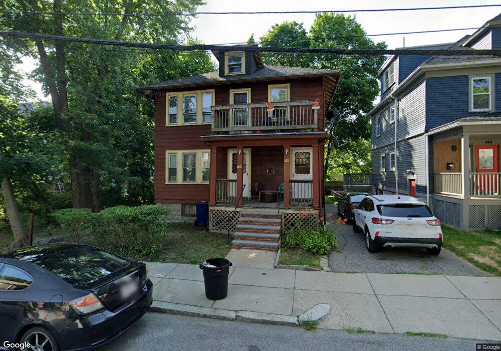
140 Hollingsworth St Unit 142 Mattapan, MA 02126
Hyde Park NeighborhoodEstimated Value: $620,000 - $723,359
4
Beds
2
Baths
2,080
Sq Ft
$332/Sq Ft
Est. Value
About This Home
This home is located at 140 Hollingsworth St Unit 142, Mattapan, MA 02126 and is currently estimated at $690,840, approximately $332 per square foot. 140 Hollingsworth St Unit 142 is a home located in Suffolk County with nearby schools including KIPP Academy Boston Charter School, Boston Preparatory Charter Public School, and St. Mary of the Hills School.
Ownership History
Date
Name
Owned For
Owner Type
Purchase Details
Closed on
Dec 11, 2015
Sold by
Pryce Cecil
Bought by
Pryce Ft
Current Estimated Value
Purchase Details
Closed on
Apr 30, 1998
Sold by
Est Obrien Alice L and Fontes Cnsvr Antony
Bought by
Pryce Cecil E
Home Financials for this Owner
Home Financials are based on the most recent Mortgage that was taken out on this home.
Original Mortgage
$108,600
Interest Rate
7.04%
Mortgage Type
Purchase Money Mortgage
Create a Home Valuation Report for This Property
The Home Valuation Report is an in-depth analysis detailing your home's value as well as a comparison with similar homes in the area
Home Values in the Area
Average Home Value in this Area
Purchase History
| Date | Buyer | Sale Price | Title Company |
|---|---|---|---|
| Pryce Ft | -- | -- | |
| Pryce Cecil E | $120,700 | -- |
Source: Public Records
Mortgage History
| Date | Status | Borrower | Loan Amount |
|---|---|---|---|
| Previous Owner | Pryce Cecil E | $108,600 |
Source: Public Records
Tax History Compared to Growth
Tax History
| Year | Tax Paid | Tax Assessment Tax Assessment Total Assessment is a certain percentage of the fair market value that is determined by local assessors to be the total taxable value of land and additions on the property. | Land | Improvement |
|---|---|---|---|---|
| 2025 | $7,103 | $613,400 | $179,100 | $434,300 |
| 2024 | $6,138 | $563,100 | $191,000 | $372,100 |
| 2023 | $5,655 | $526,500 | $178,600 | $347,900 |
| 2022 | $5,304 | $487,500 | $165,400 | $322,100 |
| 2021 | $4,954 | $464,300 | $157,500 | $306,800 |
| 2020 | $4,773 | $452,000 | $153,800 | $298,200 |
| 2019 | $4,408 | $418,200 | $112,000 | $306,200 |
| 2018 | $3,983 | $380,100 | $112,000 | $268,100 |
| 2017 | $3,694 | $348,800 | $112,000 | $236,800 |
| 2016 | $3,620 | $329,100 | $112,000 | $217,100 |
| 2015 | $3,038 | $250,900 | $84,400 | $166,500 |
| 2014 | $2,869 | $228,100 | $84,400 | $143,700 |
Source: Public Records
Map
Nearby Homes
- 23 Caton St
- 90 Hollingsworth St
- 645 River St
- 25 Alpine St Unit 7
- 48-50 Rockdale St
- 20 Massasoit St
- 7 Winborough St
- 770 Cummins Hwy Unit 1
- 770 Cummins Hwy Unit 22
- 839-843 Cummins Hwy
- 42 Osceola St
- 10 Brockton St
- 16 Blue Hill Ave
- 112 Brush Hill Rd
- 84 Blue Hills Pkwy
- 34 Ridlon Rd
- 95 Woodhaven St
- 96 Brook Rd
- 16 Concord Ave Unit 1
- 128 Blue Hills Pkwy
- 144 Hollingsworth St
- 25 Caton St
- 36 Rector Rd
- 38 Rector Rd
- 40 Rector Rd Unit 42
- 23 Caton St
- 137 Hollingsworth St
- 137 Hollingsworth St Unit 139
- 34 Rector Rd
- 139 Hollingsworth St
- 141 Hollingsworth St
- 30 Caton St
- 145 Hollingsworth St
- 149 Hollingsworth St
- 135 Hollingsworth St
- 26 Caton St
- 26 Caton St Unit 1
- 21 Caton St
- 149 Hollingsworth St
- 30 Rector Rd