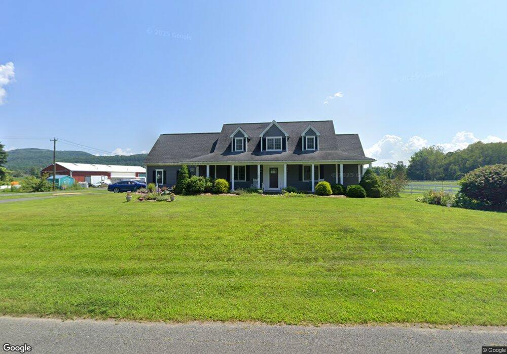
140 Russell St Sunderland, MA 01375
Estimated Value: $627,000 - $809,000
4
Beds
4
Baths
3,132
Sq Ft
$229/Sq Ft
Est. Value
About This Home
This home is located at 140 Russell St, Sunderland, MA 01375 and is currently estimated at $717,433, approximately $229 per square foot. 140 Russell St is a home located in Franklin County with nearby schools including Sunderland Elementary School and Frontier Regional School.
Ownership History
Date
Name
Owned For
Owner Type
Purchase Details
Closed on
Dec 20, 2004
Sold by
Mcdonald Lianne C
Bought by
Kolasinski Mark and Kolasinski Elizabeth
Current Estimated Value
Home Financials for this Owner
Home Financials are based on the most recent Mortgage that was taken out on this home.
Original Mortgage
$84,500
Interest Rate
5.68%
Mortgage Type
Purchase Money Mortgage
Create a Home Valuation Report for This Property
The Home Valuation Report is an in-depth analysis detailing your home's value as well as a comparison with similar homes in the area
Home Values in the Area
Average Home Value in this Area
Purchase History
| Date | Buyer | Sale Price | Title Company |
|---|---|---|---|
| Kolasinski Mark | $85,000 | -- |
Source: Public Records
Mortgage History
| Date | Status | Borrower | Loan Amount |
|---|---|---|---|
| Open | Kolasinski Mark | $350,000 | |
| Closed | Kolasinski Mark | $84,500 |
Source: Public Records
Tax History Compared to Growth
Tax History
| Year | Tax Paid | Tax Assessment Tax Assessment Total Assessment is a certain percentage of the fair market value that is determined by local assessors to be the total taxable value of land and additions on the property. | Land | Improvement |
|---|---|---|---|---|
| 2025 | $86 | $661,400 | $123,300 | $538,100 |
| 2024 | $8,691 | $661,400 | $123,300 | $538,100 |
| 2023 | $8,010 | $625,800 | $112,100 | $513,700 |
| 2022 | $8,129 | $553,000 | $96,100 | $456,900 |
| 2021 | $3,413 | $490,900 | $89,100 | $401,800 |
| 2020 | $7,546 | $488,700 | $89,100 | $399,600 |
| 2019 | $3,190 | $476,400 | $86,500 | $389,900 |
| 2018 | $7,056 | $470,400 | $83,000 | $387,400 |
| 2017 | $2,969 | $469,600 | $83,000 | $386,600 |
| 2016 | $6,987 | $476,600 | $81,400 | $395,200 |
| 2015 | $6,820 | $476,600 | $81,400 | $395,200 |
| 2014 | $6,663 | $476,600 | $81,400 | $395,200 |
Source: Public Records
Map
Nearby Homes
- 146 Old Amherst Rd
- 110 Old Amherst Rd
- 15 S Plain Rd
- 238 N Main St
- Lot C Mountain Rd
- Lot A Mountain Rd
- Lot B Mountain Rd
- 15 Crestview Dr
- 40 Eastern Ave
- 24 Graves St
- 24 Elm St
- 134 Montague Rd
- 3 Depot Rd
- 32 Swamp Rd
- 13 Capt Lathrop Dr
- 0 North St Unit 73407299
- 73 Depot Rd
- 259 Long Plain Rd
- 7 Stage Rd
- 113 Juggler Meadow Rd
- 132 Russell St
- 152 Russell St
- 156 Russell St
- 163 Russell St
- 125 Russell St
- 37 Brown Cross Rd
- 124 Russell St
- 166 Russell St
- 31 Brown Cross Rd
- 169 Russell St
- 119 Russell St
- 118 Russell St
- 27 Brown Cross Rd
- 172 Russell St
- 175 Russell St
- 113 Russell St
- 112 Russell St
- 176 Russell St
- 107 Russell St
- 179 Russell St