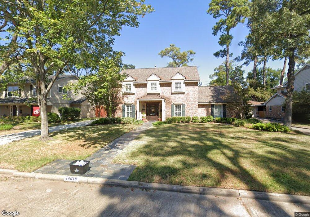
14018 Perthshire Rd Houston, TX 77079
Memorial NeighborhoodEstimated Value: $836,000 - $868,000
4
Beds
4
Baths
2,871
Sq Ft
$298/Sq Ft
Est. Value
About This Home
This home is located at 14018 Perthshire Rd, Houston, TX 77079 and is currently estimated at $856,694, approximately $298 per square foot. 14018 Perthshire Rd is a home located in Harris County with nearby schools including Wilchester Elementary School, Spring Forest Middle School, and Stratford High School.
Ownership History
Date
Name
Owned For
Owner Type
Purchase Details
Closed on
May 20, 2019
Sold by
Shoemaker Mary Katherine
Bought by
Taylor George E and Taylor Cheryl C
Current Estimated Value
Purchase Details
Closed on
May 19, 1998
Sold by
Stiffel Schwab Builders Llc
Bought by
Taylor George Ewing and Taylor Cheryl Cook
Home Financials for this Owner
Home Financials are based on the most recent Mortgage that was taken out on this home.
Original Mortgage
$200,000
Interest Rate
7.11%
Purchase Details
Closed on
Feb 20, 1998
Sold by
Boddeker Ann C and Hampton Lewis Winton
Bought by
Stiffel Schwab Builders Llc
Home Financials for this Owner
Home Financials are based on the most recent Mortgage that was taken out on this home.
Original Mortgage
$185,000
Interest Rate
6.91%
Mortgage Type
Purchase Money Mortgage
Create a Home Valuation Report for This Property
The Home Valuation Report is an in-depth analysis detailing your home's value as well as a comparison with similar homes in the area
Home Values in the Area
Average Home Value in this Area
Purchase History
| Date | Buyer | Sale Price | Title Company |
|---|---|---|---|
| Taylor George E | -- | Tradition Title Company | |
| Taylor George Ewing | -- | Charter Title Company | |
| Stiffel Schwab Builders Llc | -- | Stewart Title |
Source: Public Records
Mortgage History
| Date | Status | Borrower | Loan Amount |
|---|---|---|---|
| Previous Owner | Taylor George Ewing | $200,000 | |
| Previous Owner | Stiffel Schwab Builders Llc | $185,000 |
Source: Public Records
Tax History Compared to Growth
Tax History
| Year | Tax Paid | Tax Assessment Tax Assessment Total Assessment is a certain percentage of the fair market value that is determined by local assessors to be the total taxable value of land and additions on the property. | Land | Improvement |
|---|---|---|---|---|
| 2025 | $5,139 | $679,928 | $447,150 | $232,778 |
| 2024 | $5,139 | $720,902 | $447,150 | $273,752 |
| 2023 | $5,139 | $704,915 | $447,150 | $257,765 |
| 2022 | $13,924 | $624,031 | $406,500 | $217,531 |
| 2021 | $13,219 | $541,440 | $365,850 | $175,590 |
| 2020 | $13,807 | $551,026 | $365,850 | $185,176 |
| 2019 | $14,426 | $551,026 | $365,850 | $185,176 |
| 2018 | $3,436 | $551,000 | $365,850 | $185,150 |
| 2017 | $14,859 | $568,000 | $365,850 | $202,150 |
| 2016 | $14,175 | $620,400 | $365,850 | $254,550 |
| 2015 | $9,326 | $623,907 | $365,850 | $258,057 |
| 2014 | $9,326 | $480,333 | $308,940 | $171,393 |
Source: Public Records
Map
Nearby Homes
- 14135 Kimberley Ln
- 14122 Barryknoll Ln
- 13931 Kingsride Ln
- 14123 Misty Meadow Ln
- 14171 Misty Meadow Ln
- 807 Patchester Dr
- 710 Patchester Dr
- 736 Country Place Dr Unit A
- 800 Country Place Dr Unit 1306
- 14311 Misty Meadow Ln
- 14226 Misty Meadow Ln
- 14228 Misty Meadow Ln
- 14143 Lost Meadow Ln
- 714 Country Place Dr Unit D
- 726 Country Place Dr Unit C
- 14387 Misty Meadow Ln
- 14151 Lost Meadow Ln
- 738 Country Place Dr Unit C
- 14322 Misty Meadow Ln
- 14325 Lost Meadow Ln
- 14022 Perthshire Rd
- 14014 Perthshire Rd
- 14023 Woodthorpe Ln
- 14019 Woodthorpe Ln
- 14010 Perthshire Rd
- 14027 Woodthorpe Ln
- 14015 Woodthorpe Ln
- 14019 Perthshire Rd
- 14023 Perthshire Rd
- 14015 Perthshire Rd
- 14031 Woodthorpe Ln
- 14011 Woodthorpe Ln
- 14006 Perthshire Rd
- 14011 Perthshire Rd
- 14007 Woodthorpe Ln
- 14007 Perthshire Rd
- 14018 Pebblebrook Dr
- 14002 Perthshire Rd
- 14014 Pebblebrook Dr
- 14022 Pebblebrook Dr