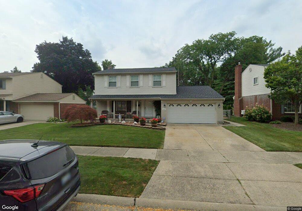
14033 Hubbard St Livonia, MI 48154
Estimated Value: $383,565 - $421,000
--
Bed
1
Bath
2,166
Sq Ft
$189/Sq Ft
Est. Value
About This Home
This home is located at 14033 Hubbard St, Livonia, MI 48154 and is currently estimated at $408,891, approximately $188 per square foot. 14033 Hubbard St is a home located in Wayne County with nearby schools including Kennedy Elementary School, Johnson Upper Elementary School, and Frost Middle School.
Ownership History
Date
Name
Owned For
Owner Type
Purchase Details
Closed on
Jan 30, 2016
Sold by
Warra Maha S and Warra Nabih R
Bought by
Warra Maha S and Warra Nabih R
Current Estimated Value
Purchase Details
Closed on
Sep 12, 2015
Sold by
Warra Maha S and Warra Nabih R
Bought by
Warra Rimon N and Warra Maha S
Purchase Details
Closed on
Jan 16, 2015
Sold by
Warra Maha S and Warra Rimon N
Bought by
Warra Maha S
Purchase Details
Closed on
Oct 24, 2011
Sold by
Warra Maha S and Warra Rimon N
Bought by
Warra Maha S and Warra Rimon N
Purchase Details
Closed on
Nov 18, 2008
Sold by
Warra Maha S
Bought by
Warra Maha S
Purchase Details
Closed on
Feb 22, 2002
Sold by
Khalil David
Bought by
Warra Maha S
Purchase Details
Closed on
Nov 30, 1999
Sold by
Collins Angelique M
Bought by
Khalil David
Create a Home Valuation Report for This Property
The Home Valuation Report is an in-depth analysis detailing your home's value as well as a comparison with similar homes in the area
Home Values in the Area
Average Home Value in this Area
Purchase History
| Date | Buyer | Sale Price | Title Company |
|---|---|---|---|
| Warra Maha S | -- | None Available | |
| Warra Rimon N | -- | Attorney | |
| Warra Maha S | -- | None Available | |
| Warra Maha S | -- | None Available | |
| Warra Maha S | -- | None Available | |
| Warra Maha S | $246,900 | -- | |
| Khalil David | $205,000 | -- |
Source: Public Records
Tax History Compared to Growth
Tax History
| Year | Tax Paid | Tax Assessment Tax Assessment Total Assessment is a certain percentage of the fair market value that is determined by local assessors to be the total taxable value of land and additions on the property. | Land | Improvement |
|---|---|---|---|---|
| 2025 | $2,196 | $177,200 | $0 | $0 |
| 2024 | $2,196 | $169,200 | $0 | $0 |
| 2023 | $2,095 | $155,300 | $0 | $0 |
| 2022 | $3,679 | $141,900 | $0 | $0 |
| 2021 | $3,574 | $132,800 | $0 | $0 |
| 2019 | $3,429 | $123,400 | $0 | $0 |
| 2018 | $1,772 | $112,600 | $0 | $0 |
| 2017 | $3,136 | $108,000 | $0 | $0 |
| 2016 | $3,297 | $108,000 | $0 | $0 |
| 2015 | $7,592 | $95,400 | $0 | $0 |
| 2012 | -- | $71,840 | $16,450 | $55,390 |
Source: Public Records
Map
Nearby Homes
- 14214 Cranston St
- 32950 Perth St
- 33025 Martin St
- 32136 Lyndon St
- 33040 Allen St
- 14327 Arden St
- 14563 Melrose St
- 14677 Auburndale St
- 14879 Fairfield St
- 14164 Bainbridge St
- 15075 Hubbard St Unit 5
- 31126 Grennada St
- 31221 Lyndon St
- 14154 Hubbell St
- 14292 Hubbell St
- 15040 Berwick St
- 32651 5 Mile Rd Unit 15
- 30831 Lyndon St
- 14127 Hillcrest St
- 30261 Buckingham St
- 14015 Hubbard St
- 14051 Hubbard St
- 13997 Hubbard St
- 14069 Hubbard St
- 14087 Hubbard St
- 13979 Hubbard St
- 14032 Hubbard St
- 14050 Hubbard St
- 14014 Hubbard St
- 14068 Hubbard St
- 13996 Hubbard St
- 14105 Hubbard St
- 14040 Brookfield St
- 14086 Hubbard St
- 13978 Hubbard St
- 13961 Hubbard St
- 32420 Scone St
- 32442 Scone St
- 14104 Hubbard St
- 14123 Hubbard St