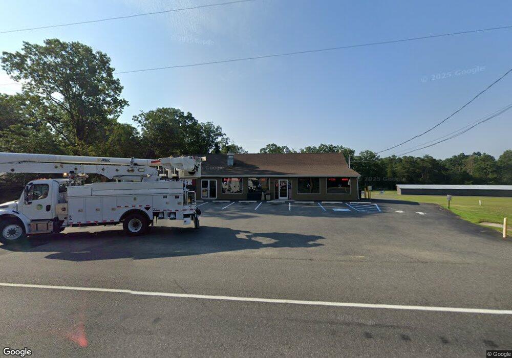
1405 Mays Landing Rd Millville, NJ 08332
Estimated Value: $308,414
--
Bed
--
Bath
--
Sq Ft
0.41
Acres
About This Home
This home is located at 1405 Mays Landing Rd, Millville, NJ 08332 and is currently estimated at $308,414. 1405 Mays Landing Rd is a home located in Cumberland County with nearby schools including Dr. William Mennies School, Landis Middle School, and Vineland Senior High School.
Ownership History
Date
Name
Owned For
Owner Type
Purchase Details
Closed on
Jan 13, 2025
Sold by
Belfus Isaac and Isaac Belfus Living Trust
Bought by
Jys Realty Llc
Current Estimated Value
Purchase Details
Closed on
Feb 17, 2005
Sold by
Zayas Jose D
Bought by
Purple Basic Co Llc
Purchase Details
Closed on
Mar 30, 2000
Sold by
Eget Corinne
Bought by
Zayas Jose D and Zayas Rebecca
Home Financials for this Owner
Home Financials are based on the most recent Mortgage that was taken out on this home.
Original Mortgage
$75,000
Interest Rate
8.3%
Mortgage Type
Commercial
Create a Home Valuation Report for This Property
The Home Valuation Report is an in-depth analysis detailing your home's value as well as a comparison with similar homes in the area
Home Values in the Area
Average Home Value in this Area
Purchase History
| Date | Buyer | Sale Price | Title Company |
|---|---|---|---|
| Jys Realty Llc | $300,000 | None Listed On Document | |
| Jys Realty Llc | $300,000 | None Listed On Document | |
| Purple Basic Co Llc | $155,000 | -- | |
| Zayas Jose D | $95,000 | -- |
Source: Public Records
Mortgage History
| Date | Status | Borrower | Loan Amount |
|---|---|---|---|
| Previous Owner | Zayas Jose D | $75,000 |
Source: Public Records
Tax History Compared to Growth
Tax History
| Year | Tax Paid | Tax Assessment Tax Assessment Total Assessment is a certain percentage of the fair market value that is determined by local assessors to be the total taxable value of land and additions on the property. | Land | Improvement |
|---|---|---|---|---|
| 2025 | $10,103 | $317,300 | $40,200 | $277,100 |
| 2024 | $10,103 | $317,300 | $40,200 | $277,100 |
| 2023 | $10,036 | $317,300 | $40,200 | $277,100 |
| 2022 | $9,738 | $317,300 | $40,200 | $277,100 |
| 2021 | $9,560 | $317,300 | $40,200 | $277,100 |
| 2020 | $9,287 | $317,300 | $40,200 | $277,100 |
| 2019 | $9,160 | $317,300 | $40,200 | $277,100 |
| 2018 | $8,919 | $317,300 | $40,200 | $277,100 |
| 2017 | $8,472 | $317,300 | $40,200 | $277,100 |
| 2016 | $8,174 | $317,300 | $40,200 | $277,100 |
| 2015 | $7,872 | $317,300 | $40,200 | $277,100 |
| 2014 | $7,444 | $317,300 | $40,200 | $277,100 |
Source: Public Records
Map
Nearby Homes
- 4225 Mays Landing Rd
- 1916 Bessie Way
- 447 Manor Ave
- 429 Manor Ave
- 9 Greenlawn Ct
- 1921 Mountain Dr
- 1812 Newcombtown Rd
- 1713 Hance Bridge Rd
- 4770 Stoney Bridge Rd
- 2801 Leaming Mill Rd
- 910 Hill Ln
- 909 Barbara Terrace
- 2110 Mays Landing Rd Unit 199
- 2110 Mays Landing Rd Unit 14
- 2110 Mays Landing Rd Unit 73
- 2110 Mays Landing Rd Unit 77
- 2110 Mays Landing Rd Unit 169
- 2110 Mays Landing Rd
- 2110 Mays Landing Rd Unit 317
- 2110 Mays Landing Rd Unit 267
- 1425 Mays Landing Rd
- 1449 Mays Landing Rd
- 539 Crest Ave
- 2305 E Broad St
- 2232 E Broad St
- 2222 E Broad St
- 2212 E Broad St
- 536 Crest Ave
- 1455 Mays Landing Rd
- 530 Crest Ave
- 525 Crest Ave
- 2210 E Broad St
- 528 Crest Ave
- 528 Crest Ave
- 519 Crest Ave
- 2211 E Broad St
- 2208 E Broad St
- 524 Crest Ave
- 533 Manor Ave
- 2203 E Broad St