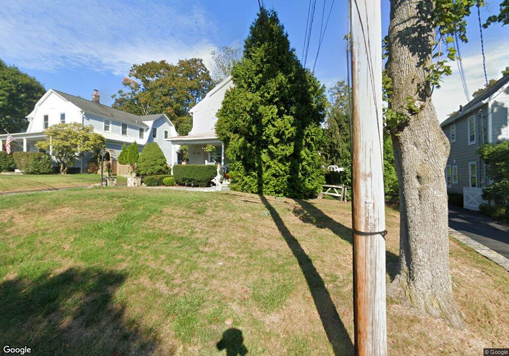
141 Richmond Hill Rd New Canaan, CT 06840
Estimated Value: $1,656,921 - $1,849,000
--
Bed
--
Bath
--
Sq Ft
0.26
Acres
About This Home
This home is located at 141 Richmond Hill Rd, New Canaan, CT 06840 and is currently estimated at $1,762,980. 141 Richmond Hill Rd is a home located in Fairfield County with nearby schools including West Elementary School, Saxe Middle School, and New Canaan High School.
Ownership History
Date
Name
Owned For
Owner Type
Purchase Details
Closed on
Aug 26, 2003
Sold by
Holt Barry W and Holt Tara N
Bought by
Benenson Serena
Current Estimated Value
Home Financials for this Owner
Home Financials are based on the most recent Mortgage that was taken out on this home.
Original Mortgage
$540,000
Interest Rate
5%
Create a Home Valuation Report for This Property
The Home Valuation Report is an in-depth analysis detailing your home's value as well as a comparison with similar homes in the area
Home Values in the Area
Average Home Value in this Area
Purchase History
| Date | Buyer | Sale Price | Title Company |
|---|---|---|---|
| Benenson Serena | $720,000 | -- |
Source: Public Records
Mortgage History
| Date | Status | Borrower | Loan Amount |
|---|---|---|---|
| Open | Benenson Serena | $650,000 | |
| Closed | Benenson Serena | $540,000 | |
| Closed | Benenson Serena | $60,000 | |
| Previous Owner | Benenson Serena | $275,000 |
Source: Public Records
Tax History Compared to Growth
Tax History
| Year | Tax Paid | Tax Assessment Tax Assessment Total Assessment is a certain percentage of the fair market value that is determined by local assessors to be the total taxable value of land and additions on the property. | Land | Improvement |
|---|---|---|---|---|
| 2025 | $14,535 | $870,870 | $631,400 | $239,470 |
| 2024 | $14,056 | $870,870 | $631,400 | $239,470 |
| 2023 | $11,943 | $630,560 | $577,920 | $52,640 |
| 2022 | $11,583 | $630,560 | $577,920 | $52,640 |
| 2021 | $11,451 | $630,560 | $577,920 | $52,640 |
| 2020 | $11,451 | $630,560 | $577,920 | $52,640 |
| 2019 | $11,501 | $630,560 | $577,920 | $52,640 |
| 2018 | $11,346 | $644,350 | $535,080 | $109,270 |
| 2017 | $11,140 | $644,350 | $535,080 | $109,270 |
| 2016 | $10,887 | $644,350 | $535,080 | $109,270 |
| 2015 | $10,672 | $644,350 | $535,080 | $109,270 |
| 2014 | $10,375 | $644,350 | $535,080 | $109,270 |
Source: Public Records
Map
Nearby Homes
- 197 Park St Unit 13
- 66 Seminary St
- 254 Park St Unit 254
- 23 Mead St
- 317 Park St
- 160 Park St Unit 103
- 160 Park St Unit 104
- 2 Mead St Unit 2
- 136 South Ave
- 15 Burtis Ave Unit Townhome D
- 15 Burtis Ave Unit West Penthouse B
- 15 Burtis Ave Unit Townhome A
- 15 Burtis Ave Unit East Plaza 203
- 42 Forest St Unit A
- 60 East Ave
- 64 East Ave
- 354 South Ave
- 79 Locust Ave Unit 212
- 180 Summer St
- 25 Gower Rd
- 147 Richmond Hill Rd
- 137 Richmond Hill Rd
- 151 Richmond Hill Rd
- 129 Richmond Hill Rd
- 127 Richmond Hill Rd
- 127 Richmond Hill Rd Unit 127
- 157 Richmond Hill Rd
- 144 Richmond Hill Rd
- 140 Richmond Hill Rd
- 161 Richmond Hill Rd
- 148 Richmond Hill Rd
- 136 Richmond Hill Rd
- 5 Marshall Ridge Rd
- 657 Weed St
- 126A Richmond Hill Rd Unit 126A
- 126 Richmond Hill Rd Unit 126B
- 126 Richmond Hill Rd Unit 126A
- 126 Richmond Hill Rd
- 117 Richmond Hill Rd
- 130 Richmond Hill Rd