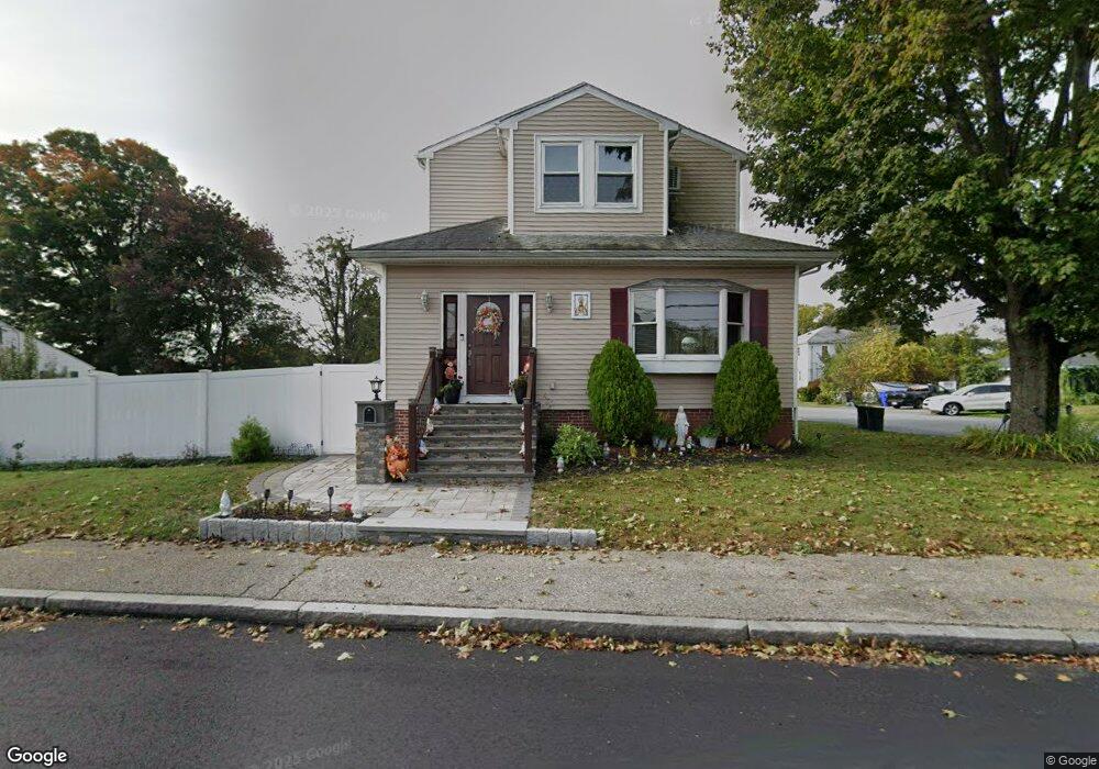
141 Wampanoag Trail Riverside, RI 02915
Kent Heights NeighborhoodEstimated Value: $486,000 - $828,000
5
Beds
2
Baths
2,713
Sq Ft
$221/Sq Ft
Est. Value
About This Home
This home is located at 141 Wampanoag Trail, Riverside, RI 02915 and is currently estimated at $599,545, approximately $220 per square foot. 141 Wampanoag Trail is a home located in Providence County with nearby schools including East Providence High School, The Gordon School, and St Mary Academy-Bay View.
Ownership History
Date
Name
Owned For
Owner Type
Purchase Details
Closed on
Apr 29, 2019
Sold by
Correia Benjamin M and Correia Alcida M
Bought by
Vieira-Moniz Paulo F and Vieira-Moniz Ana C
Current Estimated Value
Purchase Details
Closed on
Dec 22, 2010
Sold by
Quatrucci Sharon
Bought by
Correia Benjamin M and Correia Aleida M
Create a Home Valuation Report for This Property
The Home Valuation Report is an in-depth analysis detailing your home's value as well as a comparison with similar homes in the area
Home Values in the Area
Average Home Value in this Area
Purchase History
| Date | Buyer | Sale Price | Title Company |
|---|---|---|---|
| Vieira-Moniz Paulo F | $220,000 | -- | |
| Vieira-Moniz Paulo F | $220,000 | -- | |
| Correia Benjamin M | $154,000 | -- | |
| Correia Benjamin M | $154,000 | -- |
Source: Public Records
Mortgage History
| Date | Status | Borrower | Loan Amount |
|---|---|---|---|
| Previous Owner | Correia Benjamin M | $255,750 | |
| Previous Owner | Correia Benjamin M | $232,000 |
Source: Public Records
Tax History Compared to Growth
Tax History
| Year | Tax Paid | Tax Assessment Tax Assessment Total Assessment is a certain percentage of the fair market value that is determined by local assessors to be the total taxable value of land and additions on the property. | Land | Improvement |
|---|---|---|---|---|
| 2025 | $7,314 | $559,600 | $128,300 | $431,300 |
| 2024 | $6,425 | $419,100 | $107,000 | $312,100 |
| 2023 | $6,186 | $419,100 | $107,000 | $312,100 |
| 2022 | $6,554 | $299,800 | $59,600 | $240,200 |
| 2021 | $6,446 | $299,800 | $57,300 | $242,500 |
| 2020 | $6,173 | $299,800 | $57,300 | $242,500 |
| 2019 | $6,002 | $299,800 | $57,300 | $242,500 |
| 2018 | $5,965 | $260,700 | $58,500 | $202,200 |
| 2017 | $5,832 | $260,700 | $58,500 | $202,200 |
| 2016 | $5,803 | $260,700 | $58,500 | $202,200 |
| 2015 | $5,501 | $239,700 | $51,600 | $188,100 |
| 2014 | $5,501 | $239,700 | $51,600 | $188,100 |
Source: Public Records
Map
Nearby Homes
- 108 Ivan Ave
- 53 Wampanoag Trail
- 10 Fairfield Ave
- 59 Merritt Rd
- 36 Gerald St
- 180 Grassmere Ave
- 25 Ide Ave
- 87 Vincent Ave
- 14 Waterview Ave Unit 16
- 50 Kettle Point Ave Unit 50
- 74 Brookhaven Dr
- 26 Mayflower St
- 740 Veterans Memorial Pkwy
- 1463 S Broadway
- 132 S Rose St
- 75 Belmont Ave
- 17 Brown St Unit 19
- 3421 Pawtucket Ave
- 16 N Rose St
- 11 N Rose St
- 10 Elder Ave
- 149 Wampanoag Trail
- 168 Wampanoag Trail
- 133 Wampanoag Trail
- 18 Elder Ave
- 155 Wampanoag Trail
- 33 Garden Dr
- 22 Elder Ave
- 123 Wampanoag Trail
- 161 Wampanoag Trail
- 37 Garden Dr
- 5 Pickett Rd
- 6 Pickett Rd
- 29 Garden Dr
- 18 Sweetbriar Ave
- 176 Wampanoag Trail
- 30 Elder Ave
- 25 Elder Ave
- 26 Sweetbriar Ave
- 175 Wampanoag Trail