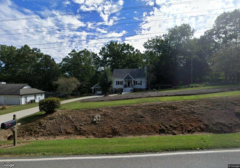
1411 Lothridge Rd Cleveland, GA 30528
Estimated Value: $307,127 - $339,000
3
Beds
2
Baths
1,485
Sq Ft
$219/Sq Ft
Est. Value
About This Home
This home is located at 1411 Lothridge Rd, Cleveland, GA 30528 and is currently estimated at $325,032, approximately $218 per square foot. 1411 Lothridge Rd is a home located in White County with nearby schools including White County 9th Grade Academy, Mount Yonah Elementary School, and White County Middle School.
Ownership History
Date
Name
Owned For
Owner Type
Purchase Details
Closed on
Jan 1, 2006
Sold by
Not Provided
Bought by
Allen Steve Arthur and Allen Mary Joyce
Current Estimated Value
Home Financials for this Owner
Home Financials are based on the most recent Mortgage that was taken out on this home.
Original Mortgage
$129,200
Outstanding Balance
$71,944
Interest Rate
6.21%
Mortgage Type
New Conventional
Estimated Equity
$253,088
Create a Home Valuation Report for This Property
The Home Valuation Report is an in-depth analysis detailing your home's value as well as a comparison with similar homes in the area
Home Values in the Area
Average Home Value in this Area
Purchase History
| Date | Buyer | Sale Price | Title Company |
|---|---|---|---|
| Allen Steve Arthur | -- | -- |
Source: Public Records
Mortgage History
| Date | Status | Borrower | Loan Amount |
|---|---|---|---|
| Open | Allen Steve Arthur | $129,200 |
Source: Public Records
Tax History Compared to Growth
Tax History
| Year | Tax Paid | Tax Assessment Tax Assessment Total Assessment is a certain percentage of the fair market value that is determined by local assessors to be the total taxable value of land and additions on the property. | Land | Improvement |
|---|---|---|---|---|
| 2025 | $1,838 | $90,212 | $12,000 | $78,212 |
| 2024 | $1,838 | $90,212 | $12,000 | $78,212 |
| 2023 | $1,322 | $78,288 | $10,000 | $68,288 |
| 2022 | $1,583 | $68,712 | $9,600 | $59,112 |
| 2021 | $1,438 | $55,636 | $7,200 | $48,436 |
| 2020 | $1,364 | $50,448 | $7,200 | $43,248 |
| 2019 | $1,368 | $50,448 | $7,200 | $43,248 |
| 2018 | $1,279 | $47,300 | $7,200 | $40,100 |
| 2017 | $1,276 | $47,612 | $7,200 | $40,412 |
| 2016 | $1,276 | $47,612 | $7,200 | $40,412 |
| 2015 | $1,218 | $119,030 | $7,200 | $40,412 |
| 2014 | $1,132 | $110,760 | $0 | $0 |
Source: Public Records
Map
Nearby Homes
- 2011 Lothridge Rd
- 915 Holiness Campground Rd
- 0 Holiness Campground Rd Unit 10629188
- 79 Hampton Hills Ln
- 164 Leatherford Rd
- 841 Yonah Meadow Dr
- 0 Black Rd Unit 7662078
- 0 Black Rd Unit 10620540
- 2301 Highway 254
- 00 Freeman Rd
- 0 Freeman Rd Unit LOT 3 10539998
- 0 Freeman Rd Unit LOT 4
- 0 Freeman Rd Unit LOT 2 10539989
- 1021 Black Rd
- 96 Joyce Dr Unit (OFF AIRPORT ROAD)
- 0 Highway 115 E Unit 10627896
- 3454 Highway 254
- 22 Laurel Park Dr
- 675 Washboard Rd
- 82 Tom Teague Rd
- 1399 Lothridge Rd
- 26 Davidson Rd
- 92 Davidson Rd
- 29 Davidson Rd
- 1285 Lothridge Rd
- 1285 Lothridge Rd Unit 6
- 136 Davidson Rd
- 105 Davidson Rd
- 32 Autumn Ln
- 191 Davidson Rd
- 0 Autumn Ln Unit LOT12 2728186
- 0 Autumn Ln
- 0 Autumn Ln Unit 7542746
- 0 Autumn Ln Unit 7264758
- 0 Davidson Rd Unit 7244717
- 0 Davidson Rd
- 176 Davidson Rd
- 90 Autumn Ln
- 102 Autumn Ln
- 23 Autumn Ln