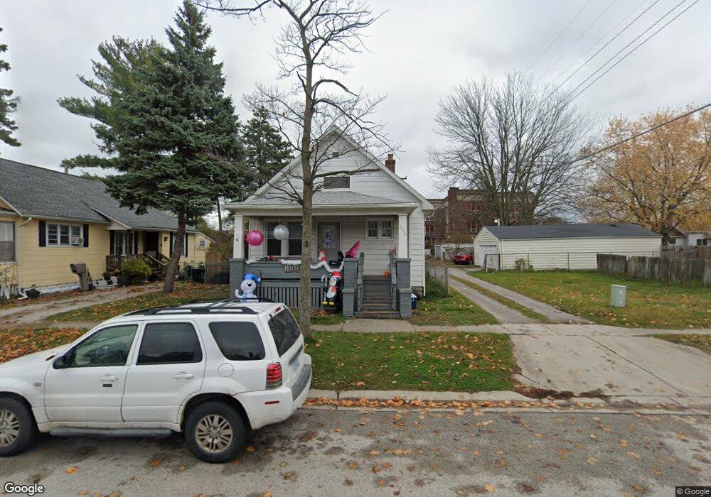
1416 11th St Port Huron, MI 48060
Estimated Value: $54,000 - $142,000
3
Beds
1
Bath
1,054
Sq Ft
$82/Sq Ft
Est. Value
About This Home
This home is located at 1416 11th St, Port Huron, MI 48060 and is currently estimated at $86,242, approximately $81 per square foot. 1416 11th St is a home located in St. Clair County with nearby schools including Woodrow Wilson Elementary School, Central Middle School, and Port Huron High School.
Ownership History
Date
Name
Owned For
Owner Type
Purchase Details
Closed on
Nov 6, 2024
Sold by
Ecker Mary L
Bought by
Bodeis Michael
Current Estimated Value
Purchase Details
Closed on
Apr 21, 2022
Sold by
Bodeis Michael L
Bought by
Bodeis Michael L
Purchase Details
Closed on
Dec 3, 2010
Sold by
Bodeis Michael L and Bodeis Gaye G
Bought by
Bodeis Michael L
Create a Home Valuation Report for This Property
The Home Valuation Report is an in-depth analysis detailing your home's value as well as a comparison with similar homes in the area
Home Values in the Area
Average Home Value in this Area
Purchase History
| Date | Buyer | Sale Price | Title Company |
|---|---|---|---|
| Bodeis Michael | $53,000 | None Listed On Document | |
| Bodeis Michael | $53,000 | None Listed On Document | |
| Bodeis Michael L | -- | Touma Watson Whaling Coury & S | |
| Bodeis Michael L | -- | None Listed On Document | |
| Bodeis Michael L | -- | None Available |
Source: Public Records
Tax History Compared to Growth
Tax History
| Year | Tax Paid | Tax Assessment Tax Assessment Total Assessment is a certain percentage of the fair market value that is determined by local assessors to be the total taxable value of land and additions on the property. | Land | Improvement |
|---|---|---|---|---|
| 2025 | $1,392 | $44,200 | $0 | $0 |
| 2024 | $1,169 | $41,800 | $0 | $0 |
| 2023 | $1,107 | $37,200 | $0 | $0 |
| 2022 | $1,055 | $29,600 | $0 | $0 |
| 2021 | $1,008 | $25,100 | $0 | $0 |
| 2020 | $1,012 | $21,900 | $21,900 | $0 |
| 2019 | $994 | $16,100 | $0 | $0 |
| 2018 | $972 | $16,100 | $0 | $0 |
| 2017 | $893 | $15,400 | $0 | $0 |
| 2016 | $785 | $15,400 | $0 | $0 |
| 2015 | $770 | $15,000 | $15,000 | $0 |
| 2014 | $770 | $14,300 | $14,300 | $0 |
| 2013 | -- | $14,300 | $0 | $0 |
Source: Public Records
Map
Nearby Homes
- 1410 11th St
- 1025 White St
- 1040 Chestnut St
- 1030 Chestnut St
- 1413 11th St
- 1039 White St
- 1107 White St
- 1104 Chestnut St
- 1108 Chestnut St
- 1023 White St
- 1115 White St
- 1114 Chestnut St
- 1029 Chestnut St
- 1417 10th St
- 1037 Chestnut St
- 1120 Chestnut St
- 1027 Chestnut St
- 1038 White St
- 1017 Chestnut St
- 1032 White St