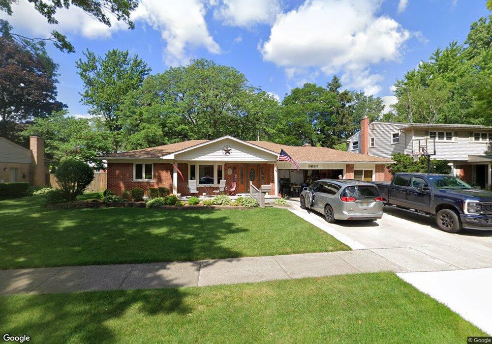
14183 Doris St Livonia, MI 48154
Estimated Value: $358,085 - $392,000
4
Beds
2
Baths
1,793
Sq Ft
$213/Sq Ft
Est. Value
About This Home
This home is located at 14183 Doris St, Livonia, MI 48154 and is currently estimated at $381,521, approximately $212 per square foot. 14183 Doris St is a home located in Wayne County with nearby schools including Roosevelt Elementary School, Emerson Middle School, and Cooper Upper Elementary School.
Ownership History
Date
Name
Owned For
Owner Type
Purchase Details
Closed on
Sep 9, 2014
Sold by
Woodcox Robert A and Woodcox Suzan V
Bought by
Woodcox Robert A and Woodcox Suzan V
Current Estimated Value
Home Financials for this Owner
Home Financials are based on the most recent Mortgage that was taken out on this home.
Original Mortgage
$50,000
Interest Rate
4.08%
Mortgage Type
Credit Line Revolving
Purchase Details
Closed on
Aug 6, 2014
Sold by
Woodcox Robert A and Woodcox Suzan V
Bought by
The Woodcox Family Living Trust
Home Financials for this Owner
Home Financials are based on the most recent Mortgage that was taken out on this home.
Original Mortgage
$50,000
Interest Rate
4.08%
Mortgage Type
Credit Line Revolving
Purchase Details
Closed on
Apr 25, 2003
Sold by
Nichols Suzan V and Woodcox Robert A
Bought by
Woodcox Robert A
Create a Home Valuation Report for This Property
The Home Valuation Report is an in-depth analysis detailing your home's value as well as a comparison with similar homes in the area
Home Values in the Area
Average Home Value in this Area
Purchase History
| Date | Buyer | Sale Price | Title Company |
|---|---|---|---|
| Woodcox Robert A | -- | Fidelity National Title | |
| Woodcox Robert A | -- | Fidelity National Title | |
| The Woodcox Family Living Trust | -- | None Available | |
| Woodcox Robert A | -- | Multiple |
Source: Public Records
Mortgage History
| Date | Status | Borrower | Loan Amount |
|---|---|---|---|
| Closed | Woodcox Robert A | $50,000 |
Source: Public Records
Tax History Compared to Growth
Tax History
| Year | Tax Paid | Tax Assessment Tax Assessment Total Assessment is a certain percentage of the fair market value that is determined by local assessors to be the total taxable value of land and additions on the property. | Land | Improvement |
|---|---|---|---|---|
| 2025 | $2,135 | $178,500 | $0 | $0 |
| 2024 | $2,135 | $168,400 | $0 | $0 |
| 2023 | $2,037 | $154,800 | $0 | $0 |
| 2022 | $3,577 | $140,300 | $0 | $0 |
| 2021 | $3,474 | $130,500 | $0 | $0 |
| 2019 | $3,333 | $111,600 | $0 | $0 |
| 2018 | $1,722 | $99,800 | $0 | $0 |
| 2017 | $3,048 | $93,100 | $0 | $0 |
| 2016 | $3,204 | $93,100 | $0 | $0 |
| 2015 | $7,159 | $76,550 | $0 | $0 |
| 2012 | -- | $67,750 | $18,000 | $49,750 |
Source: Public Records
Map
Nearby Homes
- 30261 Buckingham St
- 14127 Hillcrest St
- 30831 Lyndon St
- 14154 Hubbell St
- 14292 Hubbell St
- 29631 Lyndon St
- 14164 Bainbridge St
- 29831 Oakley St
- 31126 Grennada St
- 31221 Lyndon St
- 14109 Arden St
- 14327 Arden St
- 14962 Beatrice St
- 29109 Perth St
- 29760 Hoy St
- 14563 Melrose St
- 14334 Sunbury St
- 14677 Auburndale St
- 15345 Bainbridge St
- 32136 Lyndon St
- 14197 Doris St
- 14167 Doris St
- 14200 Henry Ruff St
- 14216 Henry Ruff St
- 14151 Doris St
- 14168 Henry Ruff St
- 14182 Doris St
- 14196 Doris St
- 14166 Doris St
- 14229 Doris St
- 14146 Henry Ruff St
- 14135 Doris St
- 14262 Henry Ruff St
- 14278 Henry Ruff St
- 30233 Perth St
- 30234 Mason St
- 14232 Doris St
- 14140 Doris St
- 14241 Doris St
- 14124 Henry Ruff St