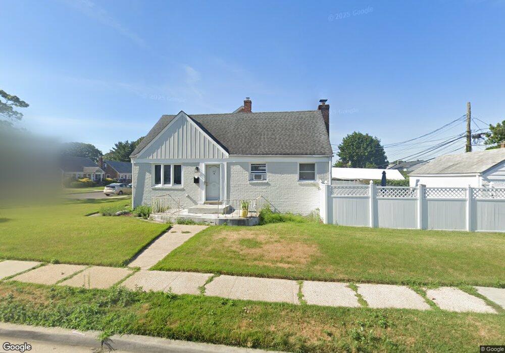
142 109th Ave Elmont, NY 11003
Estimated Value: $649,000 - $764,000
--
Bed
3
Baths
1,224
Sq Ft
$576/Sq Ft
Est. Value
About This Home
This home is located at 142 109th Ave, Elmont, NY 11003 and is currently estimated at $704,957, approximately $575 per square foot. 142 109th Ave is a home located in Nassau County with nearby schools including Martin De Porres School, Word Christian Academy, and Bible Baptist Academy.
Ownership History
Date
Name
Owned For
Owner Type
Purchase Details
Closed on
Jul 30, 2021
Sold by
Daley Samuel and Daley Jacqueline Jules
Bought by
Daley Samuel and Jules Daley Jacqueline
Current Estimated Value
Home Financials for this Owner
Home Financials are based on the most recent Mortgage that was taken out on this home.
Original Mortgage
$408,750
Interest Rate
2.8%
Mortgage Type
New Conventional
Purchase Details
Closed on
Mar 16, 2017
Sold by
Daley Samuel and Daley Jacqueline Jules
Bought by
Daley Samuel and Daley Jacqueline Jules
Purchase Details
Closed on
Jan 22, 1997
Create a Home Valuation Report for This Property
The Home Valuation Report is an in-depth analysis detailing your home's value as well as a comparison with similar homes in the area
Home Values in the Area
Average Home Value in this Area
Purchase History
| Date | Buyer | Sale Price | Title Company |
|---|---|---|---|
| Daley Samuel | -- | Amtrust Title | |
| Daley Samuel | -- | The Judicial Title Insurance | |
| -- | -- | -- |
Source: Public Records
Mortgage History
| Date | Status | Borrower | Loan Amount |
|---|---|---|---|
| Closed | Daley Samuel | $408,750 |
Source: Public Records
Tax History Compared to Growth
Tax History
| Year | Tax Paid | Tax Assessment Tax Assessment Total Assessment is a certain percentage of the fair market value that is determined by local assessors to be the total taxable value of land and additions on the property. | Land | Improvement |
|---|---|---|---|---|
| 2025 | $11,920 | $461 | $229 | $232 |
| 2024 | $3,949 | $461 | $229 | $232 |
| 2023 | $11,743 | $461 | $229 | $232 |
| 2022 | $11,743 | $461 | $229 | $232 |
| 2021 | $14,318 | $441 | $219 | $222 |
| 2020 | $11,193 | $762 | $550 | $212 |
| 2019 | $11,482 | $762 | $550 | $212 |
| 2017 | $6,112 | $762 | $550 | $212 |
| 2016 | $9,850 | $762 | $550 | $212 |
| 2015 | $3,473 | $762 | $550 | $212 |
| 2014 | $3,473 | $762 | $550 | $212 |
| 2013 | $3,256 | $762 | $550 | $212 |
Source: Public Records
Map
Nearby Homes
- 98 Locustwood Blvd
- 150 Heathcote Rd
- 165 Heathcote Rd
- 174 Wellington Rd
- 45 Warwick Rd
- 219 Locustwood Blvd
- 7 Sterling Rd
- 197 Biltmore Ave
- 10 Cedar St
- 164 Biltmore Ave
- 257 Biltmore Ave
- 80 Biltmore Ave
- 266 Biltmore Ave
- 2334 Belmont Ave
- 12 Biltmore Ave
- 86-B Gotham Ave
- 179 Hoffman Ave
- 86 Gotham Ave
- 440 Parkway Dr
- 22734 112th Rd
- 145 Sterling Rd
- 0 Sterling Rd Unit 3300326
- 140 Sussex Rd
- 129 Sterling Rd
- 149 Sterling Rd
- 146 Sussex Rd
- 126 Sussex Rd
- 154 109th Ave
- 125 Sterling Rd
- 155 Sterling Rd
- 144 Sterling Rd
- 152 Sussex Rd
- 130 Sterling Rd
- 122 Sussex Rd
- 148 Sterling Rd
- 121 Sterling Rd
- 159 Sterling Rd
- 126 Sterling Rd
- 156 Sussex Rd
- 154 Sterling Rd