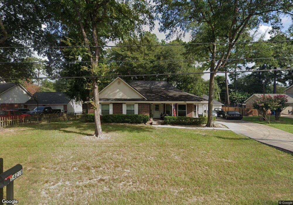
14218 Carneswood Dr Tomball, TX 77375
Estimated Value: $337,000 - $376,000
3
Beds
2
Baths
2,073
Sq Ft
$171/Sq Ft
Est. Value
About This Home
This home is located at 14218 Carneswood Dr, Tomball, TX 77375 and is currently estimated at $355,217, approximately $171 per square foot. 14218 Carneswood Dr is a home located in Harris County with nearby schools including Tomball Elementary School, Tomball Intermediate School, and Tomball Junior High School.
Ownership History
Date
Name
Owned For
Owner Type
Purchase Details
Closed on
Aug 2, 2019
Sold by
Coon Clayton D and Coon Clayton Dawayne
Bought by
Coon Wendee Day and Coon Wendee Lynn
Current Estimated Value
Home Financials for this Owner
Home Financials are based on the most recent Mortgage that was taken out on this home.
Original Mortgage
$132,275
Outstanding Balance
$116,086
Interest Rate
3.8%
Mortgage Type
New Conventional
Estimated Equity
$239,131
Purchase Details
Closed on
Feb 28, 2013
Sold by
Wright Larry
Bought by
Coon Clayton D
Home Financials for this Owner
Home Financials are based on the most recent Mortgage that was taken out on this home.
Original Mortgage
$132,275
Interest Rate
3.25%
Mortgage Type
FHA
Create a Home Valuation Report for This Property
The Home Valuation Report is an in-depth analysis detailing your home's value as well as a comparison with similar homes in the area
Home Values in the Area
Average Home Value in this Area
Purchase History
| Date | Buyer | Sale Price | Title Company |
|---|---|---|---|
| Coon Wendee Day | -- | None Available | |
| Coon Clayton D | -- | None Available |
Source: Public Records
Mortgage History
| Date | Status | Borrower | Loan Amount |
|---|---|---|---|
| Open | Coon Wendee Day | $132,275 | |
| Closed | Coon Clayton D | $132,275 |
Source: Public Records
Tax History Compared to Growth
Tax History
| Year | Tax Paid | Tax Assessment Tax Assessment Total Assessment is a certain percentage of the fair market value that is determined by local assessors to be the total taxable value of land and additions on the property. | Land | Improvement |
|---|---|---|---|---|
| 2025 | $5,888 | $353,367 | $54,020 | $299,347 |
| 2024 | $5,888 | $369,554 | $54,020 | $315,534 |
| 2023 | $5,888 | $358,000 | $49,640 | $308,360 |
| 2022 | $6,216 | $302,882 | $41,610 | $261,272 |
| 2021 | $5,946 | $250,700 | $36,500 | $214,200 |
| 2020 | $5,750 | $234,456 | $36,500 | $197,956 |
| 2019 | $5,140 | $222,000 | $30,660 | $191,340 |
| 2018 | $2,147 | $185,228 | $30,660 | $154,568 |
| 2017 | $4,975 | $197,422 | $30,660 | $166,762 |
| 2016 | $5,239 | $207,901 | $30,660 | $177,241 |
| 2015 | $3,836 | $197,422 | $30,660 | $166,762 |
| 2014 | $3,836 | $150,688 | $30,660 | $120,028 |
Source: Public Records
Map
Nearby Homes
- 14219 Turnervine Dr
- 14123 Spring Pines Dr
- 14222 Spring Pines Dr
- 14210 Altair Dr
- 11211 Stirton Dr
- 11235 Stirton Dr
- 31318 Bearing Star Ln
- 28102 Linda Ln
- 14134 Pollux Ct
- 31335 Bearing Star Ln
- 1319 Pine Trail
- 1310 Big Pines
- 1315 Big Pines
- 31407 Bearing Star Ln
- 1314 Pine Brook
- 1302 Pine Trail
- 31410 Bearing Star Ln
- 29507 Cedar Elm Way
- 930 Arbor Pine
- 0 Keen Rd
- 14226 Carneswood Dr
- 14210 Carneswood Dr
- 14211 Limerick Ln
- 14211 Carneswood Ln
- 14234 Carneswood Dr
- 14202 Carneswood Dr
- 14219 Carneswood Dr
- 14211 Carneswood Dr
- 14227 Limerick Ln
- 14203 Carneswood Dr
- 14203 Limerick Ln
- 14182 Carneswood Dr
- 14243 Limerick Ln
- 14242 Carneswood Dr
- 14235 Carneswood Dr
- 14235 Carneswood Dr
- 14210 Buckingham Ln
- 14218 Buckingham Ln
- 14183 Limerick Ln
- 14202 Buckingham Ln