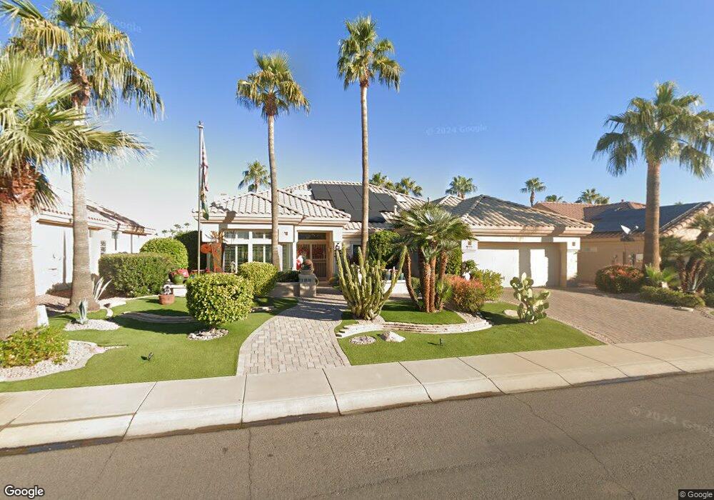
14220 W Parada Dr Sun City West, AZ 85375
Estimated Value: $498,692 - $584,000
--
Bed
3
Baths
2,164
Sq Ft
$251/Sq Ft
Est. Value
About This Home
This home is located at 14220 W Parada Dr, Sun City West, AZ 85375 and is currently estimated at $542,673, approximately $250 per square foot. 14220 W Parada Dr is a home located in Maricopa County with nearby schools including Asante Preparatory Academy, Cimarron Springs Middle School, and Willow Canyon High School.
Ownership History
Date
Name
Owned For
Owner Type
Purchase Details
Closed on
Feb 27, 2007
Sold by
Monno Patsy and Monno Janet
Bought by
Diedrich John C
Current Estimated Value
Purchase Details
Closed on
Jan 2, 2002
Sold by
Davis C Edwin
Bought by
Monno Patsy and Monno Janet
Home Financials for this Owner
Home Financials are based on the most recent Mortgage that was taken out on this home.
Original Mortgage
$143,000
Interest Rate
6.84%
Purchase Details
Closed on
Jan 25, 2001
Sold by
Anderson Gordon Benjamin
Bought by
Anderson Doris Davis
Purchase Details
Closed on
Jan 4, 1996
Sold by
Del E Webb Development Co Lp
Bought by
Anderson Gordon B and Anderson Doris D
Create a Home Valuation Report for This Property
The Home Valuation Report is an in-depth analysis detailing your home's value as well as a comparison with similar homes in the area
Home Values in the Area
Average Home Value in this Area
Purchase History
| Date | Buyer | Sale Price | Title Company |
|---|---|---|---|
| Diedrich John C | $390,000 | First American Title Ins Co | |
| Monno Patsy | $285,000 | First American Title | |
| Anderson Doris Davis | -- | -- | |
| Anderson Gordon B | $231,032 | Sun City Title Agency | |
| Del E Webb Development Co Lp | -- | Sun City Title Agency |
Source: Public Records
Mortgage History
| Date | Status | Borrower | Loan Amount |
|---|---|---|---|
| Previous Owner | Monno Patsy | $143,000 |
Source: Public Records
Tax History Compared to Growth
Tax History
| Year | Tax Paid | Tax Assessment Tax Assessment Total Assessment is a certain percentage of the fair market value that is determined by local assessors to be the total taxable value of land and additions on the property. | Land | Improvement |
|---|---|---|---|---|
| 2025 | $4,676 | $39,747 | -- | -- |
| 2024 | $4,376 | $37,855 | -- | -- |
| 2023 | $4,376 | $42,600 | $8,520 | $34,080 |
| 2022 | $4,218 | $35,350 | $7,070 | $28,280 |
| 2021 | $4,310 | $33,110 | $6,620 | $26,490 |
| 2020 | $4,233 | $32,060 | $6,410 | $25,650 |
| 2019 | $4,131 | $29,660 | $5,930 | $23,730 |
| 2018 | $4,038 | $29,260 | $5,850 | $23,410 |
| 2017 | $3,886 | $28,200 | $5,640 | $22,560 |
| 2016 | $3,719 | $26,720 | $5,340 | $21,380 |
| 2015 | $3,437 | $25,410 | $5,080 | $20,330 |
Source: Public Records
Map
Nearby Homes
- 14133 W Vía Montoya
- 22009 N Vía de La Caballa
- 21433 N 142nd Dr
- 22010 N Mirage Ln
- 21606 N Yellowstone Cir
- 14117 W Pecos Ln
- 14102 W Whitewood Dr
- 14010 W Pavillion Dr
- 14422 W Greystone Dr
- 14307 W Whitewood Dr
- 14209 W Territorial Ln
- 14429 W Wagon Wheel Dr
- 21627 N 139th Dr
- 22319 N Desperado Dr
- 14518 W Heritage Dr
- 14105 W Sky Hawk Dr Unit 40
- 14207 W Gunsight Dr
- 14514 W Huron Dr
- 14111 W Circle Ridge Dr
- 14140 W Circle Ridge Dr
- 14214 W Parada Dr Unit 52
- 14224 W Parada Dr Unit 52
- 14210 W Parada Dr
- 14217 W Parada Dr
- 14213 W Parada Dr
- 14221 W Parada Dr
- 14209 W Parada Dr
- 14206 W Parada Dr
- 14225 W Parada Dr
- 14234 W Parada Dr
- 14229 W Parada Dr
- 14205 W Parada Dr
- 14210 W Heritage Dr
- 14202 W Parada Dr
- 14206 W Heritage Dr
- 14214 W Heritage Dr
- 14236 W Parada Dr
- 14301 W Parada Dr
- 14201 W Parada Dr
- 14218 W Heritage Dr