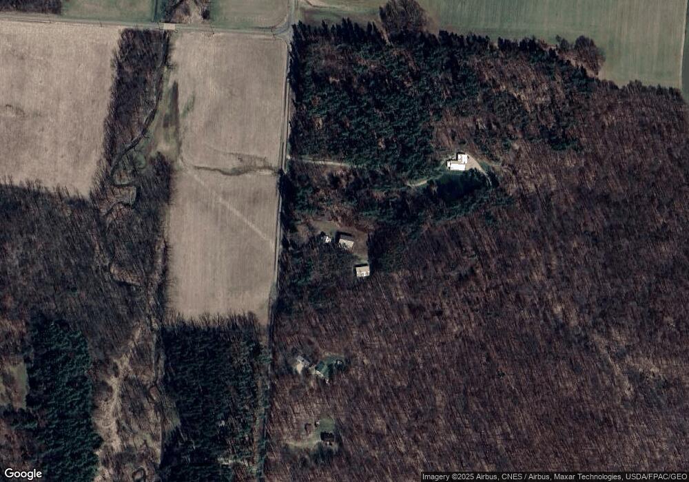
14280 Vincent Rd Mount Vernon, OH 43050
Estimated Value: $236,000 - $324,000
2
Beds
1
Bath
979
Sq Ft
$275/Sq Ft
Est. Value
About This Home
This home is located at 14280 Vincent Rd, Mount Vernon, OH 43050 and is currently estimated at $268,828, approximately $274 per square foot. 14280 Vincent Rd is a home located in Knox County with nearby schools including Mount Vernon High School.
Ownership History
Date
Name
Owned For
Owner Type
Purchase Details
Closed on
May 12, 2006
Sold by
Laymon Cheryl and Phillips Donald J
Bought by
Snow Arlie D and Snow Kimberly
Current Estimated Value
Home Financials for this Owner
Home Financials are based on the most recent Mortgage that was taken out on this home.
Original Mortgage
$26,800
Interest Rate
8.62%
Mortgage Type
Adjustable Rate Mortgage/ARM
Purchase Details
Closed on
May 1, 2001
Sold by
Hess Ronald D
Bought by
Laymon Cheryl and Laymon Phillips
Purchase Details
Closed on
Nov 22, 1988
Sold by
Magers Richard M
Bought by
Hess Ronald D
Create a Home Valuation Report for This Property
The Home Valuation Report is an in-depth analysis detailing your home's value as well as a comparison with similar homes in the area
Home Values in the Area
Average Home Value in this Area
Purchase History
| Date | Buyer | Sale Price | Title Company |
|---|---|---|---|
| Snow Arlie D | $100,500 | None Available | |
| Laymon Cheryl | $79,900 | -- | |
| Hess Ronald D | $20,000 | -- |
Source: Public Records
Mortgage History
| Date | Status | Borrower | Loan Amount |
|---|---|---|---|
| Closed | Snow Arlie D | $26,800 |
Source: Public Records
Tax History Compared to Growth
Tax History
| Year | Tax Paid | Tax Assessment Tax Assessment Total Assessment is a certain percentage of the fair market value that is determined by local assessors to be the total taxable value of land and additions on the property. | Land | Improvement |
|---|---|---|---|---|
| 2024 | $2,918 | $68,230 | $19,240 | $48,990 |
| 2023 | $2,918 | $68,230 | $19,240 | $48,990 |
| 2022 | $2,184 | $47,060 | $13,270 | $33,790 |
| 2021 | $2,184 | $47,060 | $13,270 | $33,790 |
| 2020 | $2,131 | $47,060 | $13,270 | $33,790 |
| 2019 | $2,085 | $42,840 | $11,030 | $31,810 |
| 2018 | $1,750 | $42,840 | $11,030 | $31,810 |
| 2017 | $1,722 | $36,070 | $11,030 | $25,040 |
| 2016 | $1,604 | $33,390 | $10,210 | $23,180 |
| 2015 | $1,610 | $33,390 | $10,210 | $23,180 |
| 2014 | $1,618 | $33,390 | $10,210 | $23,180 |
| 2013 | $1,747 | $34,980 | $9,560 | $25,420 |
Source: Public Records
Map
Nearby Homes
- 0 Monroe Mills Rd
- 0 Berry Rd Unit 225024403
- 0 Berry Rd Unit 9067495
- 0 Berry Rd
- 0 Greenlawn Dr Unit 225012211
- 0 Greenlawn Dr Unit 20250232
- 15014 Monroe Mills Rd
- 843 Country Club Dr
- 1709 Apple Valley Dr
- 847 Fairway Dr
- 629 Mcintosh Dr
- 43 Hawkeye Ct
- 15066 Monroe Mills Rd
- 2028 Apple Valley Dr
- 561 Mcintosh Dr
- 2536 Apple Valley Dr
- 2536 Apple Valley Dr Unit Lot 298
- 2100 Apple Valley Dr Unit Lot 63
- 3142 Apple Valley Dr
- 2037 Apple Valley Dr Unit 514, 515
- 14100 Vincent Rd
- 14318 Vincent Rd
- 14060 Vincent Rd
- 13941 Vincent Rd
- 14669 Gilchrist Rd
- 13960 Vincent Rd
- 14790 Gilchrist Rd
- 20579 Berry Rd
- 13901 Vincet Rd
- 20481 Berry Rd
- 13901 Vincent Rd
- 20715 Berry Rd
- 14583 Gilchrist Rd
- 13887 Vincent Rd
- 20653 Harding Rd
- 20467 Harding Rd
- 20841 Berry Rd
- 20790 Berry Rd
- 20889 Berry Rd
- 20819 Harding Rd
