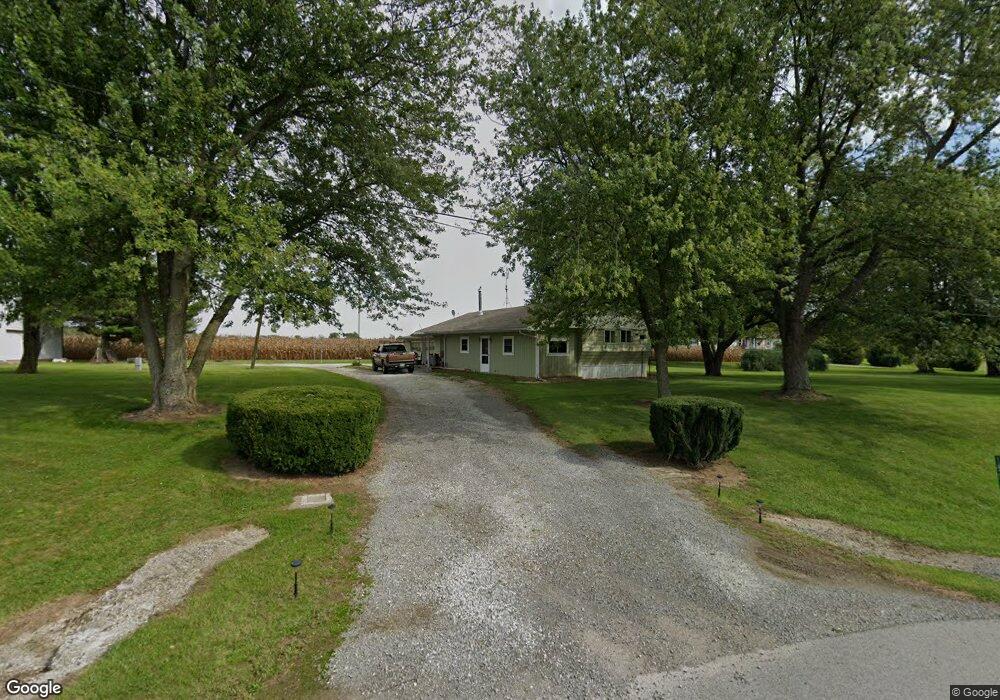
14292 State Route 65 Wapakoneta, OH 45895
Estimated Value: $117,328 - $164,000
2
Beds
1
Bath
1,144
Sq Ft
$117/Sq Ft
Est. Value
About This Home
This home is located at 14292 State Route 65, Wapakoneta, OH 45895 and is currently estimated at $133,832, approximately $116 per square foot. 14292 State Route 65 is a home located in Auglaize County with nearby schools including Wapakoneta Elementary School, Wapakoneta High School, and Wapakoneta Middle School.
Ownership History
Date
Name
Owned For
Owner Type
Purchase Details
Closed on
Jan 13, 2014
Sold by
Fannie Mae
Bought by
Belka Robert and Belka Kathy Ann
Current Estimated Value
Purchase Details
Closed on
Sep 12, 2013
Sold by
Paxton Randy
Bought by
Federal National Mortgage Association
Purchase Details
Closed on
Aug 29, 2013
Sold by
Paxton Randy and Rosell Kim
Bought by
Federal National Mortgage Association
Purchase Details
Closed on
Jun 1, 2006
Sold by
Micheal Debra A and Micheal Kyle
Bought by
Paxton Randy and Rosell Kim
Home Financials for this Owner
Home Financials are based on the most recent Mortgage that was taken out on this home.
Original Mortgage
$55,000
Interest Rate
6.62%
Mortgage Type
Purchase Money Mortgage
Purchase Details
Closed on
Jul 12, 2004
Sold by
Metz Michael E
Bought by
Micheal Debra A
Purchase Details
Closed on
Apr 1, 1987
Create a Home Valuation Report for This Property
The Home Valuation Report is an in-depth analysis detailing your home's value as well as a comparison with similar homes in the area
Home Values in the Area
Average Home Value in this Area
Purchase History
| Date | Buyer | Sale Price | Title Company |
|---|---|---|---|
| Belka Robert | -- | Omega Title Agency Llc | |
| Federal National Mortgage Association | $34,000 | Attorney | |
| Federal National Mortgage Association | $34,000 | Attorney | |
| Paxton Randy | $55,000 | Lawyers Title Agency | |
| Micheal Debra A | -- | -- | |
| -- | $26,000 | -- |
Source: Public Records
Mortgage History
| Date | Status | Borrower | Loan Amount |
|---|---|---|---|
| Previous Owner | Paxton Randy | $55,000 |
Source: Public Records
Tax History Compared to Growth
Tax History
| Year | Tax Paid | Tax Assessment Tax Assessment Total Assessment is a certain percentage of the fair market value that is determined by local assessors to be the total taxable value of land and additions on the property. | Land | Improvement |
|---|---|---|---|---|
| 2024 | $1,355 | $26,710 | $8,780 | $17,930 |
| 2023 | $622 | $26,710 | $8,780 | $17,930 |
| 2022 | $610 | $24,140 | $7,320 | $16,820 |
| 2021 | $590 | $24,140 | $7,320 | $16,820 |
| 2020 | $307 | $24,137 | $7,319 | $16,818 |
| 2019 | $458 | $20,154 | $6,101 | $14,053 |
| 2018 | $441 | $20,154 | $6,101 | $14,053 |
| 2017 | $437 | $20,154 | $6,101 | $14,053 |
| 2016 | $481 | $21,473 | $5,807 | $15,666 |
| 2015 | $251 | $21,473 | $5,807 | $15,666 |
| 2014 | $485 | $21,473 | $5,807 | $15,666 |
| 2013 | $370 | $21,473 | $5,807 | $15,666 |
Source: Public Records
Map
Nearby Homes
- 17 E Walnut St
- 37 N Main St
- 0 Ohio 67
- 20630 State Route 67
- 17092 Hauss Rd
- 0 Ohio 67
- 409 S Pine St
- 0 Wapakoneta Cridersville Rd
- 201 E Pearl St
- 22275 Buckland Holden Rd
- 9 E Silver St
- 102 Wapak St
- 211 W Benton St
- 307 W Benton St
- 307 W Auglaize St
- 414 W Auglaize St
- 109 Bluegrass Dr
- 420 Hoopengarner St
- 608 W Benton St
- 14346 State Route 65
- 14252 State Route 65
- 14348 State Route 65
- 14213 State Route 65
- 14166 State Route 65
- 14428 State Route 65
- 14498 State Route 65
- 14509 State Route 65
- 14122 Lima St
- 14115 Lima St
- 14513 Ohio 65
- 14511 State Route 65
- 14552 State Route 65
- 19159 Washington St
- 14513 State Route 65
- 19235 Center St
- 19245 Center St
- 19223 Center St
- 19159 Center St