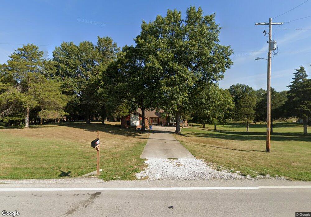
1431 Highway W Foristell, MO 63348
Estimated Value: $439,327 - $543,000
5
Beds
3
Baths
1,660
Sq Ft
$287/Sq Ft
Est. Value
About This Home
This home is located at 1431 Highway W, Foristell, MO 63348 and is currently estimated at $477,082, approximately $287 per square foot. 1431 Highway W is a home located in St. Charles County with nearby schools including Wabash Elementary.
Ownership History
Date
Name
Owned For
Owner Type
Purchase Details
Closed on
Jul 3, 2019
Sold by
Paul Carolynn G and Lundry Carolynn G
Bought by
Lundry Carolynn G and Lundry Walter K
Current Estimated Value
Purchase Details
Closed on
Aug 16, 2013
Sold by
Hruska Joseph G and Hruska Susan M
Bought by
Paul Carolynn G
Home Financials for this Owner
Home Financials are based on the most recent Mortgage that was taken out on this home.
Original Mortgage
$231,800
Outstanding Balance
$173,340
Interest Rate
4.53%
Mortgage Type
New Conventional
Estimated Equity
$303,742
Purchase Details
Closed on
Jul 7, 2000
Sold by
Harris Donald E and Harris Constance Fay
Bought by
Hruska Joseph G and Hruska Susan M
Home Financials for this Owner
Home Financials are based on the most recent Mortgage that was taken out on this home.
Original Mortgage
$191,580
Interest Rate
8.56%
Mortgage Type
VA
Create a Home Valuation Report for This Property
The Home Valuation Report is an in-depth analysis detailing your home's value as well as a comparison with similar homes in the area
Home Values in the Area
Average Home Value in this Area
Purchase History
| Date | Buyer | Sale Price | Title Company |
|---|---|---|---|
| Lundry Carolynn G | -- | None Available | |
| Paul Carolynn G | $244,000 | Benchmark Title Llc | |
| Hruska Joseph G | -- | -- |
Source: Public Records
Mortgage History
| Date | Status | Borrower | Loan Amount |
|---|---|---|---|
| Open | Paul Carolynn G | $231,800 | |
| Previous Owner | Hruska Joseph G | $191,580 |
Source: Public Records
Tax History Compared to Growth
Tax History
| Year | Tax Paid | Tax Assessment Tax Assessment Total Assessment is a certain percentage of the fair market value that is determined by local assessors to be the total taxable value of land and additions on the property. | Land | Improvement |
|---|---|---|---|---|
| 2025 | $3,644 | $63,596 | -- | -- |
| 2023 | $3,644 | $57,486 | $0 | $0 |
| 2022 | $3,357 | $49,417 | $0 | $0 |
| 2021 | $3,360 | $49,417 | $0 | $0 |
| 2020 | $3,347 | $47,217 | $0 | $0 |
| 2019 | $3,106 | $47,217 | $0 | $0 |
| 2018 | $2,736 | $39,623 | $0 | $0 |
| 2017 | $2,735 | $39,623 | $0 | $0 |
| 2016 | $2,726 | $37,839 | $0 | $0 |
| 2015 | $2,690 | $37,839 | $0 | $0 |
| 2014 | $2,274 | $34,320 | $0 | $0 |
Source: Public Records
Map
Nearby Homes
- 0 Unknown Unit MIS22063488
- 0 Unknown Unit MIS22063456
- 0 Unknown Unit MIS22063473
- 0 Unknown Unit MIS22063511
- 0 Unknown Unit MIS22063497
- 0 Unknown Unit MIS22063493
- 0 Unknown Unit MIS22063500
- 0 Unknown Unit MIS22063480
- 0 Unknown Unit MIS22063469
- 1605 High Sierra Dr
- 26 Madre Ct
- 107 Intrepid Ave
- 627 Brinton Ct
- 1813 Travis Ct
- 140 Shady Creek Ln
- 4 Emma Ct
- 2617 Defender Dr
- 375 Valley Bluff Dr
- 50 Huntleigh Woods Ct
- 56 Huntleigh Park Ct
- 1443 Highway W
- 1419 Highway W
- 1407 Highway W
- 1455 Highway W
- 1467 Highway W
- 1479 Highway W
- 101 Falcon Woods Ct
- 1491 Highway W
- 1389 Highway W
- 111 Falcon Woods Ct
- 102 Falcon Woods Ct
- 1507 Highway W
- 1611 Highway W
- 108 Falcon Woods Ct
- 12 Quiet Village Dr
- 36 Quiet Village Dr
- 24 Quiet Village Dr
- 115 Falcon Woods Ct
- 114 Falcon Woods Ct
- 11 Quiet Village Dr