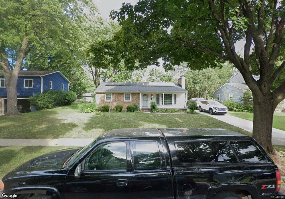
1434 Benjamin Ave NE Grand Rapids, MI 49505
North East Citizens Action NeighborhoodEstimated Value: $296,000 - $357,000
3
Beds
1
Bath
1
Sq Ft
$324,409/Sq Ft
Est. Value
About This Home
This home is located at 1434 Benjamin Ave NE, Grand Rapids, MI 49505 and is currently estimated at $324,409, approximately $324,409 per square foot. 1434 Benjamin Ave NE is a home located in Kent County with nearby schools including Kent Hills School, Riverside Middle School, and Union High School.
Ownership History
Date
Name
Owned For
Owner Type
Purchase Details
Closed on
Oct 17, 2012
Sold by
Mcdonald Toni E and Williams Toni E
Bought by
Mcdonald Toni E
Current Estimated Value
Purchase Details
Closed on
Sep 28, 1995
Bought by
Mcdonald Williams T and Mcdonald Toni E
Purchase Details
Closed on
Jul 13, 1995
Sold by
Allied Group and Allied Dhud
Bought by
Mcdonald Dhud and Mcdonald Toni E
Purchase Details
Closed on
Jun 28, 1995
Bought by
Allied Gr Mtg Co and Mcdonald Toni E
Purchase Details
Closed on
Oct 7, 1994
Sold by
White White C C and Lambrecht White
Bought by
Mcdonald Toni E
Purchase Details
Closed on
Apr 7, 1994
Bought by
Mcdonald Toni E
Purchase Details
Closed on
Mar 22, 1990
Sold by
Hager Hager R R and Hager White C
Bought by
Mcdonald Toni E
Create a Home Valuation Report for This Property
The Home Valuation Report is an in-depth analysis detailing your home's value as well as a comparison with similar homes in the area
Home Values in the Area
Average Home Value in this Area
Purchase History
| Date | Buyer | Sale Price | Title Company |
|---|---|---|---|
| Mcdonald Toni E | -- | None Available | |
| Mcdonald Williams T | $77,000 | -- | |
| Mcdonald Dhud | -- | -- | |
| Allied Gr Mtg Co | -- | -- | |
| Mcdonald Toni E | -- | -- | |
| Mcdonald Toni E | -- | -- | |
| Mcdonald Toni E | $70,000 | -- |
Source: Public Records
Tax History Compared to Growth
Tax History
| Year | Tax Paid | Tax Assessment Tax Assessment Total Assessment is a certain percentage of the fair market value that is determined by local assessors to be the total taxable value of land and additions on the property. | Land | Improvement |
|---|---|---|---|---|
| 2025 | $2,226 | $145,700 | $0 | $0 |
| 2024 | $2,226 | $134,100 | $0 | $0 |
| 2023 | $2,259 | $113,700 | $0 | $0 |
| 2022 | $2,140 | $98,200 | $0 | $0 |
| 2021 | $1,974 | $92,200 | $0 | $0 |
| 2020 | $2,004 | $87,700 | $0 | $0 |
| 2019 | $2,099 | $78,600 | $0 | $0 |
| 2018 | $2,027 | $72,700 | $0 | $0 |
| 2017 | $1,973 | $65,900 | $0 | $0 |
| 2016 | $1,997 | $58,800 | $0 | $0 |
| 2015 | $1,858 | $58,800 | $0 | $0 |
| 2013 | -- | $56,400 | $0 | $0 |
Source: Public Records
Map
Nearby Homes
- 1452 Carlton Ave NE
- 1444 Sweet St NE
- 1518 Mayfield Ave NE
- 1119 Spencer St NE
- 1339 Fuller Ave NE
- 1238 Carlton Ave NE
- 1666 Carlton Ave NE
- 1524 Sweet St NE
- 1455 Ball Ave NE
- 1250 Mayfield Ave NE
- 1237 Dale Ct NE
- 1332 Leonard St NE
- 1228 Spring Ave NE
- 1119 Kentwood Dr NE
- 1060 Leonard St NE
- 1256 Diamond Ave NE
- 1824 Herrick Ave NE
- 1150 Diamond Ave NE
- 1100 Coldbrook St NE
- 914 Leonard St NE
- 1440 Benjamin Ave NE
- 1426 Benjamin Ave NE
- 1448 Benjamin Ave NE
- 1420 Benjamin Ave NE
- 1437 Carlton Ave NE
- 1431 Carlton Ave NE
- 1443 Carlton Ave NE
- 1425 Carlton Ave NE
- 1433 Benjamin Ave NE
- 1449 Carlton Ave NE
- 1439 Benjamin Ave NE
- 1425 Benjamin Ave NE
- 1414 Benjamin Ave NE
- 1454 Benjamin Ave NE
- 1419 Carlton Ave NE
- 1447 Benjamin Ave NE
- 1419 Benjamin Ave NE
- 1455 Carlton Ave NE
- 1345 Spencer St NE
- 1413 Carlton Ave NE