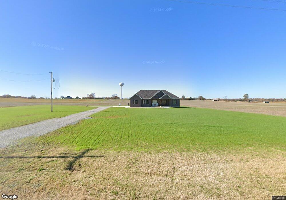
14347 Paulton Rd Pittsburg, IL 62974
Estimated Value: $146,000 - $396,000
--
Bed
--
Bath
1,064
Sq Ft
$255/Sq Ft
Est. Value
About This Home
This home is located at 14347 Paulton Rd, Pittsburg, IL 62974 and is currently estimated at $271,000, approximately $254 per square foot. 14347 Paulton Rd is a home with nearby schools including Johnston City High School.
Ownership History
Date
Name
Owned For
Owner Type
Purchase Details
Closed on
Mar 19, 2024
Sold by
Anderson James Timothy and Anderson Gena Marie
Bought by
Anderson Drew and Watson Kelsey
Current Estimated Value
Home Financials for this Owner
Home Financials are based on the most recent Mortgage that was taken out on this home.
Original Mortgage
$283,000
Interest Rate
6.63%
Mortgage Type
Construction
Purchase Details
Closed on
Mar 14, 2024
Sold by
Anderson James Timothy and Anderson Gena Marie
Bought by
Anderson Drew and Watson Kelsey
Home Financials for this Owner
Home Financials are based on the most recent Mortgage that was taken out on this home.
Original Mortgage
$283,000
Interest Rate
6.63%
Mortgage Type
Construction
Purchase Details
Closed on
Mar 1, 2019
Sold by
Helen Jenkins
Bought by
Anderson James Timothy and Anderson Gena Marie
Create a Home Valuation Report for This Property
The Home Valuation Report is an in-depth analysis detailing your home's value as well as a comparison with similar homes in the area
Home Values in the Area
Average Home Value in this Area
Purchase History
| Date | Buyer | Sale Price | Title Company |
|---|---|---|---|
| Anderson Drew | -- | None Listed On Document | |
| Anderson Drew | -- | None Listed On Document | |
| Anderson James Timothy | $42,000 | Law Firm Of Howerton Dorris & |
Source: Public Records
Mortgage History
| Date | Status | Borrower | Loan Amount |
|---|---|---|---|
| Closed | Anderson Drew | $283,000 | |
| Closed | Anderson Drew | $283,000 |
Source: Public Records
Tax History Compared to Growth
Tax History
| Year | Tax Paid | Tax Assessment Tax Assessment Total Assessment is a certain percentage of the fair market value that is determined by local assessors to be the total taxable value of land and additions on the property. | Land | Improvement |
|---|---|---|---|---|
| 2025 | $39 | $680 | $680 | $0 |
| 2024 | $39 | $680 | $680 | $0 |
| 2023 | $39 | $585 | $585 | $0 |
| 2022 | $33 | $500 | $500 | $0 |
| 2021 | $33 | $355 | $355 | $0 |
| 2020 | $28 | $355 | $355 | $0 |
| 2019 | $1,053 | $5,280 | $5,280 | $0 |
| 2018 | $1,053 | $14,000 | $5,280 | $8,720 |
| 2017 | $887 | $17,870 | $5,280 | $12,590 |
| 2015 | $874 | $16,930 | $5,000 | $11,930 |
| 2013 | -- | $16,930 | $5,000 | $11,930 |
| 2012 | -- | $16,930 | $5,000 | $11,930 |
Source: Public Records
Map
Nearby Homes
- 00 Galatia Post Rd
- 11298 Paulton Rd
- 15063 Lighthouse Rd
- 000 Brushy Creek Rd
- 012 Perry Rd
- 13686 Somers Church Rd
- 203 W Scranton Ave
- 208 W Pennsylvania Ave
- 9983 Stilleys Mill Rd
- 000 Pittsburg Rd
- 9358 Leisure Ln
- 12563 Saraville Rd
- 4490 Brushy Creek Church Rd
- 0000 Old Delta Mine Rd
- 960 N America Rd
- 14892 Fowler School Rd
- TBD Eastland Rd
- 1234 Khoury League Rd
- 15866 Moellers Rd
- 10415 Chayla Rd
- 14215 Paulton Rd
- 14144 Paulton Rd
- 20597 New Ohio Coal Rd
- 14593 Paulton Rd
- 13130 Etherton Rd
- 14703 Paulton Rd
- 21111 Grant Brick Rd
- 14645 Paulton Rd
- 14797 Paulton Rd
- 13894 Paulton Rd
- 21455 Grant Brick Rd
- 20350 New Ohio Coal Rd
- 21178 Grant Brick Rd
- 13852 Paulton Rd
- 21229 Grant Brick Rd
- 12644 Poordo Rd
- 20172 New Ohio Coal Rd
- 0000 Partridge Rd
- TBD Tbd Rr
- TBD-6 Tbd