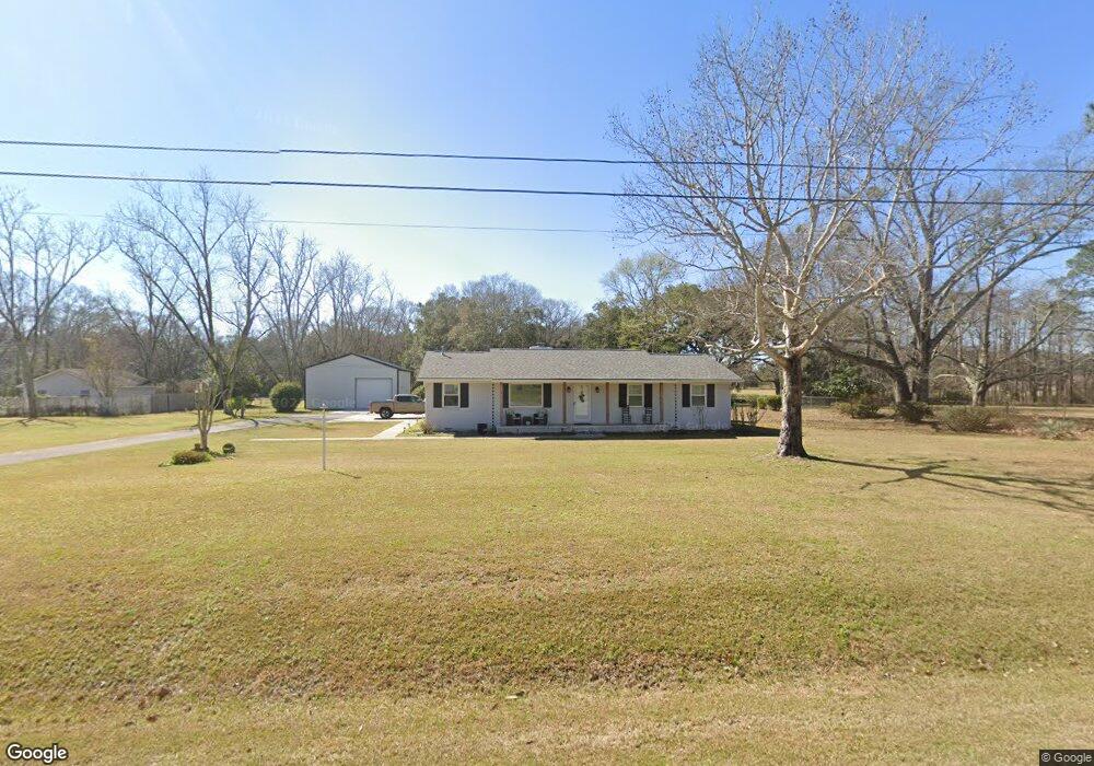
1435 Bush St Pensacola, FL 32534
Estimated Value: $252,000 - $274,000
--
Bed
2
Baths
1,540
Sq Ft
$171/Sq Ft
Est. Value
About This Home
This home is located at 1435 Bush St, Pensacola, FL 32534 and is currently estimated at $263,000, approximately $170 per square foot. 1435 Bush St is a home located in Escambia County with nearby schools including Lincoln Park Elementary School, Beulah Middle School, and J.M. Tate Senior High School.
Ownership History
Date
Name
Owned For
Owner Type
Purchase Details
Closed on
Apr 2, 2016
Sold by
Wilson Stuart and Wilson Holly A
Bought by
Eller Ronald K
Current Estimated Value
Purchase Details
Closed on
Oct 6, 2015
Sold by
Smith Harold S
Bought by
Wilson Holly A and Wilsom Stuart
Home Financials for this Owner
Home Financials are based on the most recent Mortgage that was taken out on this home.
Original Mortgage
$101,900
Interest Rate
3.93%
Mortgage Type
New Conventional
Purchase Details
Closed on
May 23, 1996
Sold by
Smith Harold S and Smith Sarah F
Bought by
Billingsley Barbara P
Create a Home Valuation Report for This Property
The Home Valuation Report is an in-depth analysis detailing your home's value as well as a comparison with similar homes in the area
Home Values in the Area
Average Home Value in this Area
Purchase History
| Date | Buyer | Sale Price | Title Company |
|---|---|---|---|
| Eller Ronald K | $40,000 | None Available | |
| Wilson Holly A | $108,400 | Surety Land Title Of Fl Llc | |
| Billingsley Barbara P | $35,000 | -- |
Source: Public Records
Mortgage History
| Date | Status | Borrower | Loan Amount |
|---|---|---|---|
| Previous Owner | Wilson Holly A | $101,900 |
Source: Public Records
Tax History Compared to Growth
Tax History
| Year | Tax Paid | Tax Assessment Tax Assessment Total Assessment is a certain percentage of the fair market value that is determined by local assessors to be the total taxable value of land and additions on the property. | Land | Improvement |
|---|---|---|---|---|
| 2024 | $1,383 | $139,185 | -- | -- |
| 2023 | $1,383 | $135,132 | $0 | $0 |
| 2022 | $1,345 | $131,197 | $0 | $0 |
| 2021 | $1,338 | $127,376 | $0 | $0 |
| 2020 | $1,303 | $125,618 | $0 | $0 |
| 2019 | $1,276 | $122,794 | $0 | $0 |
| 2018 | $1,272 | $120,505 | $0 | $0 |
| 2017 | $1,266 | $118,027 | $0 | $0 |
| 2016 | $1,341 | $121,590 | $0 | $0 |
| 2015 | $940 | $95,195 | $0 | $0 |
| 2014 | $936 | $94,440 | $0 | $0 |
Source: Public Records
Map
Nearby Homes
- 1620 Addies Way
- 1463 Keylan Cove
- 1621 Addies Way
- 1904 Mary Jo Way
- 8521 Fowler Ave Unit 34
- 8324 Highland Ridge Dr Unit 2A
- 8328 Highland Ridge Dr Unit 3A
- 9200 Bowman Ave
- 1510 W Detroit Blvd
- 1433 Claridge Place
- 1755 Mary Jo Way
- 8405 Fowler Ave
- 1830 Mary Jo Way
- 1817 Nestle Dr
- 9200 Fowler Ave
- 1783 Mary Jo Way
- 8907 Abbington Dr
- 8964 Abbington Dr
- 8100 BLK Durand Ave
- 1760 Paisleigh Dr