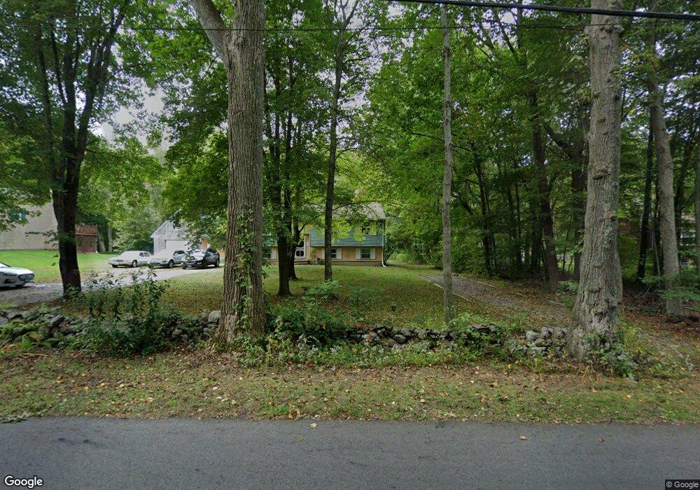
144 Standish Rd Colchester, CT 06415
Estimated Value: $333,000 - $384,000
2
Beds
2
Baths
1,094
Sq Ft
$329/Sq Ft
Est. Value
About This Home
This home is located at 144 Standish Rd, Colchester, CT 06415 and is currently estimated at $359,784, approximately $328 per square foot. 144 Standish Rd is a home located in New London County with nearby schools including Colchester Elementary School, Jack Jackter Intermediate School, and William J. Johnston Middle School.
Ownership History
Date
Name
Owned For
Owner Type
Purchase Details
Closed on
Jun 28, 2002
Sold by
Gustafson Stephen and Gustafson Linda
Bought by
Talbot Paul and Talbot Toni
Current Estimated Value
Purchase Details
Closed on
Jul 2, 2001
Sold by
Hauzeur Richard and Hauzeur Debra
Bought by
Gusafson Stephen and Gusafson Linda
Purchase Details
Closed on
Aug 1, 1995
Sold by
Loftus Daniel J and Loftus Julie
Bought by
Hauzer Richard J and Hauzer Debra
Create a Home Valuation Report for This Property
The Home Valuation Report is an in-depth analysis detailing your home's value as well as a comparison with similar homes in the area
Home Values in the Area
Average Home Value in this Area
Purchase History
| Date | Buyer | Sale Price | Title Company |
|---|---|---|---|
| Talbot Paul | $168,500 | -- | |
| Gusafson Stephen | $152,000 | -- | |
| Hauzer Richard J | $115,000 | -- |
Source: Public Records
Mortgage History
| Date | Status | Borrower | Loan Amount |
|---|---|---|---|
| Open | Hauzer Richard J | $187,000 | |
| Closed | Hauzer Richard J | $37,000 | |
| Closed | Hauzer Richard J | $168,750 |
Source: Public Records
Tax History Compared to Growth
Tax History
| Year | Tax Paid | Tax Assessment Tax Assessment Total Assessment is a certain percentage of the fair market value that is determined by local assessors to be the total taxable value of land and additions on the property. | Land | Improvement |
|---|---|---|---|---|
| 2025 | $5,092 | $170,200 | $45,100 | $125,100 |
| 2024 | $4,880 | $170,200 | $45,100 | $125,100 |
| 2023 | $4,633 | $170,200 | $45,100 | $125,100 |
| 2022 | $4,609 | $170,200 | $45,100 | $125,100 |
| 2021 | $4,304 | $145,900 | $46,200 | $99,700 |
| 2020 | $4,791 | $145,900 | $46,200 | $99,700 |
| 2019 | $4,703 | $143,200 | $46,200 | $97,000 |
| 2018 | $4,071 | $143,200 | $46,200 | $97,000 |
| 2017 | $3,417 | $143,200 | $46,200 | $97,000 |
| 2016 | $4,627 | $149,700 | $60,100 | $89,600 |
| 2015 | $4,605 | $149,700 | $60,100 | $89,600 |
| 2014 | $4,576 | $149,700 | $60,100 | $89,600 |
Source: Public Records
Map
Nearby Homes
- 87 Standish Rd
- 35 Brookstone Dr
- "0" Middletown Rd
- 19 Esther Ln
- Lot #2 Taylor Rd
- 10 Taylor Rd
- 6 Taylor Rd
- 3 Taylor Rd
- 9 Taylor Rd
- 74 Pinebrook Rd
- 7 Taylor Rd
- 63 Taylor Rd
- 17 Harvest Ln
- 597 Westchester Rd
- 286 Middletown Rd
- 335 Westchester Rd
- 23 Olmstead Rd
- 54 Bulkeley Hill Rd
- 21 Olmstead Rd
- 39 Briarwood Dr
- 148 Standish Rd
- 140 Standish Rd
- 136 Standish Rd
- 152 Standish Rd
- 4 Red Schoolhouse Rd
- 147 Standish Rd
- 132 Standish Rd
- 0 Red Schoolhouse Rd Unit G537908
- 0 Red Schoolhouse Rd Unit G554773
- 0 Red Schoolhouse Rd Unit G675999
- 0 Red Schoolhouse Rd Unit 170452021
- 0 Red Schoolhouse Rd Unit 170274873
- 131 Standish Rd
- 155 Standish Rd
- 141 Standish Rd
- 20 Red Schoolhouse Rd
- 15 Red Schoolhouse Rd
- 166 Standish Rd
- 19 Red Schoolhouse Rd
- 168 Standish Rd