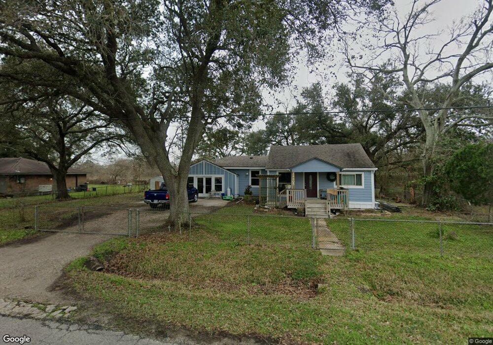
14405 Ash Rd Santa Fe, TX 77517
Estimated Value: $239,000 - $308,000
3
Beds
1
Bath
1,104
Sq Ft
$238/Sq Ft
Est. Value
About This Home
This home is located at 14405 Ash Rd, Santa Fe, TX 77517 and is currently estimated at $262,984, approximately $238 per square foot. 14405 Ash Rd is a home located in Galveston County with nearby schools including Roy J. Wollam Elementary School, Santa Fe Junior High School, and Santa Fe High School.
Ownership History
Date
Name
Owned For
Owner Type
Purchase Details
Closed on
Jan 11, 2012
Sold by
The Bank Of New York Mellon
Bought by
Guerrero Martha
Current Estimated Value
Purchase Details
Closed on
Oct 13, 2011
Sold by
Coker Deidra
Bought by
The Bank Of New York Mellon
Purchase Details
Closed on
Mar 12, 2007
Sold by
Roberts Verva I
Bought by
Coker Deidra
Home Financials for this Owner
Home Financials are based on the most recent Mortgage that was taken out on this home.
Original Mortgage
$74,100
Interest Rate
10.5%
Mortgage Type
Purchase Money Mortgage
Create a Home Valuation Report for This Property
The Home Valuation Report is an in-depth analysis detailing your home's value as well as a comparison with similar homes in the area
Home Values in the Area
Average Home Value in this Area
Purchase History
| Date | Buyer | Sale Price | Title Company |
|---|---|---|---|
| Guerrero Martha | -- | None Available | |
| The Bank Of New York Mellon | $39,600 | Lsi Title Agency Inc | |
| Coker Deidra | -- | South Land Title Company |
Source: Public Records
Mortgage History
| Date | Status | Borrower | Loan Amount |
|---|---|---|---|
| Previous Owner | Coker Deidra | $74,100 |
Source: Public Records
Tax History Compared to Growth
Tax History
| Year | Tax Paid | Tax Assessment Tax Assessment Total Assessment is a certain percentage of the fair market value that is determined by local assessors to be the total taxable value of land and additions on the property. | Land | Improvement |
|---|---|---|---|---|
| 2025 | $1,578 | $148,121 | -- | -- |
| 2024 | $1,578 | $134,655 | -- | -- |
| 2023 | $1,578 | $122,414 | $0 | $0 |
| 2022 | $2,507 | $111,285 | $0 | $0 |
| 2021 | $2,490 | $156,410 | $52,530 | $103,880 |
| 2020 | $2,352 | $141,680 | $52,530 | $89,150 |
| 2019 | $2,212 | $83,610 | $15,080 | $68,530 |
| 2018 | $2,231 | $83,610 | $15,080 | $68,530 |
| 2017 | $2,043 | $83,610 | $15,080 | $68,530 |
| 2016 | $1,857 | $78,580 | $15,080 | $63,500 |
| 2015 | $730 | $68,000 | $15,080 | $52,920 |
| 2014 | $684 | $54,770 | $15,080 | $39,690 |
Source: Public Records
Map
Nearby Homes
- 0 Birch Rd
- 4842 Birch St
- 4910 Cark St
- 4301 Peck St
- 15510 Pinehurst Ln
- 15418 Pinehurst Ln
- 15826 Sugar Maple Ln
- 15407 Pinehurst Ln
- 15502 Pinehurst Ln
- 3111 Oakmont Ln
- 15410 Pinehurst Ln
- 15406 Pinehurst Ln
- 15414 Pinehurst Ln
- 3119 Oakmont Ln
- 15419 Pinehurst Ln
- 3107 Oakmont Ln
- 15423 Pinehurst Ln
- 15403 Pinehurst Ln
- 15506 Pinehurst Ln
- 15415 Pinehurst Ln