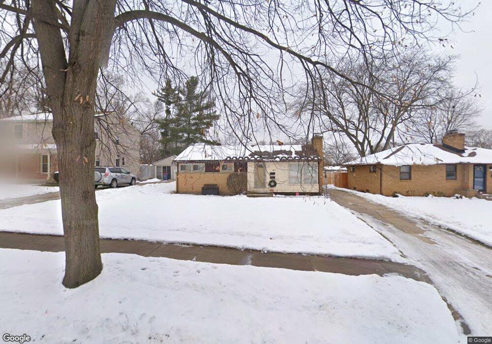
1441 Mayfield Ave NE Grand Rapids, MI 49505
North East Citizens Action NeighborhoodEstimated Value: $248,000 - $298,000
3
Beds
1
Bath
1,038
Sq Ft
$265/Sq Ft
Est. Value
About This Home
This home is located at 1441 Mayfield Ave NE, Grand Rapids, MI 49505 and is currently estimated at $274,853, approximately $264 per square foot. 1441 Mayfield Ave NE is a home located in Kent County with nearby schools including Kent Hills School, Riverside Middle School, and Union High School.
Ownership History
Date
Name
Owned For
Owner Type
Purchase Details
Closed on
Jun 3, 2005
Sold by
Gloria S Schmich Trust
Bought by
Stanciel William
Current Estimated Value
Home Financials for this Owner
Home Financials are based on the most recent Mortgage that was taken out on this home.
Original Mortgage
$96,800
Outstanding Balance
$50,730
Interest Rate
5.82%
Mortgage Type
Fannie Mae Freddie Mac
Estimated Equity
$224,123
Purchase Details
Closed on
Mar 5, 1993
Sold by
Brown Brown L L and Brown Schmich G
Bought by
Stanciel William
Purchase Details
Closed on
Mar 4, 1993
Sold by
Brown Brown L L and Brown Schmich G
Bought by
Stanciel William
Purchase Details
Closed on
Jan 31, 1991
Sold by
Schock Schock J J and Schock Brown L
Bought by
Stanciel William
Purchase Details
Closed on
Apr 21, 1989
Create a Home Valuation Report for This Property
The Home Valuation Report is an in-depth analysis detailing your home's value as well as a comparison with similar homes in the area
Home Values in the Area
Average Home Value in this Area
Purchase History
| Date | Buyer | Sale Price | Title Company |
|---|---|---|---|
| Stanciel William | $121,000 | -- | |
| Stanciel William | $69,000 | -- | |
| Stanciel William | $69,000 | -- | |
| Stanciel William | $67,500 | -- | |
| -- | $59,900 | -- |
Source: Public Records
Mortgage History
| Date | Status | Borrower | Loan Amount |
|---|---|---|---|
| Open | Stanciel William | $96,800 |
Source: Public Records
Tax History Compared to Growth
Tax History
| Year | Tax Paid | Tax Assessment Tax Assessment Total Assessment is a certain percentage of the fair market value that is determined by local assessors to be the total taxable value of land and additions on the property. | Land | Improvement |
|---|---|---|---|---|
| 2025 | $2,882 | $117,300 | $0 | $0 |
| 2024 | $2,882 | $108,700 | $0 | $0 |
| 2023 | $2,859 | $93,800 | $0 | $0 |
| 2022 | $2,717 | $81,000 | $0 | $0 |
| 2021 | $2,647 | $76,200 | $0 | $0 |
| 2020 | $2,559 | $72,400 | $0 | $0 |
| 2019 | $2,620 | $64,800 | $0 | $0 |
| 2018 | $2,540 | $60,600 | $0 | $0 |
| 2017 | $2,478 | $54,600 | $0 | $0 |
| 2016 | $2,490 | $48,800 | $0 | $0 |
| 2015 | $2,372 | $48,800 | $0 | $0 |
| 2013 | -- | $46,800 | $0 | $0 |
Source: Public Records
Map
Nearby Homes
- 1452 Carlton Ave NE
- 1518 Mayfield Ave NE
- 1455 Ball Ave NE
- 1444 Sweet St NE
- 1524 Sweet St NE
- 1250 Mayfield Ave NE
- 1238 Carlton Ave NE
- 1332 Leonard St NE
- 1339 Fuller Ave NE
- 1119 Spencer St NE
- 1237 Dale Ct NE
- 1119 Kentwood Dr NE
- 1228 Spring Ave NE
- 1060 Leonard St NE
- 1256 Diamond Ave NE
- 1824 Herrick Ave NE
- 1100 Coldbrook St NE
- 1150 Diamond Ave NE
- 1535 Mason St NE
- 1539 Mason St NE
- 1437 Mayfield Ave NE
- 1447 Mayfield Ave NE
- 1431 Mayfield Ave NE
- 1453 Mayfield Ave NE
- 1440 Lewison Ave NE
- 1446 Lewison Ave NE
- 1427 Mayfield Ave NE
- 1452 Lewison Ave NE
- 1430 Lewison Ave NE
- 1457 Mayfield Ave NE
- 1440 Mayfield Ave NE
- 1436 Mayfield Ave NE
- 1446 Mayfield Ave NE
- 1426 Lewison Ave NE
- 1456 Lewison Ave NE
- 1430 Mayfield Ave NE
- 1452 Mayfield Ave NE
- 1426 Mayfield Ave NE
- 1456 Mayfield Ave NE
- 1451 Spencer St NE