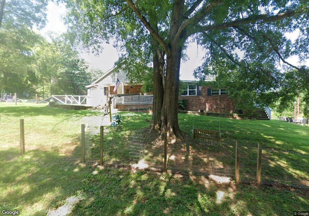
1444 Snead Rd Stoneville, NC 27048
Estimated Value: $232,000 - $281,000
--
Bed
--
Bath
1,798
Sq Ft
$144/Sq Ft
Est. Value
About This Home
This home is located at 1444 Snead Rd, Stoneville, NC 27048 and is currently estimated at $258,051, approximately $143 per square foot. 1444 Snead Rd is a home located in Rockingham County with nearby schools including Stoneville Elementary School, Western Rockingham Middle School, and Dalton McMichael High School.
Ownership History
Date
Name
Owned For
Owner Type
Purchase Details
Closed on
Mar 23, 2009
Sold by
Shropshire Michael Todd and Shropshire Jeanie H
Bought by
Swisher Amy Tapson and Swisher Kenneth Dwight
Current Estimated Value
Home Financials for this Owner
Home Financials are based on the most recent Mortgage that was taken out on this home.
Original Mortgage
$125,681
Outstanding Balance
$80,592
Interest Rate
5.29%
Mortgage Type
FHA
Estimated Equity
$177,459
Purchase Details
Closed on
Feb 9, 2007
Sold by
Citibank N A
Bought by
Shropshire Michael Todd
Purchase Details
Closed on
Oct 10, 2006
Sold by
Rothrock John S and Rothrock Deborah T
Bought by
Citibank N A
Create a Home Valuation Report for This Property
The Home Valuation Report is an in-depth analysis detailing your home's value as well as a comparison with similar homes in the area
Home Values in the Area
Average Home Value in this Area
Purchase History
| Date | Buyer | Sale Price | Title Company |
|---|---|---|---|
| Swisher Amy Tapson | $128,000 | None Available | |
| Shropshire Michael Todd | $34,000 | None Available | |
| Citibank N A | $78,973 | None Available |
Source: Public Records
Mortgage History
| Date | Status | Borrower | Loan Amount |
|---|---|---|---|
| Open | Swisher Amy Tapson | $125,681 |
Source: Public Records
Tax History Compared to Growth
Tax History
| Year | Tax Paid | Tax Assessment Tax Assessment Total Assessment is a certain percentage of the fair market value that is determined by local assessors to be the total taxable value of land and additions on the property. | Land | Improvement |
|---|---|---|---|---|
| 2025 | $1,247 | $214,964 | $37,443 | $177,521 |
| 2024 | $1,247 | $214,964 | $37,443 | $177,521 |
| 2023 | $1,247 | $122,117 | $19,822 | $102,295 |
| 2022 | $849 | $122,117 | $19,822 | $102,295 |
| 2021 | $849 | $122,117 | $19,822 | $102,295 |
| 2020 | $849 | $122,117 | $19,822 | $102,295 |
| 2019 | $849 | $122,117 | $19,822 | $102,295 |
| 2018 | $780 | $112,138 | $27,840 | $84,298 |
| 2017 | $780 | $112,138 | $27,840 | $84,298 |
| 2015 | $788 | $112,138 | $27,840 | $84,298 |
| 2014 | -- | $112,138 | $27,840 | $84,298 |
Source: Public Records
Map
Nearby Homes
- 12 Noel Rd
- 13 Noel Rd
- 151 Noel Rd
- 000 Price Rd
- 120 Lemons St
- 118 Simpson St
- 0 US Highway 220 Business
- 109 Gerry St
- 180 Mountain Valley Dr
- 00 King St
- 131 Calvary Rd
- Contact Listing Agent
- 355 Tanglebrook Trail
- 301 Bryan St
- N/A Wild Turkey Ln
- 223 W Matthews St
- 228 W Matthews St
- 2282 Price Rd
- 122 Legrande Dr
- 4125 Us Highway 220 Bus
- 1402 Snead Rd
- 1664 Wray Rd
- 1733 Wray Rd
- 1590 Wray Rd
- 0 Price Grange Rd
- 1434 Price Grange Rd
- 1624 Price Grange Rd
- 1493 Price Grange Rd
- 1457 Price Grange Rd
- 1710 Snead Rd
- 1414 Price Grange Rd
- 1730 Snead Rd
- 1681 Snead Rd
- 1400 Wray Rd
- 1639 Snead Rd
- 1739 Snead Rd
- 1731 Price Grange Rd
- 1802 Snead Rd
- 1461 Wray Rd
- 1334 Price Grange Rd