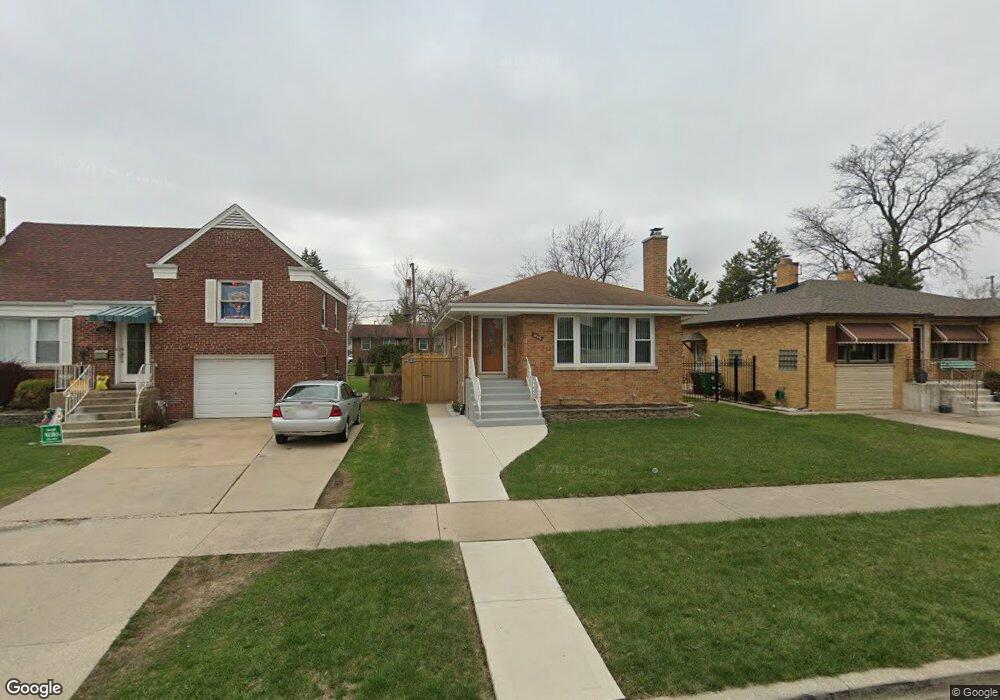
1446 Newcastle Ave Westchester, IL 60154
Estimated Value: $308,323 - $356,000
2
Beds
1
Bath
1,087
Sq Ft
$305/Sq Ft
Est. Value
About This Home
This home is located at 1446 Newcastle Ave, Westchester, IL 60154 and is currently estimated at $331,581, approximately $305 per square foot. 1446 Newcastle Ave is a home located in Cook County with nearby schools including Westchester Primary School, Westchester Intermediate School, and Westchester Middle School.
Ownership History
Date
Name
Owned For
Owner Type
Purchase Details
Closed on
Nov 11, 1998
Sold by
Dalporto Virginia B
Bought by
Merrick James and Jenkins Patsy
Current Estimated Value
Home Financials for this Owner
Home Financials are based on the most recent Mortgage that was taken out on this home.
Original Mortgage
$144,134
Interest Rate
6.83%
Mortgage Type
FHA
Purchase Details
Closed on
Nov 21, 1997
Sold by
Rigitano Steven and Rigitano Liane M
Bought by
Dalporto Virginia B
Home Financials for this Owner
Home Financials are based on the most recent Mortgage that was taken out on this home.
Original Mortgage
$30,000
Interest Rate
7.45%
Create a Home Valuation Report for This Property
The Home Valuation Report is an in-depth analysis detailing your home's value as well as a comparison with similar homes in the area
Home Values in the Area
Average Home Value in this Area
Purchase History
| Date | Buyer | Sale Price | Title Company |
|---|---|---|---|
| Merrick James | $147,000 | Professional National Title | |
| Dalporto Virginia B | $142,500 | -- |
Source: Public Records
Mortgage History
| Date | Status | Borrower | Loan Amount |
|---|---|---|---|
| Previous Owner | Merrick James | $144,134 | |
| Previous Owner | Dalporto Virginia B | $30,000 |
Source: Public Records
Tax History Compared to Growth
Tax History
| Year | Tax Paid | Tax Assessment Tax Assessment Total Assessment is a certain percentage of the fair market value that is determined by local assessors to be the total taxable value of land and additions on the property. | Land | Improvement |
|---|---|---|---|---|
| 2024 | $4,296 | $19,673 | $3,063 | $16,610 |
| 2023 | $3,125 | $23,001 | $3,063 | $19,938 |
| 2022 | $3,125 | $17,083 | $2,625 | $14,458 |
| 2021 | $3,078 | $17,082 | $2,625 | $14,457 |
| 2020 | $3,681 | $18,343 | $2,625 | $15,718 |
| 2019 | $3,356 | $15,309 | $2,406 | $12,903 |
| 2018 | $4,294 | $18,836 | $2,406 | $16,430 |
| 2017 | $4,228 | $18,836 | $2,406 | $16,430 |
| 2016 | $3,466 | $14,383 | $2,187 | $12,196 |
| 2015 | $3,386 | $14,383 | $2,187 | $12,196 |
| 2014 | $3,323 | $14,383 | $2,187 | $12,196 |
| 2013 | $2,990 | $14,524 | $2,187 | $12,337 |
Source: Public Records
Map
Nearby Homes
- 10072 Drury Ln
- 1500 Bristol Ave
- 1623 Manchester Ave
- 1601 Bristol Ave
- 1247 S Mannheim Rd Unit 3
- 1816 Manchester Ave
- 1119 Newcastle Ave
- 1907 Suffolk Ave
- 1932 Newcastle Ave
- 1900 Manchester Ave
- 1840 Gardner Rd
- 10524 Camelot St
- 10531 Camelot St
- 920 Suffolk Ave
- 2128 Hull Ave
- 10567 Waterford Dr
- 923 Manchester Ave
- 814 Norfolk Ave
- 805 Norfolk Ave
- 750 Bristol Ave
- 1440 Newcastle Ave
- 1440 Newcastle Ave
- 1450 Newcastle Ave
- 1456 Newcastle Ave
- 1434 Newcastle Ave
- 1445 Hull Ave
- 1449 Hull Ave
- 1430 Newcastle Ave
- 1430 Newcastle Ave
- 1439 Hull Ave
- 10120 Chaucer St
- 10120 Chaucer St
- 1433 Hull Ave
- 1449 Newcastle Ave
- 1441 Newcastle Ave
- 1439 Newcastle Ave
- 1455 Newcastle Ave
- 1424 Newcastle Ave
- 1500 Newcastle Ave
- 1433 Newcastle Ave