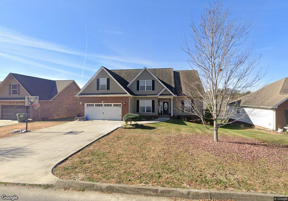
145 Millstone Cir Clinton, TN 37716
Estimated Value: $386,958 - $457,000
3
Beds
2
Baths
2,100
Sq Ft
$201/Sq Ft
Est. Value
About This Home
This home is located at 145 Millstone Cir, Clinton, TN 37716 and is currently estimated at $422,490, approximately $201 per square foot. 145 Millstone Cir is a home located in Anderson County with nearby schools including Norris Elementary School and Norris Middle School.
Ownership History
Date
Name
Owned For
Owner Type
Purchase Details
Closed on
May 13, 2009
Sold by
Willoughby Adam W
Bought by
Harris Robert Blake
Current Estimated Value
Purchase Details
Closed on
Sep 28, 2007
Sold by
Brookstone Ridge Llc
Bought by
Willoughby Adam W
Home Financials for this Owner
Home Financials are based on the most recent Mortgage that was taken out on this home.
Original Mortgage
$191,000
Interest Rate
6.41%
Purchase Details
Closed on
Jan 4, 2006
Bought by
Brookstone Ridge Llc
Create a Home Valuation Report for This Property
The Home Valuation Report is an in-depth analysis detailing your home's value as well as a comparison with similar homes in the area
Home Values in the Area
Average Home Value in this Area
Purchase History
| Date | Buyer | Sale Price | Title Company |
|---|---|---|---|
| Harris Robert Blake | $210,300 | -- | |
| Willoughby Adam W | $32,900 | -- | |
| Brookstone Ridge Llc | $425,000 | -- |
Source: Public Records
Mortgage History
| Date | Status | Borrower | Loan Amount |
|---|---|---|---|
| Previous Owner | Brookstone Ridge Llc | $191,000 |
Source: Public Records
Tax History Compared to Growth
Tax History
| Year | Tax Paid | Tax Assessment Tax Assessment Total Assessment is a certain percentage of the fair market value that is determined by local assessors to be the total taxable value of land and additions on the property. | Land | Improvement |
|---|---|---|---|---|
| 2024 | $1,413 | $53,750 | $10,000 | $43,750 |
| 2023 | $1,413 | $53,750 | $0 | $0 |
| 2022 | $1,413 | $53,750 | $10,000 | $43,750 |
| 2021 | $1,413 | $53,750 | $10,000 | $43,750 |
| 2020 | $1,282 | $53,750 | $10,000 | $43,750 |
| 2019 | $1,328 | $45,950 | $7,500 | $38,450 |
| 2018 | $1,282 | $45,950 | $7,500 | $38,450 |
| 2017 | $1,282 | $45,950 | $7,500 | $38,450 |
| 2016 | $1,282 | $45,950 | $7,500 | $38,450 |
| 2015 | -- | $45,950 | $7,500 | $38,450 |
| 2014 | -- | $45,950 | $7,500 | $38,450 |
| 2013 | -- | $49,950 | $0 | $0 |
Source: Public Records
Map
Nearby Homes
- 208 Cornerstone Cir
- 191 Cornerstone Cir
- 214 Mossy Rock Rd
- 229 Mossy Rock Rd
- 218 Mossy Rock Rd
- 174 Flagstone Way
- 2902 Andersonville Hwy
- 285 Joe Owen Rd
- 170 Lone Mountain Rd
- 649 Jade Ct
- 0 Chicory Dr Unit 1313759
- 3816 Andersonville Hwy
- 0 Larkspur Dr
- 106 Crescent Rd
- 224 Oak Rd
- 116 Blue Phlox Ln
- 124 Blue Phlox Ln
- 145 Grace Cir
- 123 Orchard Rd
- 36 Deer Ridge Rd
- 141 Millstone Cir
- 149 Millstone Cir
- 107 Millstone Cir
- 111 Millstone Cir
- 103 Millstone Cir
- 146 Millstone Cir
- 135 Millstone Cir
- 150 Millstone Cir
- 117 Millstone Cir
- 212 Cornerstone Cir
- 102 Cornerstone Cir
- 417 Brookstone Ridge Dr
- 406 Brookstone Ridge Dr
- 106 Millstone Cir
- 134 Millstone Cir
- 0 Brookstone Ridge Unit 685741
- 0 Brookstone Ridge Unit 691642
- 0 Brookstone Ridge Unit 716295
- 0 Brookstone Ridge Unit 716286
- 0 Brookstone Ridge Unit 751803