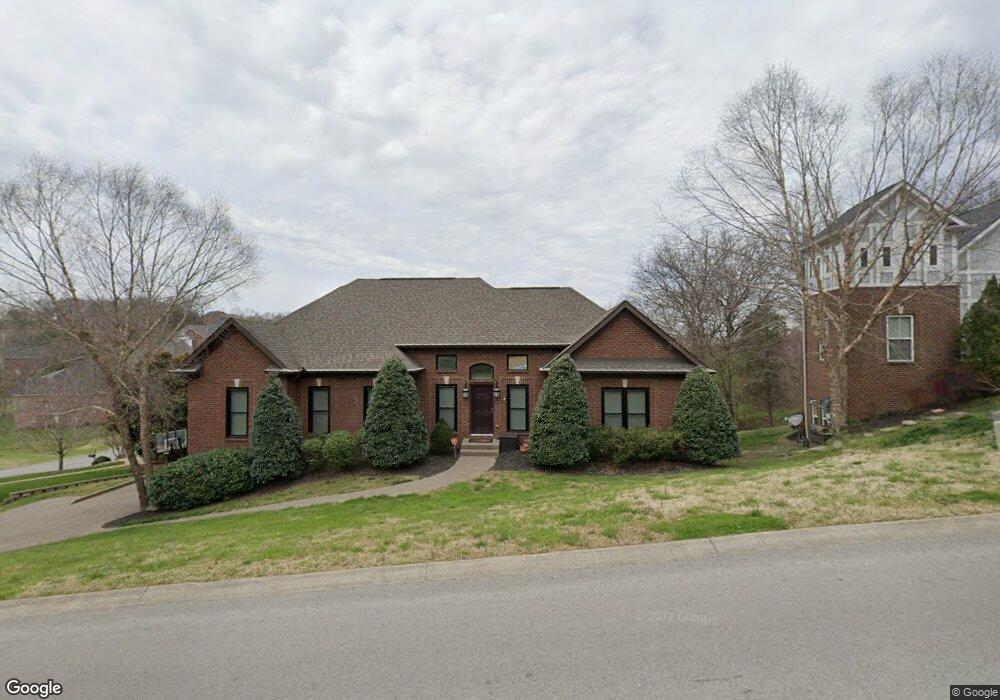
1453 Red Oak Dr Brentwood, TN 37027
Estimated Value: $880,151 - $1,016,000
--
Bed
5
Baths
2,353
Sq Ft
$411/Sq Ft
Est. Value
About This Home
This home is located at 1453 Red Oak Dr, Brentwood, TN 37027 and is currently estimated at $966,538, approximately $410 per square foot. 1453 Red Oak Dr is a home located in Williamson County with nearby schools including Edmondson Elementary School, Brentwood Middle School, and Brentwood High School.
Ownership History
Date
Name
Owned For
Owner Type
Purchase Details
Closed on
Nov 26, 2003
Sold by
Courtside Development Partnership
Bought by
Degrie Royce A and Degrie Eve C
Current Estimated Value
Home Financials for this Owner
Home Financials are based on the most recent Mortgage that was taken out on this home.
Original Mortgage
$269,900
Outstanding Balance
$134,125
Interest Rate
6.07%
Mortgage Type
Purchase Money Mortgage
Estimated Equity
$832,413
Purchase Details
Closed on
Jun 3, 2003
Sold by
Morningside Development Corp
Bought by
Courtside Development Partnership
Home Financials for this Owner
Home Financials are based on the most recent Mortgage that was taken out on this home.
Original Mortgage
$2,159,346
Interest Rate
5.79%
Mortgage Type
Purchase Money Mortgage
Create a Home Valuation Report for This Property
The Home Valuation Report is an in-depth analysis detailing your home's value as well as a comparison with similar homes in the area
Home Values in the Area
Average Home Value in this Area
Purchase History
| Date | Buyer | Sale Price | Title Company |
|---|---|---|---|
| Degrie Royce A | $59,900 | Aspen Grove Title Inc | |
| Courtside Development Partnership | -- | -- |
Source: Public Records
Mortgage History
| Date | Status | Borrower | Loan Amount |
|---|---|---|---|
| Open | Degrie Royce A | $269,900 | |
| Previous Owner | Courtside Development Partnership | $2,159,346 |
Source: Public Records
Tax History Compared to Growth
Tax History
| Year | Tax Paid | Tax Assessment Tax Assessment Total Assessment is a certain percentage of the fair market value that is determined by local assessors to be the total taxable value of land and additions on the property. | Land | Improvement |
|---|---|---|---|---|
| 2025 | $3,360 | $248,650 | $55,000 | $193,650 |
| 2024 | $3,360 | $154,825 | $27,500 | $127,325 |
| 2023 | $3,360 | $154,825 | $27,500 | $127,325 |
| 2022 | $3,360 | $154,825 | $27,500 | $127,325 |
| 2021 | $3,360 | $154,825 | $27,500 | $127,325 |
| 2020 | $3,120 | $120,925 | $25,000 | $95,925 |
| 2019 | $3,120 | $120,925 | $25,000 | $95,925 |
| 2018 | $3,035 | $120,925 | $25,000 | $95,925 |
| 2017 | $3,011 | $120,925 | $25,000 | $95,925 |
| 2016 | $0 | $120,925 | $25,000 | $95,925 |
| 2015 | -- | $100,650 | $22,500 | $78,150 |
| 2014 | $443 | $100,650 | $22,500 | $78,150 |
Source: Public Records
Map
Nearby Homes
- 1239 Buckhead Dr
- 1329 Chestnut Dr
- 415 Enclave Ct
- 602 Firefox Dr
- 1081 Sunset Rd
- 6961 Stone Run Dr
- 9508 Eldwick Dr
- 817 Holt Grove Ct
- 821 Holt Grove Ct
- 6948 Stone Run Dr
- 7117 Holt Run Dr
- 9634 Brunswick Dr
- 750 Sunnybrook Ct
- 6924 Stone Run Dr
- 7137 Holt Run Dr
- 351 Childe Harolds Cir
- 2108 Willowmet Dr
- 6459 Holt Rd
- 6549 Holt Rd
- 1153 Pin Oak Ln
- 1598 Red Oak Ln
- 1449 Red Oak Dr
- 1450 Red Oak Dr
- 1454 Red Oak Dr
- 1597 Red Oak Ln
- 1594 Red Oak Ln
- 1458 Red Oak Dr
- 1595 Red Oak Dr
- 1595 Red Oak Ln
- 1445 Red Oak Dr
- 1462 Red Oak Dr
- 1436 Red Oak Dr
- 1465 Red Oak Dr
- 1591 Red Oak Ln
- 1590 Red Oak Ln
- 7005 N Lake Dr
- 1004 Crimson Clover Dr
- 316 Sweetwater Ct
- 312 Sweetwater Ct