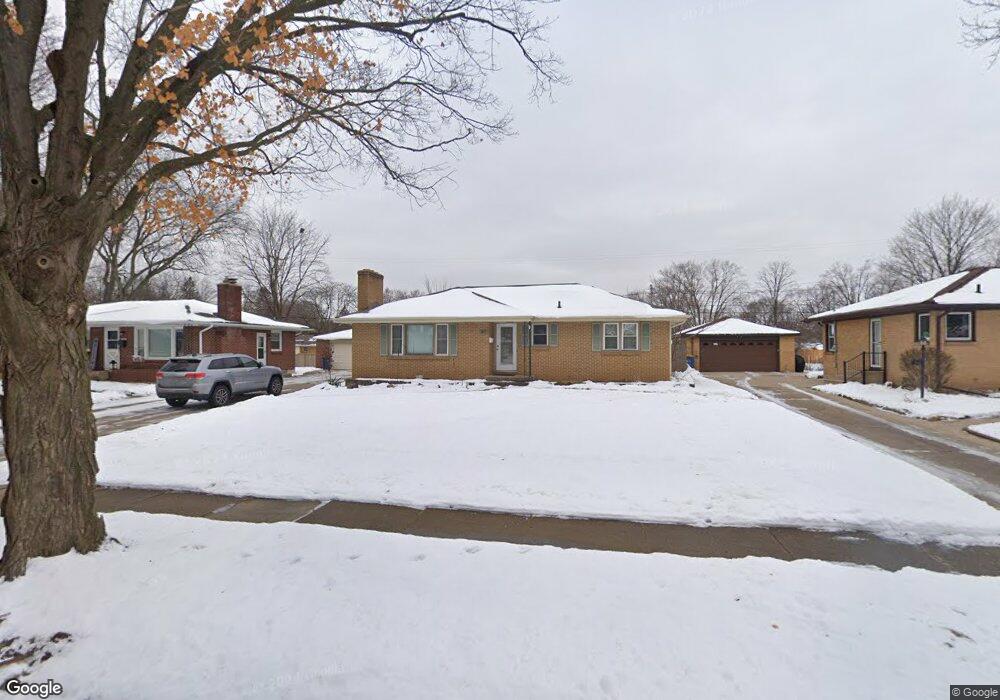
1457 Mayfield Ave NE Grand Rapids, MI 49505
North East Citizens Action NeighborhoodEstimated Value: $290,816 - $324,000
3
Beds
1
Bath
1,125
Sq Ft
$275/Sq Ft
Est. Value
About This Home
This home is located at 1457 Mayfield Ave NE, Grand Rapids, MI 49505 and is currently estimated at $309,454, approximately $275 per square foot. 1457 Mayfield Ave NE is a home located in Kent County with nearby schools including Kent Hills School, Riverside Middle School, and Union High School.
Ownership History
Date
Name
Owned For
Owner Type
Purchase Details
Closed on
Jul 30, 2004
Sold by
Robotham Christopher and Robotham Heather
Bought by
Slocum Ronald J
Current Estimated Value
Home Financials for this Owner
Home Financials are based on the most recent Mortgage that was taken out on this home.
Original Mortgage
$122,900
Outstanding Balance
$58,381
Interest Rate
5.37%
Mortgage Type
Purchase Money Mortgage
Estimated Equity
$251,073
Purchase Details
Closed on
Jul 11, 1997
Sold by
Rbthm Mcswn R
Bought by
Robotham Christophr and Robotham Kerry
Purchase Details
Closed on
Aug 31, 1994
Sold by
Fosner Fosner S S and Fosner Mcswain R
Bought by
Slocum Ronald J Jr
Purchase Details
Closed on
Jun 18, 1990
Sold by
Fosner Fosner S S and Fosner S
Bought by
Slocum Ronald J Jr
Create a Home Valuation Report for This Property
The Home Valuation Report is an in-depth analysis detailing your home's value as well as a comparison with similar homes in the area
Home Values in the Area
Average Home Value in this Area
Purchase History
| Date | Buyer | Sale Price | Title Company |
|---|---|---|---|
| Slocum Ronald J | $122,900 | -- | |
| Robotham Christophr | $86,500 | -- | |
| Slocum Ronald J Jr | $70,000 | -- | |
| Slocum Ronald J Jr | $100 | -- |
Source: Public Records
Mortgage History
| Date | Status | Borrower | Loan Amount |
|---|---|---|---|
| Open | Slocum Ronald J | $122,900 |
Source: Public Records
Tax History Compared to Growth
Tax History
| Year | Tax Paid | Tax Assessment Tax Assessment Total Assessment is a certain percentage of the fair market value that is determined by local assessors to be the total taxable value of land and additions on the property. | Land | Improvement |
|---|---|---|---|---|
| 2025 | $3,276 | $135,800 | $0 | $0 |
| 2024 | $3,276 | $125,900 | $0 | $0 |
| 2023 | $3,399 | $108,700 | $0 | $0 |
| 2022 | $3,228 | $93,800 | $0 | $0 |
| 2021 | $3,148 | $88,200 | $0 | $0 |
| 2020 | $3,043 | $82,700 | $0 | $0 |
| 2019 | $3,115 | $74,100 | $0 | $0 |
| 2018 | $3,020 | $68,000 | $0 | $0 |
| 2017 | $2,946 | $65,100 | $0 | $0 |
| 2016 | $2,960 | $58,000 | $0 | $0 |
| 2015 | $2,821 | $58,000 | $0 | $0 |
| 2013 | -- | $55,700 | $0 | $0 |
Source: Public Records
Map
Nearby Homes
- 1518 Mayfield Ave NE
- 1452 Carlton Ave NE
- 1444 Sweet St NE
- 1455 Ball Ave NE
- 1524 Sweet St NE
- 1666 Carlton Ave NE
- 1250 Mayfield Ave NE
- 1238 Carlton Ave NE
- 1237 Dale Ct NE
- 1119 Spencer St NE
- 1339 Fuller Ave NE
- 1332 Leonard St NE
- 1119 Kentwood Dr NE
- 1824 Herrick Ave NE
- 1228 Spring Ave NE
- 1060 Leonard St NE
- 1256 Diamond Ave NE
- 1335 Knapp St NE
- 1150 Diamond Ave NE
- 2027 Joan Ave NE
- 1453 Mayfield Ave NE
- 1447 Mayfield Ave NE
- 1456 Lewison Ave NE
- 1505 Mayfield Ave NE
- 1460 Lewison Ave NE
- 1452 Lewison Ave NE
- 1441 Mayfield Ave NE
- 1446 Lewison Ave NE
- 1504 Lewison Ave NE
- 1456 Mayfield Ave NE
- 1513 Mayfield Ave NE
- 1452 Mayfield Ave NE
- 1460 Mayfield Ave NE
- 1440 Lewison Ave NE
- 1446 Mayfield Ave NE
- 1437 Mayfield Ave NE
- 1504 Mayfield Ave NE
- 1512 Lewison Ave NE
- 1440 Mayfield Ave NE
- 1519 Mayfield Ave NE