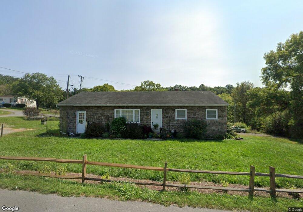
1470 Buchanan Trail W Greencastle, PA 17225
Estimated Value: $86,893 - $266,000
--
Bed
--
Bath
1,188
Sq Ft
$175/Sq Ft
Est. Value
About This Home
This home is located at 1470 Buchanan Trail W, Greencastle, PA 17225 and is currently estimated at $208,473, approximately $175 per square foot. 1470 Buchanan Trail W is a home located in Franklin County with nearby schools including Greencastle-Antrim Primary School, Greencastle-Antrim Elementary School, and Greencastle-Antrim Middle School.
Ownership History
Date
Name
Owned For
Owner Type
Purchase Details
Closed on
Jan 30, 2006
Sold by
Thornton Joseph K and Thornton Donna J
Bought by
Grimm Steven P and Grimm Mary L
Current Estimated Value
Home Financials for this Owner
Home Financials are based on the most recent Mortgage that was taken out on this home.
Original Mortgage
$125,000
Outstanding Balance
$70,828
Interest Rate
6.31%
Mortgage Type
New Conventional
Estimated Equity
$137,645
Create a Home Valuation Report for This Property
The Home Valuation Report is an in-depth analysis detailing your home's value as well as a comparison with similar homes in the area
Home Values in the Area
Average Home Value in this Area
Purchase History
| Date | Buyer | Sale Price | Title Company |
|---|---|---|---|
| Grimm Steven P | $125,000 | None Available |
Source: Public Records
Mortgage History
| Date | Status | Borrower | Loan Amount |
|---|---|---|---|
| Open | Grimm Steven P | $125,000 |
Source: Public Records
Tax History Compared to Growth
Tax History
| Year | Tax Paid | Tax Assessment Tax Assessment Total Assessment is a certain percentage of the fair market value that is determined by local assessors to be the total taxable value of land and additions on the property. | Land | Improvement |
|---|---|---|---|---|
| 2025 | $2,504 | $14,970 | $680 | $14,290 |
| 2024 | $2,272 | $14,970 | $680 | $14,290 |
| 2023 | $2,097 | $13,980 | $680 | $13,300 |
| 2022 | $2,097 | $13,980 | $680 | $13,300 |
| 2021 | $2,056 | $13,980 | $680 | $13,300 |
| 2020 | $2,002 | $13,980 | $680 | $13,300 |
| 2019 | $1,957 | $13,980 | $680 | $13,300 |
| 2018 | $1,936 | $13,980 | $680 | $13,300 |
| 2017 | $1,887 | $13,980 | $680 | $13,300 |
| 2016 | $401 | $13,980 | $680 | $13,300 |
| 2015 | $373 | $13,980 | $680 | $13,300 |
| 2014 | $373 | $13,980 | $680 | $13,300 |
Source: Public Records
Map
Nearby Homes
- 112541 Shannon Dr S
- 112566 Shannon Dr S
- 112501 Shannon Dr S
- 112506 Shannon Dr S
- 112531 Shannon Dr S
- 112551 Shannon Dr S
- 112526 Delanie Dr
- 112556 Shannon Dr S
- 112546 Shannon Dr S
- 112521 Delanie Dr
- 112576 Shannon Dr S
- 1014 Divinity Dr
- 112537 Shannon Dr S
- 382 Teaberry Dr
- 115HOM Shannon Dr S
- 375 Carolle St
- 1299 Divinity Dr
- 1882 Shannon Dr S
- LOT 666B Maya Dr
- 1809 Shannon Dr S
- 2136 Buchanan Trail W
- 1408 Buchanan Trail W
- 2156 Buchanan Trail W
- 2201 Buchanan Trail W
- 1412 Buchanan Trail W
- 2166 Buchanan Trail W
- 2140 Buchanan Trail W
- 2160 Buchanan Trail W
- 2276 Buchanan Trail W
- 1394 Buchanan Trail W
- 2370 Buchanan Trail W
- 9021 Buchanan Trail W
- 2372 Buchanan Trail W
- 2375 Buchanan Trail W
- 2371 Buchanan Trail W
- 0 Buchanan Trail W Unit LOT 2 PAFL178866
- 0 Buchanan Trail W
- 10649 Grant Shook Rd
- 10351 Grant Shook Rd
- 10721 Grant Shook Rd