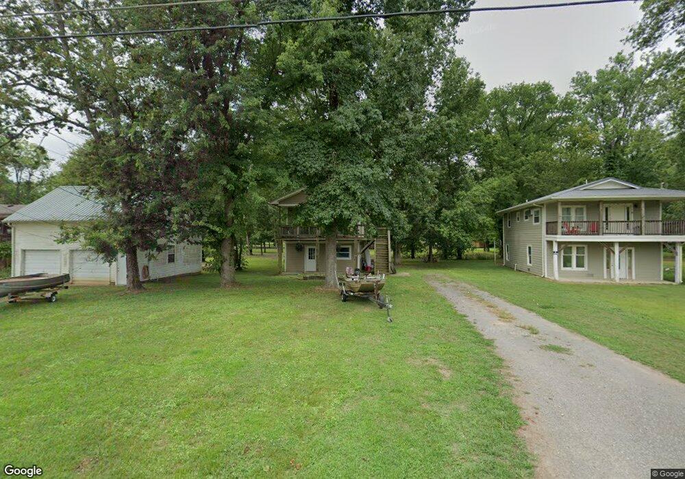
1476 Chapmansboro Rd Unit A Chapmansboro, TN 37035
Chapmansboro NeighborhoodEstimated Value: $170,389 - $310,000
--
Bed
1
Bath
440
Sq Ft
$543/Sq Ft
Est. Value
About This Home
This home is located at 1476 Chapmansboro Rd Unit A, Chapmansboro, TN 37035 and is currently estimated at $238,847, approximately $542 per square foot. 1476 Chapmansboro Rd Unit A is a home located in Cheatham County with nearby schools including Ashland City Elementary School, Cheatham Middle School, and Cheatham County Central High School.
Ownership History
Date
Name
Owned For
Owner Type
Purchase Details
Closed on
Nov 20, 2012
Sold by
Gossett Ronald
Bought by
Housch Paul T
Current Estimated Value
Purchase Details
Closed on
Aug 1, 2000
Sold by
Michael Abraham
Bought by
Gossett Ronald
Purchase Details
Closed on
Jul 31, 1991
Bought by
Abraham Michael
Purchase Details
Closed on
Mar 14, 1986
Bought by
Abraham Martin
Purchase Details
Closed on
Jan 1, 1976
Create a Home Valuation Report for This Property
The Home Valuation Report is an in-depth analysis detailing your home's value as well as a comparison with similar homes in the area
Home Values in the Area
Average Home Value in this Area
Purchase History
| Date | Buyer | Sale Price | Title Company |
|---|---|---|---|
| Housch Paul T | $90,000 | -- | |
| Gossett Ronald | $50,000 | -- | |
| Abraham Michael | $16,300 | -- | |
| Abraham Martin | -- | -- | |
| -- | $4,000 | -- |
Source: Public Records
Tax History Compared to Growth
Tax History
| Year | Tax Paid | Tax Assessment Tax Assessment Total Assessment is a certain percentage of the fair market value that is determined by local assessors to be the total taxable value of land and additions on the property. | Land | Improvement |
|---|---|---|---|---|
| 2025 | $544 | $31,400 | $0 | $0 |
| 2024 | $544 | $31,400 | $11,775 | $19,625 |
| 2023 | $442 | $15,525 | $2,050 | $13,475 |
| 2022 | $422 | $15,525 | $2,050 | $13,475 |
| 2021 | $422 | $15,525 | $2,050 | $13,475 |
| 2020 | $417 | $15,525 | $2,050 | $13,475 |
| 2019 | $417 | $15,525 | $2,050 | $13,475 |
| 2018 | $295 | $9,375 | $1,950 | $7,425 |
| 2017 | $280 | $9,375 | $1,950 | $7,425 |
| 2016 | $266 | $9,375 | $1,950 | $7,425 |
| 2015 | $255 | $8,425 | $1,950 | $6,475 |
| 2014 | $216 | $7,125 | $1,950 | $5,175 |
Source: Public Records
Map
Nearby Homes
- Lot 5 Matlock Dr
- 1341 Chapmansboro Rd
- 1001 Cumberland Dr
- 1921 Highway 12 N
- 392 Feather Ridge Rd
- 702 Cherrywood Ct
- 501 Chapmansboro Rd
- 432 Slow Roll Dr
- 5 Highway 12 N
- 1 Highway 12 N
- 4 Highway 12 N
- 0 Bobbitt Rd
- 3257 Ashland City Hwy
- 0 Hwy 49 W
- 0 Aresti Dr
- 1032 Lockridge Ln
- 2789 Highway 12 N
- 1719 Wynnewood Dr
- 0 Hwy 49 E Unit RTC2641595
- 2055 Petway Rd
- 1470 Chapmansboro Rd
- 1478A Chapmansboro Rd
- 1477 Chapmansboro Rd
- 1469 Chapmansboro Rd
- 1480 Chapmansboro Rd
- 1481 Chapmansboro Rd
- 1467 Chapmansboro Rd
- 0 Matlock Dr Unit 1943918
- 0 Matlock Dr Unit 1936906
- 0 Matlock Dr Unit RTC2618990
- 0 Matlock Dr Unit RTC2581236
- 0 Matlock Dr Unit RTC2482950
- 0 Matlock Dr Unit RTC2429280
- 0 Matlock Dr Unit 2119212
- 1465 Chapmansboro Rd
- 1463 Chapmansboro Rd
- 1485 Chapmansboro Rd
- 0 Matlock Dr
- 5 Matlock Dr
- 1461 Chapmansboro Rd