Estimated Value: $355,000 - $398,000
3
Beds
3
Baths
2,222
Sq Ft
$169/Sq Ft
Est. Value
About This Home
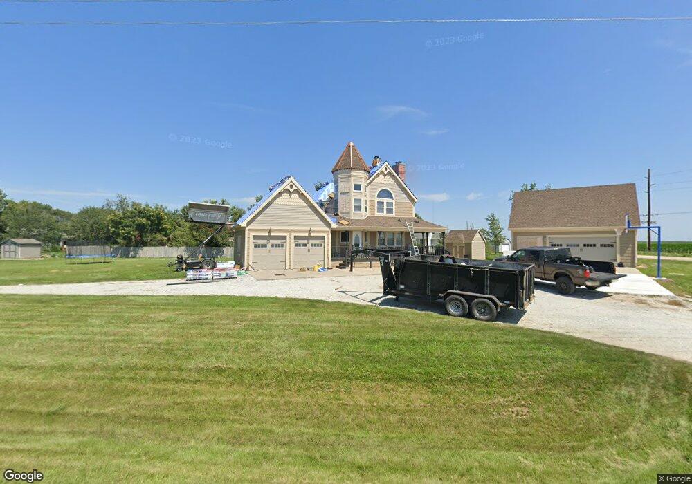
This home is located at 1480 F St, Utica, NE 68456 and is currently estimated at $374,692, approximately $168 per square foot. 1480 F St is a home with nearby schools including Centennial Elementary School, Centennial High School, and St. Paul Lutheran School.
Ownership History
Date
Name
Owned For
Owner Type
Purchase Details
Closed on
Apr 1, 2021
Sold by
Stuhr Kaela R
Bought by
Ford Seth E and Ford Keshia R
Current Estimated Value
Home Financials for this Owner
Home Financials are based on the most recent Mortgage that was taken out on this home.
Original Mortgage
$224,200
Outstanding Balance
$202,099
Interest Rate
2.9%
Mortgage Type
New Conventional
Estimated Equity
$172,593
Purchase Details
Closed on
May 4, 2020
Sold by
Stuhr Chad M
Bought by
Stuhr Kaela R
Purchase Details
Closed on
May 4, 2019
Sold by
Stuhr Chad M
Bought by
Stuhr Kaela R
Create a Home Valuation Report for This Property
The Home Valuation Report is an in-depth analysis detailing your home's value as well as a comparison with similar homes in the area
Home Values in the Area
Average Home Value in this Area
Purchase History
| Date | Buyer | Sale Price | Title Company |
|---|---|---|---|
| Ford Seth E | $281,000 | Homeservices Title | |
| Stuhr Kaela R | -- | None Available | |
| Stuhr Kaela R | -- | None Listed On Document |
Source: Public Records
Mortgage History
| Date | Status | Borrower | Loan Amount |
|---|---|---|---|
| Open | Ford Seth E | $224,200 |
Source: Public Records
Tax History Compared to Growth
Tax History
| Year | Tax Paid | Tax Assessment Tax Assessment Total Assessment is a certain percentage of the fair market value that is determined by local assessors to be the total taxable value of land and additions on the property. | Land | Improvement |
|---|---|---|---|---|
| 2024 | $2,899 | $281,692 | $22,268 | $259,424 |
| 2023 | $3,316 | $258,240 | $22,268 | $235,972 |
| 2022 | $3,088 | $229,035 | $22,268 | $206,767 |
| 2021 | $2,679 | $204,222 | $22,268 | $181,954 |
| 2020 | $2,644 | $204,222 | $22,268 | $181,954 |
| 2019 | $2,455 | $193,869 | $21,715 | $172,154 |
| 2018 | $2,222 | $177,407 | $21,399 | $156,008 |
| 2017 | $2,124 | $196,152 | $20,294 | $175,858 |
| 2016 | $2,061 | $168,959 | $20,380 | $148,579 |
| 2015 | $1,977 | $168,959 | $20,380 | $148,579 |
| 2013 | $2,265 | $168,959 | $20,380 | $148,579 |
Source: Public Records
Map
Nearby Homes
- 230 Montana Cir
- 141 Bronco Cir
- 410 B St
- 703 420th
- 735 Dimery Ave
- 1107 Road P
- 2307 Nebraska 69
- 640 A St
- 1419 Road N
- 2326 E 16th St
- 3027 Bluff Rd
- 0 Tbd 294 Rd Unit 11552208
- 1802 E 17th St
- 1903 E 17th St
- Durango Plan at Shadow Brook
- Denver Plan at Shadow Brook
- Inca Plan at Shadow Brook
- Boulder Plan at Shadow Brook
- Vail II Plan at Shadow Brook
- Nantucket Plan at Shadow Brook