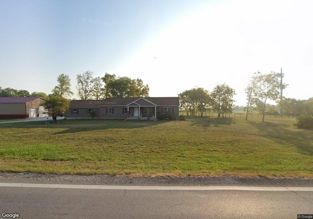
14805 State Route 56 SE Mount Sterling, OH 43143
Estimated Value: $361,000 - $578,695
3
Beds
2
Baths
1,984
Sq Ft
$241/Sq Ft
Est. Value
About This Home
This home is located at 14805 State Route 56 SE, Mount Sterling, OH 43143 and is currently estimated at $477,174, approximately $240 per square foot. 14805 State Route 56 SE is a home located in Madison County with nearby schools including Madison-Plains Elementary School, Madison-Plains Intermediate School, and Madison-Plains Junior High School.
Ownership History
Date
Name
Owned For
Owner Type
Purchase Details
Closed on
Oct 25, 2023
Sold by
Aep Ohio Transmission Co Inc
Bought by
Buckeye Power Inc
Current Estimated Value
Purchase Details
Closed on
Feb 17, 2022
Sold by
Murray David C
Bought by
Mowry Hugh R and Mowry Donna F
Purchase Details
Closed on
Feb 10, 2013
Sold by
Murray Phillip C
Bought by
Murray David C and Murray James O
Purchase Details
Closed on
Oct 27, 2003
Sold by
Murray Verna A
Bought by
Murray Verna A and The Trust Of Verna A Murray
Create a Home Valuation Report for This Property
The Home Valuation Report is an in-depth analysis detailing your home's value as well as a comparison with similar homes in the area
Home Values in the Area
Average Home Value in this Area
Purchase History
| Date | Buyer | Sale Price | Title Company |
|---|---|---|---|
| Buckeye Power Inc | -- | None Listed On Document | |
| Buckeye Power Inc | -- | None Listed On Document | |
| Mowry Hugh R | -- | Brooks L Steven | |
| Murray David C | $8,400 | None Available | |
| Murray Verna A | -- | -- |
Source: Public Records
Tax History Compared to Growth
Tax History
| Year | Tax Paid | Tax Assessment Tax Assessment Total Assessment is a certain percentage of the fair market value that is determined by local assessors to be the total taxable value of land and additions on the property. | Land | Improvement |
|---|---|---|---|---|
| 2024 | $6,141 | $167,210 | $18,820 | $148,390 |
| 2023 | $5,848 | $147,720 | $18,820 | $128,900 |
| 2022 | $1,552 | $41,770 | $13,860 | $27,910 |
| 2021 | $911 | $25,130 | $11,550 | $13,580 |
| 2020 | $403 | $11,090 | $11,090 | $0 |
| 2019 | $405 | $11,490 | $11,490 | $0 |
| 2018 | $405 | $11,490 | $11,490 | $0 |
| 2017 | $397 | $11,490 | $11,490 | $0 |
| 2016 | $382 | $11,490 | $11,490 | $0 |
| 2015 | $374 | $11,490 | $11,490 | $0 |
| 2014 | $374 | $11,490 | $11,490 | $0 |
| 2013 | -- | $11,490 | $11,490 | $0 |
Source: Public Records
Map
Nearby Homes
- 94 Jefferson St
- 60 N London St
- 67 W Columbus St
- 110 Mountview Ct
- 230 W Columbus St
- 10741 2nd St
- 500 Wingate Place N
- 16185 State Route 207
- 15561 Blain Rd
- 10495 Anderson Antioch Rd
- 12265 Woods Opossum Run
- 8713 State Route 207
- 0 Renick Rd
- 10586 Baldwin Rd
- 14008 1st St
- 16270 Cook Yankeetown Rd NE
- 13810 Yankeetown Chenoweth Rd
- 0 Rockwell Rd Unit 225016734
- 19763 Clarks Run Rd
- 11444 Kellough Rd
- 14793 State Route 56 SE
- 283 N London St
- 284 N London St
- 350 N London St
- 10880 South St
- 14690 West St
- 10901 South St
- 10890 South St
- 10910 South St
- 10920 South St
- 14695 West St
- 14720 State Route 56 SE
- 269 N London St
- 14685 West St
- 272 New St
- 20 5th Ave
- 22 5th Ave
- 22 5th St
- 14670 High St
- 14681 State Route 56 SE