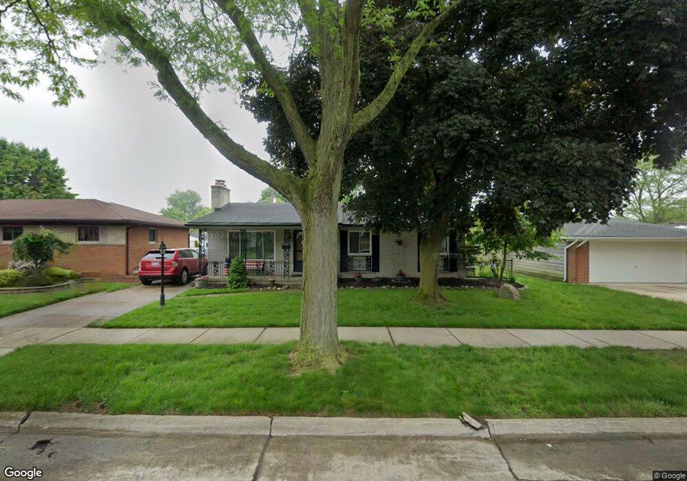
14832 Brookfield St Livonia, MI 48154
Estimated Value: $238,000 - $323,000
--
Bed
2
Baths
1,281
Sq Ft
$220/Sq Ft
Est. Value
About This Home
This home is located at 14832 Brookfield St, Livonia, MI 48154 and is currently estimated at $281,279, approximately $219 per square foot. 14832 Brookfield St is a home located in Wayne County with nearby schools including Kennedy Elementary School, Johnson Upper Elementary School, and Frost Middle School.
Ownership History
Date
Name
Owned For
Owner Type
Purchase Details
Closed on
Aug 5, 2021
Sold by
Green Charmarie A
Bought by
Axford Alan
Current Estimated Value
Home Financials for this Owner
Home Financials are based on the most recent Mortgage that was taken out on this home.
Original Mortgage
$110,250
Outstanding Balance
$100,401
Interest Rate
3%
Mortgage Type
New Conventional
Estimated Equity
$180,878
Purchase Details
Closed on
Aug 18, 2020
Sold by
Green Charmarie A
Bought by
Green Charmarie A
Purchase Details
Closed on
Aug 3, 2020
Sold by
Green Charmarie A
Bought by
Green Charmarie A and The Charmarie A Green Living Trust
Purchase Details
Closed on
Dec 17, 2013
Sold by
Green Catherine A
Bought by
Green Catherine A and The Catherine A Green Living Trust
Create a Home Valuation Report for This Property
The Home Valuation Report is an in-depth analysis detailing your home's value as well as a comparison with similar homes in the area
Home Values in the Area
Average Home Value in this Area
Purchase History
| Date | Buyer | Sale Price | Title Company |
|---|---|---|---|
| Axford Alan | $147,000 | None Available | |
| Green Charmarie A | -- | None Available | |
| Green Charmarie A | -- | None Available | |
| Green Catherine A | -- | None Available |
Source: Public Records
Mortgage History
| Date | Status | Borrower | Loan Amount |
|---|---|---|---|
| Open | Axford Alan | $110,250 |
Source: Public Records
Tax History Compared to Growth
Tax History
| Year | Tax Paid | Tax Assessment Tax Assessment Total Assessment is a certain percentage of the fair market value that is determined by local assessors to be the total taxable value of land and additions on the property. | Land | Improvement |
|---|---|---|---|---|
| 2025 | $2,640 | $139,200 | $0 | $0 |
| 2024 | $2,640 | $131,400 | $0 | $0 |
| 2023 | $2,518 | $117,400 | $0 | $0 |
| 2022 | $4,422 | $108,300 | $0 | $0 |
| 2021 | $3,504 | $104,000 | $0 | $0 |
| 2019 | $2,756 | $90,400 | $0 | $0 |
| 2018 | $1,424 | $81,900 | $0 | $0 |
| 2017 | $2,520 | $77,200 | $0 | $0 |
| 2016 | $2,649 | $77,200 | $0 | $0 |
| 2015 | $5,946 | $66,460 | $0 | $0 |
| 2012 | -- | $57,620 | $15,000 | $42,620 |
Source: Public Records
Map
Nearby Homes
- 14879 Fairfield St
- 15075 Hubbard St Unit 5
- 32136 Lyndon St
- 33040 Allen St
- 32651 5 Mile Rd Unit 15
- 32925 Martin St
- 33025 Martin St
- 14677 Auburndale St
- 15040 Berwick St
- 32950 Perth St
- 14214 Cranston St
- 14563 Melrose St
- 14327 Arden St
- 15600 Auburndale St
- 31221 Lyndon St
- 31126 Grennada St
- 15873 Shadyside Dr
- 14164 Bainbridge St
- 14292 Hubbell St
- 31005 Roycroft St
- 14844 Brookfield St
- 32658 Meadowbrook St
- 32644 Meadowbrook St
- 14856 Brookfield St
- 14833 Fairfield St
- 32630 Meadowbrook St
- 14845 Fairfield St
- 14857 Fairfield St
- 14831 Brookfield St
- 32616 Meadowbrook St
- 14843 Brookfield St
- 14819 Brookfield St
- 14876 Brookfield St
- 14855 Brookfield St
- 14807 Brookfield St
- 32657 Meadowbrook St
- 32643 Meadowbrook St
- 14888 Brookfield St Unit 12
- 32703 Meadowbrook St
- 32629 Meadowbrook St