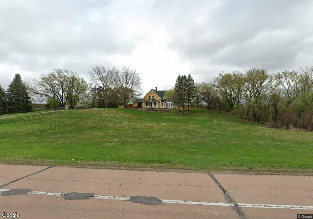
1485 County Road 27 Watertown, MN 55388
Estimated Value: $551,000 - $703,000
4
Beds
3
Baths
3,284
Sq Ft
$188/Sq Ft
Est. Value
About This Home
This home is located at 1485 County Road 27, Watertown, MN 55388 and is currently estimated at $616,118, approximately $187 per square foot. 1485 County Road 27 is a home located in Carver County with nearby schools including Watertown-Mayer Elementary School, Watertown-Mayer Middle School, and Watertown Mayer High School.
Ownership History
Date
Name
Owned For
Owner Type
Purchase Details
Closed on
Jun 11, 2025
Sold by
Grant Kathleen D
Bought by
Grant Kelley M
Current Estimated Value
Purchase Details
Closed on
Sep 14, 2022
Sold by
Jirik Lucille M
Bought by
Grant Kathleen D
Create a Home Valuation Report for This Property
The Home Valuation Report is an in-depth analysis detailing your home's value as well as a comparison with similar homes in the area
Home Values in the Area
Average Home Value in this Area
Purchase History
| Date | Buyer | Sale Price | Title Company |
|---|---|---|---|
| Grant Kelley M | $500 | None Listed On Document | |
| Grant Kathleen D | $610,000 | Watermark Title |
Source: Public Records
Tax History Compared to Growth
Tax History
| Year | Tax Paid | Tax Assessment Tax Assessment Total Assessment is a certain percentage of the fair market value that is determined by local assessors to be the total taxable value of land and additions on the property. | Land | Improvement |
|---|---|---|---|---|
| 2025 | $4,378 | $539,100 | $255,000 | $284,100 |
| 2024 | $4,516 | $534,600 | $248,800 | $285,800 |
| 2023 | $3,346 | $541,100 | $248,800 | $292,300 |
| 2022 | $3,204 | $374,800 | $189,800 | $185,000 |
| 2021 | $3,270 | $296,300 | $146,600 | $149,700 |
| 2020 | $3,260 | $86,400 | $73,300 | $13,100 |
| 2019 | $3,094 | $276,000 | $133,700 | $142,300 |
| 2018 | $3,086 | $362,200 | $207,000 | $155,200 |
| 2017 | $3,260 | $342,400 | $198,800 | $143,600 |
| 2016 | $3,352 | $330,900 | $0 | $0 |
| 2015 | $3,066 | $312,400 | $0 | $0 |
| 2014 | $3,066 | $289,300 | $0 | $0 |
Source: Public Records
Map
Nearby Homes
- 160 Wildwood Cir Unit 160
- 120 Riverside Terrace Dr Unit 102
- 85 Riverside Terrace Dr Unit 85
- 29 Riverside Terrace Dr Unit 29
- 417 Lewis Ave N
- The Calhoun Plan at Forest Hills
- The Rockwell Plan at Forest Hills
- The Stratford Plan at Forest Hills
- The Springfield Plan at Forest Hills
- The Wentworth Plan at Forest Hills
- The Arlington Plan at Forest Hills
- The Linden II Plan at Forest Hills
- The Meadow Plan at Forest Hills
- The Poplar II Plan at Forest Hills
- The Summit Plan at Forest Hills
- The Birch Plan at Forest Hills
- The Everest Plan at Forest Hills
- The Willow Plan at Forest Hills
- The Hickory Plan at Forest Hills
- The Afton Plan at Forest Hills
- 11988 11988 Dalton-Avenue-se
- 11883 Dalton Ave SE
- 11744 Dalton Ave SE
- 11855 Dalton Ave SE
- 11988 Dalton Ave SE
- 11781 Dalton Ave SE
- 1720 County Road 27
- 815 Mill Ave
- 11740 Dalton Ave SE
- 1455 County Road 27
- 829 Mill Ave
- xxx NE Mill Ave
- 217 Ortloff Trail NW
- 11847 Dalton Ave SE
- 341 Ann St NW
- 337 Ann St NW
- 301 Ortloff Trail NW
- 345 Ann St NW
- 333 Ann St NW
- 216 Ortloff Trail NW