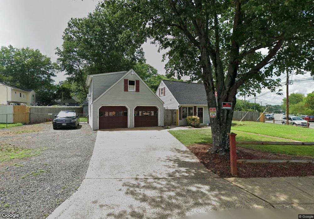
149 Manassas Dr Manassas Park, VA 20111
Estimated Value: $396,000 - $407,000
3
Beds
1
Bath
941
Sq Ft
$426/Sq Ft
Est. Value
About This Home
This home is located at 149 Manassas Dr, Manassas Park, VA 20111 and is currently estimated at $400,579, approximately $425 per square foot. 149 Manassas Dr is a home located in Manassas Park City with nearby schools including Cougar Elementary School, Manassas Park Elementary School, and Manassas Park Middle School.
Ownership History
Date
Name
Owned For
Owner Type
Purchase Details
Closed on
May 21, 1999
Sold by
Garcia Michael A
Bought by
Samuels Wade
Current Estimated Value
Home Financials for this Owner
Home Financials are based on the most recent Mortgage that was taken out on this home.
Original Mortgage
$116,450
Outstanding Balance
$29,690
Interest Rate
6.88%
Estimated Equity
$370,889
Create a Home Valuation Report for This Property
The Home Valuation Report is an in-depth analysis detailing your home's value as well as a comparison with similar homes in the area
Home Values in the Area
Average Home Value in this Area
Purchase History
| Date | Buyer | Sale Price | Title Company |
|---|---|---|---|
| Samuels Wade | $118,000 | -- |
Source: Public Records
Mortgage History
| Date | Status | Borrower | Loan Amount |
|---|---|---|---|
| Open | Samuels Wade | $116,450 |
Source: Public Records
Tax History Compared to Growth
Tax History
| Year | Tax Paid | Tax Assessment Tax Assessment Total Assessment is a certain percentage of the fair market value that is determined by local assessors to be the total taxable value of land and additions on the property. | Land | Improvement |
|---|---|---|---|---|
| 2025 | $5,237 | $376,300 | $157,900 | $218,400 |
| 2024 | $5,237 | $349,400 | $143,500 | $205,900 |
| 2023 | $5,237 | $360,600 | $114,800 | $245,800 |
| 2022 | $5,018 | $350,100 | $109,300 | $240,800 |
| 2021 | $4,754 | $318,200 | $95,000 | $223,200 |
| 2020 | $4,472 | $297,300 | $78,300 | $219,000 |
| 2019 | $4,472 | $279,100 | $79,100 | $200,000 |
| 2018 | $3,914 | $263,300 | $74,600 | $188,700 |
| 2017 | $3,825 | $250,700 | $74,600 | $176,100 |
| 2016 | $3,790 | $244,500 | $74,600 | $169,900 |
| 2015 | $3,314 | $228,500 | $74,600 | $153,900 |
| 2014 | $3,314 | $189,600 | $74,600 | $115,000 |
Source: Public Records
Map
Nearby Homes
- 167 Scott Dr
- 8275 Vermont Place
- 185 Cabbel Dr
- 8494 Kirby St
- 8468 Battle Ct
- 8625 Point of Woods Dr
- 9022 New Britain Cir
- 135 Polk Dr
- 8321 Maplewood Dr
- 8300 Sunnyside Ct
- 8319 Leighlex Ct
- 8020 Towering Oak Way
- 8639 Union Place
- 504 Tassita Ln
- 8006 Well St
- 8667 Madera Ct Unit 75
- 248 Manassas Dr
- 8584 Liberia Ave
- 8396 Woodline Ct
- 319 Moseby Ct Unit E
- 151 Manassas Dr
- 102 Forrest St
- 104 Forrest St
- 147 Manassas Dr
- 106 Forrest St
- 103 Price Dr
- 148 Manassas Dr
- 150 Manassas Dr
- 146 Manassas Dr
- 155 Manassas Dr
- 144 Manassas Dr
- 108 Forrest St
- 105 Price Dr
- 101 Forrest St
- 152 Manassas Dr
- 145 Manassas Dr
- 157 Manassas Dr
- 142 Manassas Dr
- 110 Forrest St
- 154 Manassas Dr