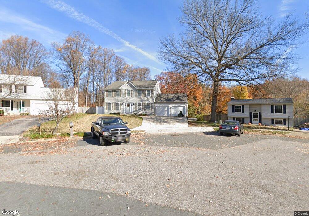
1499 Amberwood Dr S Annapolis, MD 21409
Pendennis Mount NeighborhoodEstimated Value: $543,000 - $655,000
--
Bed
3
Baths
2,268
Sq Ft
$270/Sq Ft
Est. Value
About This Home
This home is located at 1499 Amberwood Dr S, Annapolis, MD 21409 and is currently estimated at $611,336, approximately $269 per square foot. 1499 Amberwood Dr S is a home located in Anne Arundel County with nearby schools including Windsor Farm Elementary School, Severn River Middle School, and Broadneck High School.
Ownership History
Date
Name
Owned For
Owner Type
Purchase Details
Closed on
Oct 21, 2009
Sold by
Hering Daniel
Bought by
Hering Paige M
Current Estimated Value
Home Financials for this Owner
Home Financials are based on the most recent Mortgage that was taken out on this home.
Original Mortgage
$407,000
Interest Rate
5.14%
Mortgage Type
New Conventional
Purchase Details
Closed on
Feb 8, 1999
Sold by
Hering Daniel
Bought by
Hering Daniel and Hering Paige M
Purchase Details
Closed on
Aug 29, 1995
Sold by
Boulder Dev Inc
Bought by
Hering Daniel
Home Financials for this Owner
Home Financials are based on the most recent Mortgage that was taken out on this home.
Original Mortgage
$185,625
Interest Rate
7.32%
Create a Home Valuation Report for This Property
The Home Valuation Report is an in-depth analysis detailing your home's value as well as a comparison with similar homes in the area
Home Values in the Area
Average Home Value in this Area
Purchase History
| Date | Buyer | Sale Price | Title Company |
|---|---|---|---|
| Hering Paige M | -- | -- | |
| Hering Daniel | -- | -- | |
| Hering Daniel | $206,250 | -- |
Source: Public Records
Mortgage History
| Date | Status | Borrower | Loan Amount |
|---|---|---|---|
| Closed | Hering Paige M | $407,000 | |
| Previous Owner | Hering Daniel | $185,625 |
Source: Public Records
Tax History Compared to Growth
Tax History
| Year | Tax Paid | Tax Assessment Tax Assessment Total Assessment is a certain percentage of the fair market value that is determined by local assessors to be the total taxable value of land and additions on the property. | Land | Improvement |
|---|---|---|---|---|
| 2025 | $4,057 | $514,100 | -- | -- |
| 2024 | $4,057 | $480,300 | $258,000 | $222,300 |
| 2023 | $3,944 | $466,167 | $0 | $0 |
| 2022 | $3,688 | $452,033 | $0 | $0 |
| 2021 | $7,237 | $437,900 | $226,000 | $211,900 |
| 2020 | $3,504 | $419,033 | $0 | $0 |
| 2019 | $3,434 | $400,167 | $0 | $0 |
| 2018 | $3,866 | $381,300 | $173,000 | $208,300 |
| 2017 | $3,230 | $378,367 | $0 | $0 |
| 2016 | -- | $375,433 | $0 | $0 |
| 2015 | -- | $372,500 | $0 | $0 |
| 2014 | -- | $372,300 | $0 | $0 |
Source: Public Records
Map
Nearby Homes
- 1742 Woodtree Cir
- 332 Charred Oak Ct
- 78 Old Mill Bottom Rd N
- B2 Plan at Element at Mill Creek
- Element 3 Bed Plan at Element at Mill Creek
- B3 Plan at Element at Mill Creek
- B4 Plan at Element at Mill Creek
- C1 Plan at Element at Mill Creek
- B2 Alt Reverse Plan at Element at Mill Creek
- A1 Plan at Element at Mill Creek
- Element 2 Bed Plan at Element at Mill Creek
- C2 Plan at Element at Mill Creek
- 78 Old Mill Bottom Rd N Unit 107
- B1 Plan at Element at Mill Creek
- B1 Alt-1 Plan at Element at Mill Creek
- Element 1 Bed Plan at Element at Mill Creek
- B4 Alt-1 Plan at Element at Mill Creek
- 76 Old Mill Bottom Rd N Unit 312
- 76 Old Mill Bottom Rd N Unit 111
- 76 Old Mill Bottom Rd N Unit 308
- 1497 Amberwood Dr S
- 1506 Amberwood Dr S
- 1495 Amberwood Dr S
- 1504 Amberwood Dr S
- 1494 Amberwood Dr S
- 1493 Amberwood Dr S
- 1502 Amberwood Dr S
- 1492 Amberwood Dr S
- 1500 Amberwood Dr S
- 1496 Amberwood Dr S
- 1498 Amberwood Dr S
- 1491 Amberwood Dr S
- 1490 Amberwood Dr S
- 1488 Amberwood Dr S
- 1489 Amberwood Dr S
- 396 Blossom Tree Dr
- 398 Blossom Tree Dr
- 400 Blossom Tree Dr
- 394 Blossom Tree Dr
- 1486 Amberwood Dr S