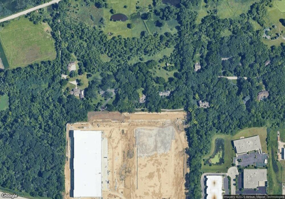
14N550 Covered Bridge Rd Dundee, IL 60118
Estimated Value: $500,000 - $641,592
--
Bed
--
Bath
2,496
Sq Ft
$232/Sq Ft
Est. Value
About This Home
This home is located at 14N550 Covered Bridge Rd, Dundee, IL 60118 and is currently estimated at $579,898, approximately $232 per square foot. 14N550 Covered Bridge Rd is a home located in Kane County with nearby schools including Sleepy Hollow Elementary School, Dundee Middle School, and Dundee-Crown High School.
Ownership History
Date
Name
Owned For
Owner Type
Purchase Details
Closed on
Jun 4, 2003
Sold by
Conti Joseph V
Bought by
Ahlman William and Ahlman Joan
Current Estimated Value
Purchase Details
Closed on
Jun 9, 1999
Sold by
Conti Kimberly A
Bought by
Conti Joseph
Purchase Details
Closed on
Apr 30, 1996
Sold by
Hanley Harry E
Bought by
Conti Joseph A and Conti Kimberly A
Home Financials for this Owner
Home Financials are based on the most recent Mortgage that was taken out on this home.
Original Mortgage
$122,500
Interest Rate
7.86%
Create a Home Valuation Report for This Property
The Home Valuation Report is an in-depth analysis detailing your home's value as well as a comparison with similar homes in the area
Home Values in the Area
Average Home Value in this Area
Purchase History
| Date | Buyer | Sale Price | Title Company |
|---|---|---|---|
| Ahlman William | $217,000 | -- | |
| Conti Joseph | -- | -- | |
| Conti Joseph A | $175,000 | -- |
Source: Public Records
Mortgage History
| Date | Status | Borrower | Loan Amount |
|---|---|---|---|
| Previous Owner | Conti Joseph A | $122,500 |
Source: Public Records
Tax History Compared to Growth
Tax History
| Year | Tax Paid | Tax Assessment Tax Assessment Total Assessment is a certain percentage of the fair market value that is determined by local assessors to be the total taxable value of land and additions on the property. | Land | Improvement |
|---|---|---|---|---|
| 2024 | $12,277 | $195,474 | $71,434 | $124,040 |
| 2023 | $11,681 | $175,881 | $64,274 | $111,607 |
| 2022 | $11,029 | $158,282 | $64,274 | $94,008 |
| 2021 | $10,692 | $149,449 | $60,687 | $88,762 |
| 2020 | $10,487 | $146,089 | $59,323 | $86,766 |
| 2019 | $10,192 | $138,684 | $56,316 | $82,368 |
| 2018 | $10,442 | $136,936 | $74,861 | $62,075 |
| 2017 | $9,997 | $128,097 | $70,029 | $58,068 |
| 2016 | $10,261 | $124,029 | $67,805 | $56,224 |
| 2015 | -- | $116,219 | $63,535 | $52,684 |
| 2014 | -- | $136,473 | $88,116 | $48,357 |
| 2013 | -- | $140,650 | $90,813 | $49,837 |
Source: Public Records
Map
Nearby Homes
- 1121 Forest Dr
- 10 Chateau Dr
- 1223 Ridgeway Dr
- 89 Brookwood Ct
- 36W225 Hickory Hollow Dr
- 36W251 Oak Hill Dr
- 5 Creekside Cir Unit B
- 1235 Meadow Ln
- 1177 Meadow Ln
- 936 Glen Oak Dr
- 997 Meadow Ln
- 41 Lockman Cir Unit 5
- 1214 Carol Crest Dr
- 1405 Creekside Ct Unit B
- 938 Hillcrest Rd
- 1142 Morningside Dr
- 1104 Florimond Dr
- 36W650 Hickory Hollow Dr
- 842 Winmoor Dr
- 1042 Chateau Bluff Ln
- 14N544 Covered Bridge Rd
- 35W590 Tollgate Rd
- 14N546 Covered Bridge Rd
- 35W660 Tollgate Rd
- 35W530 Tollgate Rd
- 35W495 Chateau Dr W
- 35W755 Boncosky Rd
- 35W490 Chateau Dr W
- 35W450 Chateau Dr W
- 35W655 Tollgate Rd
- 35W416 Chateau Dr W
- 35W625 Tollgate Rd
- 35W625 Tollgate Rd
- 35W645 Tollgate Rd
- 35W401 Chateau Dr W
- 35W575 Boncosky Rd
- 35W388 Chateau Dr W
- 35W525 Boncosky Rd
- 35W360 Chateau Dr W
- 35W349 Chateau Dr W
