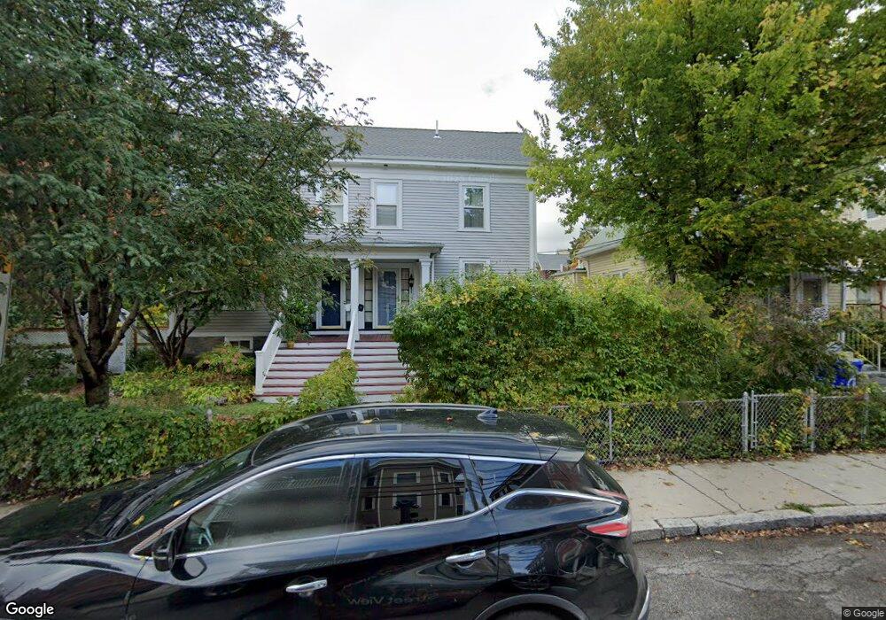
15 Athol St Allston, MA 02134
Allston NeighborhoodEstimated Value: $780,000 - $940,000
4
Beds
1
Bath
1,780
Sq Ft
$471/Sq Ft
Est. Value
About This Home
This home is located at 15 Athol St, Allston, MA 02134 and is currently estimated at $838,288, approximately $470 per square foot. 15 Athol St is a home located in Suffolk County with nearby schools including German International School Boston, Buckingham Browne & Nichols School, and St Herman Of Alaska Christian School.
Ownership History
Date
Name
Owned For
Owner Type
Purchase Details
Closed on
Nov 17, 2021
Sold by
Vaidya Rita L and Vaidya Rita L
Bought by
Eskew Julia R and Vaidya Rita L
Current Estimated Value
Purchase Details
Closed on
Jun 12, 1997
Sold by
Carpenter Michael G and Carpenter Antonett M
Bought by
Eskew John R and Vaidya Rita L
Home Financials for this Owner
Home Financials are based on the most recent Mortgage that was taken out on this home.
Original Mortgage
$103,200
Interest Rate
7.97%
Mortgage Type
Purchase Money Mortgage
Create a Home Valuation Report for This Property
The Home Valuation Report is an in-depth analysis detailing your home's value as well as a comparison with similar homes in the area
Home Values in the Area
Average Home Value in this Area
Purchase History
| Date | Buyer | Sale Price | Title Company |
|---|---|---|---|
| Eskew Julia R | -- | None Available | |
| Eskew Julia R | -- | None Available | |
| Vaidya Rita L | -- | None Available | |
| Eskew John R | $129,000 | -- | |
| Eskew John R | $129,000 | -- |
Source: Public Records
Mortgage History
| Date | Status | Borrower | Loan Amount |
|---|---|---|---|
| Previous Owner | Eskew John R | $103,200 |
Source: Public Records
Tax History Compared to Growth
Tax History
| Year | Tax Paid | Tax Assessment Tax Assessment Total Assessment is a certain percentage of the fair market value that is determined by local assessors to be the total taxable value of land and additions on the property. | Land | Improvement |
|---|---|---|---|---|
| 2025 | $7,674 | $662,700 | $0 | $662,700 |
| 2024 | $3,829 | $351,300 | $0 | $351,300 |
| 2023 | $3,526 | $328,300 | $0 | $328,300 |
| 2022 | $3,338 | $306,800 | $0 | $306,800 |
| 2021 | $3,274 | $306,800 | $0 | $306,800 |
| 2020 | $3,376 | $319,700 | $0 | $319,700 |
| 2019 | $3,008 | $285,400 | $0 | $285,400 |
| 2018 | $2,820 | $269,100 | $0 | $269,100 |
| 2017 | $2,639 | $249,200 | $0 | $249,200 |
| 2016 | $2,516 | $228,700 | $0 | $228,700 |
| 2015 | $3,254 | $268,700 | $0 | $268,700 |
| 2014 | $3,102 | $246,600 | $0 | $246,600 |
Source: Public Records
Map
Nearby Homes
- 54-60 Holton St Unit 58
- 11 Easton St
- 110-112 Litchfield St
- 180 Telford St Unit 5-9
- 180 Telford St Unit 321
- 27 Coolidge Rd Unit 1
- 408 Western Ave
- 472-474 Western Ave
- 22 Royal St
- 8 Franklin St Unit 202
- 8 Franklin St Unit 403
- 8 Franklin St Unit 401
- 4 Franklin St Unit 403
- 20 Penniman Rd Unit 208
- 1 Highgate St
- 30 Penniman Rd Unit 201
- 42 Waverly St Unit M
- 42 Waverly St Unit 3
- 100 Lincoln St Unit 302
- 100 Lincoln St Unit 507
- 15 Athol St Unit 15
- 15 Athol St Unit 2
- 17 Athol St
- 9 Athol St
- 9 Athol St Unit 9
- 23 Athol St
- 12 Athol St Unit 1
- 12 Athol St
- 12 Athol St Unit 2
- 12 Athol St Unit 3
- 17 Raymond St Unit 1
- 17 Raymond St
- 27 Athol St
- 10 Athol St
- 10 Athol St Unit 2
- 10 Athol St Unit 3
- 6 Athol St
- 6 Athol St Unit 3
- 6 Athol St Unit 2
- 15 Raymond St Unit 15A