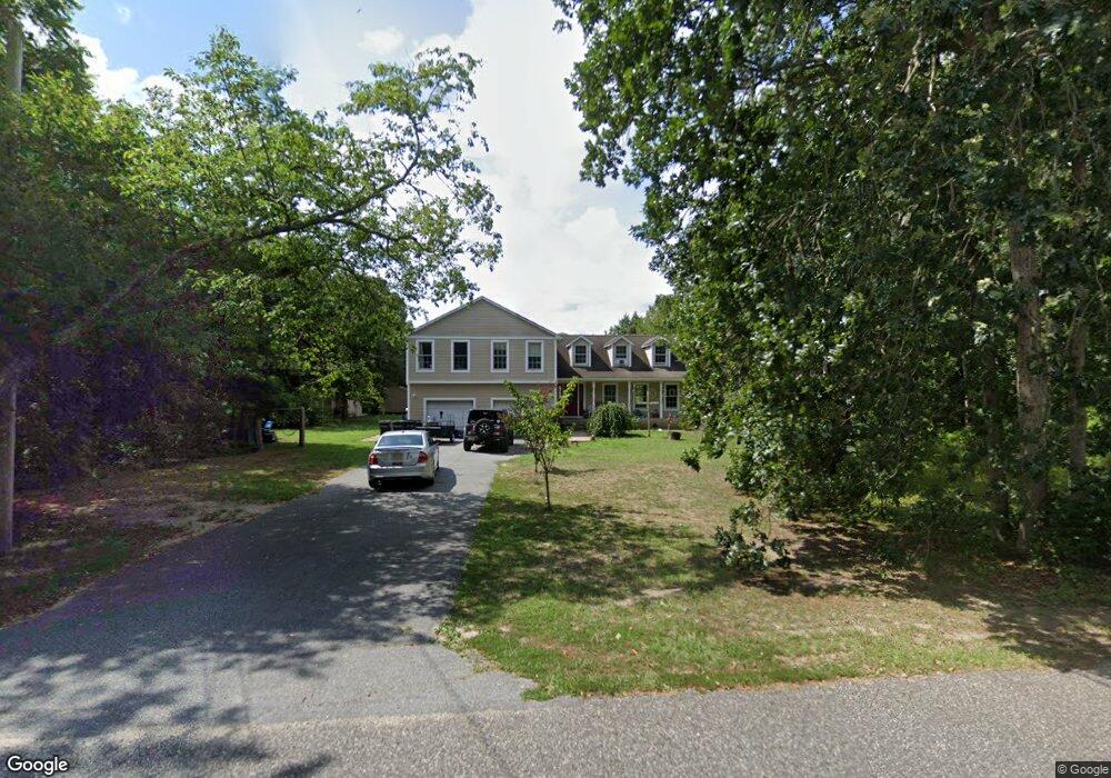
15 Brooks Ave Cape May Court House, NJ 08210
Estimated Value: $627,000 - $729,597
4
Beds
3
Baths
3,007
Sq Ft
$226/Sq Ft
Est. Value
About This Home
This home is located at 15 Brooks Ave, Cape May Court House, NJ 08210 and is currently estimated at $679,399, approximately $225 per square foot. 15 Brooks Ave is a home located in Cape May County with nearby schools including Middle Township Elementary No. 1, Middle Township Elementary No. 2, and Middle Township Middle School.
Ownership History
Date
Name
Owned For
Owner Type
Purchase Details
Closed on
May 18, 2010
Sold by
The Bank Of New York Mellon
Bought by
Guild Jonathan Richard
Current Estimated Value
Home Financials for this Owner
Home Financials are based on the most recent Mortgage that was taken out on this home.
Original Mortgage
$228,800
Outstanding Balance
$153,955
Interest Rate
5.13%
Mortgage Type
New Conventional
Estimated Equity
$525,444
Purchase Details
Closed on
Oct 21, 2009
Sold by
Szambelak Stanley P and Szambelak Susan M
Bought by
The Bank Of New York Mellon and The Bank Of New York
Purchase Details
Closed on
Jun 17, 2005
Sold by
Deangelis Joseph and Lacoste Lorraine
Bought by
Szambelak Stanley and Szambelak Susan M
Home Financials for this Owner
Home Financials are based on the most recent Mortgage that was taken out on this home.
Original Mortgage
$310,500
Interest Rate
5.73%
Mortgage Type
New Conventional
Create a Home Valuation Report for This Property
The Home Valuation Report is an in-depth analysis detailing your home's value as well as a comparison with similar homes in the area
Home Values in the Area
Average Home Value in this Area
Purchase History
| Date | Buyer | Sale Price | Title Company |
|---|---|---|---|
| Guild Jonathan Richard | $286,000 | Land Title Services | |
| The Bank Of New York Mellon | -- | None Available | |
| Szambelak Stanley | $345,000 | -- |
Source: Public Records
Mortgage History
| Date | Status | Borrower | Loan Amount |
|---|---|---|---|
| Open | Guild Jonathan Richard | $228,800 | |
| Previous Owner | Szambelak Stanley | $310,500 |
Source: Public Records
Tax History Compared to Growth
Tax History
| Year | Tax Paid | Tax Assessment Tax Assessment Total Assessment is a certain percentage of the fair market value that is determined by local assessors to be the total taxable value of land and additions on the property. | Land | Improvement |
|---|---|---|---|---|
| 2025 | $7,386 | $350,200 | $151,000 | $199,200 |
| 2024 | $7,386 | $350,200 | $151,000 | $199,200 |
| 2023 | $7,200 | $350,200 | $151,000 | $199,200 |
| 2022 | $6,993 | $350,200 | $151,000 | $199,200 |
| 2021 | $6,825 | $350,200 | $151,000 | $199,200 |
| 2020 | $6,685 | $350,200 | $151,000 | $199,200 |
| 2019 | $6,514 | $350,200 | $151,000 | $199,200 |
| 2018 | $6,412 | $350,200 | $151,000 | $199,200 |
| 2017 | $6,283 | $350,200 | $151,000 | $199,200 |
| 2016 | $6,125 | $350,200 | $151,000 | $199,200 |
| 2015 | $6,079 | $350,200 | $151,000 | $199,200 |
| 2014 | $6,041 | $350,200 | $151,000 | $199,200 |
Source: Public Records
Map
Nearby Homes
- 30 Brooks Ave
- 17 Eagle Way Ct
- 19 Eagle Way Ct
- 1845 Route 9 N
- 3 Fairway Dr
- 1877 Route 9 N
- 26 Pine Wood Ct
- 28 Pinewood Ct
- 18 Brook Ridge Rd
- 18 Avalon Blvd
- 12 Seagrove Ave
- 2044 Route 9 N
- 119 Hagen Rd
- 201 Saint Andrews Dr Unit 201
- 7 Barbers Ln
- 176 S Ravenwood Dr
- 18 Ravenwood Dr E
- 809 Turnberry Ct Unit 809 TURNBERRY COURT
- 57 Siegtown Rd
- 63 Siegtown Rd