Estimated Value: $802,438 - $868,000
4
Beds
2
Baths
1,932
Sq Ft
$431/Sq Ft
Est. Value
About This Home
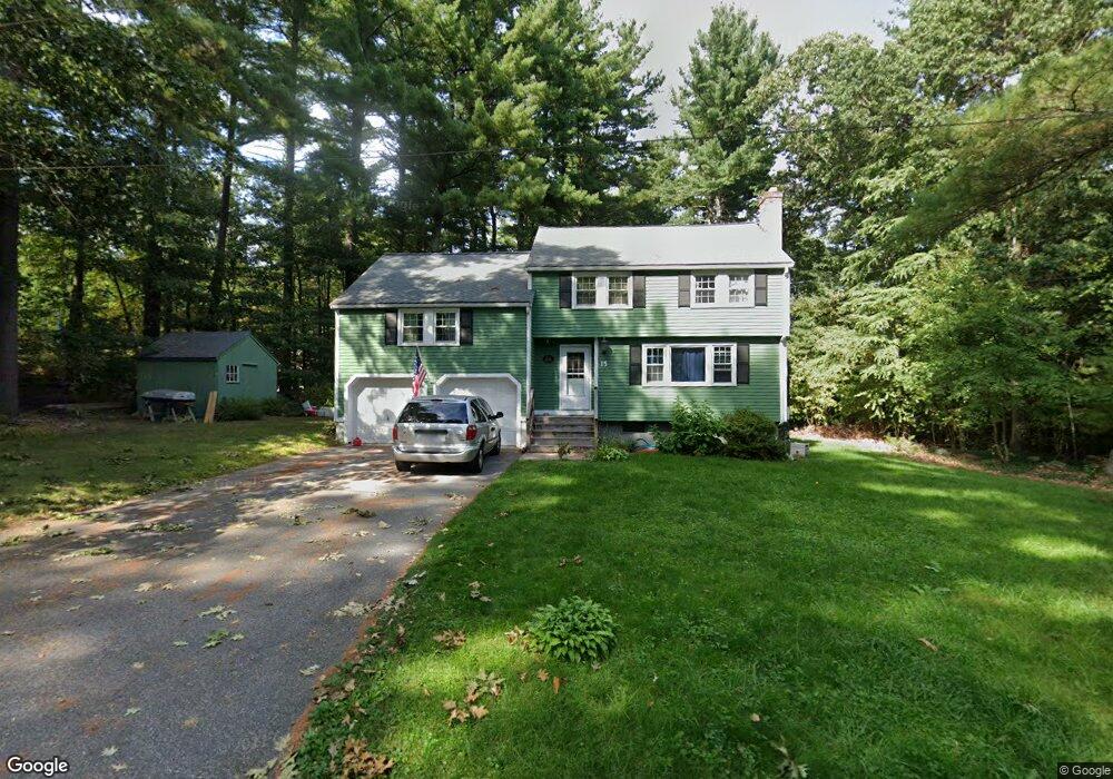
This home is located at 15 Marian Rd, Acton, MA 01720 and is currently estimated at $832,860, approximately $431 per square foot. 15 Marian Rd is a home located in Middlesex County with nearby schools including Acton-Boxborough Regional High School.
Ownership History
Date
Name
Owned For
Owner Type
Purchase Details
Closed on
Apr 1, 2005
Sold by
Brown Karey D and Brown Wilfred E
Bought by
Bradbury Sarah B and Bradbury Timothy P
Current Estimated Value
Home Financials for this Owner
Home Financials are based on the most recent Mortgage that was taken out on this home.
Original Mortgage
$220,000
Outstanding Balance
$112,274
Interest Rate
5.61%
Mortgage Type
Purchase Money Mortgage
Estimated Equity
$720,586
Create a Home Valuation Report for This Property
The Home Valuation Report is an in-depth analysis detailing your home's value as well as a comparison with similar homes in the area
Home Values in the Area
Average Home Value in this Area
Purchase History
| Date | Buyer | Sale Price | Title Company |
|---|---|---|---|
| Bradbury Sarah B | $320,000 | -- |
Source: Public Records
Mortgage History
| Date | Status | Borrower | Loan Amount |
|---|---|---|---|
| Open | Bradbury Sarah B | $220,000 |
Source: Public Records
Tax History Compared to Growth
Tax History
| Year | Tax Paid | Tax Assessment Tax Assessment Total Assessment is a certain percentage of the fair market value that is determined by local assessors to be the total taxable value of land and additions on the property. | Land | Improvement |
|---|---|---|---|---|
| 2025 | $11,794 | $687,700 | $340,800 | $346,900 |
| 2024 | $11,096 | $665,600 | $340,800 | $324,800 |
| 2023 | $10,784 | $614,100 | $309,700 | $304,400 |
| 2022 | $10,235 | $526,200 | $269,300 | $256,900 |
| 2021 | $9,967 | $492,700 | $249,400 | $243,300 |
| 2020 | $9,787 | $508,700 | $249,400 | $259,300 |
| 2019 | $9,441 | $487,400 | $249,400 | $238,000 |
| 2018 | $9,302 | $480,000 | $249,400 | $230,600 |
| 2017 | $9,076 | $476,200 | $249,400 | $226,800 |
| 2016 | $8,942 | $465,000 | $249,400 | $215,600 |
| 2015 | $8,786 | $461,200 | $249,400 | $211,800 |
| 2014 | $8,570 | $440,600 | $249,400 | $191,200 |
Source: Public Records
Map
Nearby Homes
- 12 Olde Lantern Rd
- 92 Willow St Unit 3
- 92 Willow St Unit 2
- 90 Willow St Unit 1
- 3 Heather Hill Rd
- 89 Windsor Ave
- 4,7,8 Crestwood Ln
- 285 Central St Unit 285
- 68 Macintosh Ln
- 134 Russet Ln
- 96 Cedarwood Rd
- 5 Elm St Unit 1
- 9 Elm St Unit 1
- 169 Main St
- 31 Mohawk Dr
- 19 Railroad St Unit C2
- 220 Red Acre Rd
- 207 Boxboro Rd
- 131 Main St
- 129 Main St Unit 129
- 17 Marian Rd
- 13 Marian Rd
- 18 Notre Dame Rd
- 1 Duggan Rd
- 20 Notre Dame Rd
- 6 Squirrel Hill Rd
- 2 Duggan Rd
- 16 Notre Dame Rd
- 1 Squirrel Hill Rd
- 11 Marian Rd
- 8 Squirrel Hill Rd
- 8 Squirrel Hill Rd Unit 15
- 4 Duggan Rd
- 3 Duggan Rd
- 17 Notre Dame Rd
- 14 Marian Rd
- 7 Squirrel Hill Rd
- 423 Arlington St
- 15 Notre Dame Rd
- 14 Notre Dame Rd