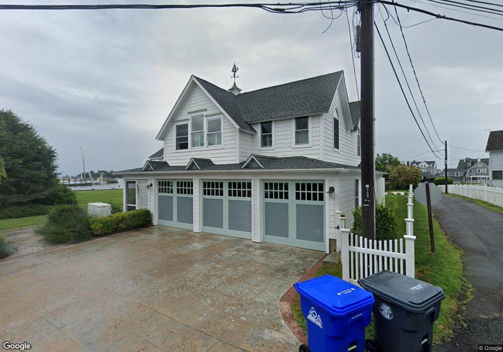
15 Waterside Rd Branford, CT 06405
Estimated Value: $2,476,000 - $2,923,000
5
Beds
6
Baths
5,634
Sq Ft
$485/Sq Ft
Est. Value
About This Home
This home is located at 15 Waterside Rd, Branford, CT 06405 and is currently estimated at $2,734,725, approximately $485 per square foot. 15 Waterside Rd is a home located in New Haven County with nearby schools including Francis Walsh Intermediate School, Branford High School, and East Shoreline Catholic Academy.
Ownership History
Date
Name
Owned For
Owner Type
Purchase Details
Closed on
Jul 22, 2020
Sold by
Kenna Frank and Kenna Kimberly B
Bought by
Kenna Kimberly B
Current Estimated Value
Purchase Details
Closed on
Mar 23, 2015
Sold by
Ruwe Patrick A and Ruwe Stacy S
Bought by
Kenna Kimberly B
Purchase Details
Closed on
Oct 30, 1995
Sold by
Ely Donna D and Delfini Ronald H
Bought by
Ruwe Patrick A and Ruwe Stacy S
Create a Home Valuation Report for This Property
The Home Valuation Report is an in-depth analysis detailing your home's value as well as a comparison with similar homes in the area
Home Values in the Area
Average Home Value in this Area
Purchase History
| Date | Buyer | Sale Price | Title Company |
|---|---|---|---|
| Kenna Kimberly B | -- | None Available | |
| Kenna Kimberly B | $1,700,000 | -- | |
| Ruwe Patrick A | $570,000 | -- |
Source: Public Records
Mortgage History
| Date | Status | Borrower | Loan Amount |
|---|---|---|---|
| Previous Owner | Ruwe Patrick A | $767,000 | |
| Previous Owner | Ruwe Patrick A | $1,416,000 | |
| Previous Owner | Ruwe Patrick A | $1,365,000 | |
| Previous Owner | Ruwe Patrick A | $1,100,000 |
Source: Public Records
Tax History Compared to Growth
Tax History
| Year | Tax Paid | Tax Assessment Tax Assessment Total Assessment is a certain percentage of the fair market value that is determined by local assessors to be the total taxable value of land and additions on the property. | Land | Improvement |
|---|---|---|---|---|
| 2025 | $42,280 | $1,975,700 | $1,162,200 | $813,500 |
| 2024 | $35,890 | $1,177,500 | $634,600 | $542,900 |
| 2023 | $35,195 | $1,177,500 | $634,600 | $542,900 |
| 2022 | $34,677 | $1,177,500 | $634,600 | $542,900 |
| 2021 | $34,677 | $1,177,500 | $634,600 | $542,900 |
| 2020 | $33,449 | $1,156,600 | $613,700 | $542,900 |
| 2019 | $30,750 | $1,057,800 | $593,900 | $463,900 |
| 2018 | $30,295 | $1,057,800 | $593,900 | $463,900 |
| 2017 | $30,024 | $1,054,600 | $593,900 | $460,700 |
| 2016 | $28,907 | $1,054,600 | $593,900 | $460,700 |
| 2015 | $28,400 | $1,054,600 | $593,900 | $460,700 |
| 2014 | $27,990 | $1,066,700 | $692,900 | $373,800 |
Source: Public Records
Map
Nearby Homes
- 10 Island View Ave
- 33 Thimble Farms Rd
- 29 Blackstone Ave
- 29 Crescent Bluff Ave
- 8 Gaylea Dr
- 0 Belden Island Unit 24090225
- 0 Rogers Island
- 0 Rogers Island Unit 122749
- 29 Seaview Ave
- 175 Pine Orchard Rd
- 0 Potato Island Unit 24032744
- 2 W Haycock Point Rd
- 48 Meadow Wood Rd
- 76 Limewood Ave
- 12 Bowhay Hill Rd
- 15 Griffing Pond Rd
- 155 Stony Creek Rd
- 42 Waverly Rd
- 294 Thimble Island Rd
- 86 Pine Orchard Rd
- 5 Brandagee Ave
- 9 Waters Edge Ln
- 19 Waterside Rd
- 5 Waterside Rd
- 60 Island View Ave
- 1 Brandagee Ave
- 58 Island View Ave
- 17 Club Pkwy
- 46 Island View Ave
- 42 Island View Ave
- 14 Waterside Rd
- 54 Island View Ave
- 10 Waterside Rd
- 12 Waterside Rd
- 6 Waterside Rd
- 50 Island View Ave
- 41 Island View Ave
- 45 Island View Ave Unit 47
- 11 Maclean Place
- 49 Island View Ave