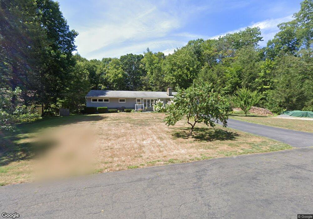
15 Woodland Dr Harwinton, CT 06791
Estimated Value: $380,000 - $435,000
3
Beds
2
Baths
1,456
Sq Ft
$277/Sq Ft
Est. Value
About This Home
This home is located at 15 Woodland Dr, Harwinton, CT 06791 and is currently estimated at $402,612, approximately $276 per square foot. 15 Woodland Dr is a home located in Litchfield County with nearby schools including Harwinton Consolidated School, Har-Bur Middle School, and Lewis S. Mills High School.
Ownership History
Date
Name
Owned For
Owner Type
Purchase Details
Closed on
Oct 28, 1996
Sold by
Farkas John A
Bought by
Steeves Eric and Steeves Jennifer L
Current Estimated Value
Home Financials for this Owner
Home Financials are based on the most recent Mortgage that was taken out on this home.
Original Mortgage
$106,800
Interest Rate
7.63%
Mortgage Type
Unknown
Purchase Details
Closed on
Jul 1, 1988
Sold by
Pierce Kevin M
Bought by
Farkas John A
Create a Home Valuation Report for This Property
The Home Valuation Report is an in-depth analysis detailing your home's value as well as a comparison with similar homes in the area
Home Values in the Area
Average Home Value in this Area
Purchase History
| Date | Buyer | Sale Price | Title Company |
|---|---|---|---|
| Steeves Eric | $133,500 | -- | |
| Steeves Eric | $133,500 | -- | |
| Farkas John A | $166,000 | -- |
Source: Public Records
Mortgage History
| Date | Status | Borrower | Loan Amount |
|---|---|---|---|
| Open | Farkas John A | $69,000 | |
| Closed | Farkas John A | $20,000 | |
| Closed | Farkas John A | $130,000 | |
| Closed | Farkas John A | $106,800 |
Source: Public Records
Tax History Compared to Growth
Tax History
| Year | Tax Paid | Tax Assessment Tax Assessment Total Assessment is a certain percentage of the fair market value that is determined by local assessors to be the total taxable value of land and additions on the property. | Land | Improvement |
|---|---|---|---|---|
| 2025 | $4,638 | $201,640 | $57,130 | $144,510 |
| 2024 | $4,618 | $201,640 | $57,130 | $144,510 |
| 2023 | $3,929 | $134,550 | $40,810 | $93,740 |
| 2022 | $3,835 | $134,550 | $40,810 | $93,740 |
| 2021 | $3,862 | $134,550 | $40,810 | $93,740 |
| 2020 | $3,767 | $134,550 | $40,810 | $93,740 |
| 2019 | $3,767 | $134,550 | $40,810 | $93,740 |
| 2018 | $3,789 | $135,330 | $43,110 | $92,220 |
| 2017 | $3,762 | $135,330 | $43,110 | $92,220 |
| 2016 | $3,762 | $135,330 | $43,110 | $92,220 |
| 2015 | $3,695 | $135,330 | $43,110 | $92,220 |
| 2014 | $3,640 | $135,330 | $43,110 | $92,220 |
Source: Public Records
Map
Nearby Homes
- 164 Birge Park Rd
- 74 Pine Ridge Dr
- 73 Shirley Rd
- 21 Oak Meadow Ln
- 51 Bradford Rd
- 111 Oxbow Dr
- 69 Sunrise Dr
- 21 South Rd
- 144 Morningside Dr
- 33 Dawn Ave
- 410 Circle Dr
- 325 Circle Dr
- 175 Ramstein Rd
- 29 Hannah Way
- 141 Highfield Dr
- 157 Edgewood Dr
- 178 Edgewood Dr
- 595 Torringford St
- 29 Branch Rd
- 100 Nutmeg Dr
- 14 Woodland Dr
- 22 Woodland Dr
- 21 Woodland Dr
- 29 Woodland Dr
- 28 Woodland Dr
- 204 Lead Mine Brook Rd
- 196 Lead Mine Brook Rd
- 34 Woodland Dr
- 192 Lead Mine Brook Rd
- 38 Woodland Dr
- 37 Woodland Dr
- 20 Beechwood Dr
- 24 Beechwood Dr
- 14 Beechwood Dr
- 11 Ridgewood Dr
- 5 Ridgewood Dr
- 9 Ridgewood Dr
- 43 Woodland Dr
- 19 Ridgewood Dr
- 205 Lead Mine Brook Rd