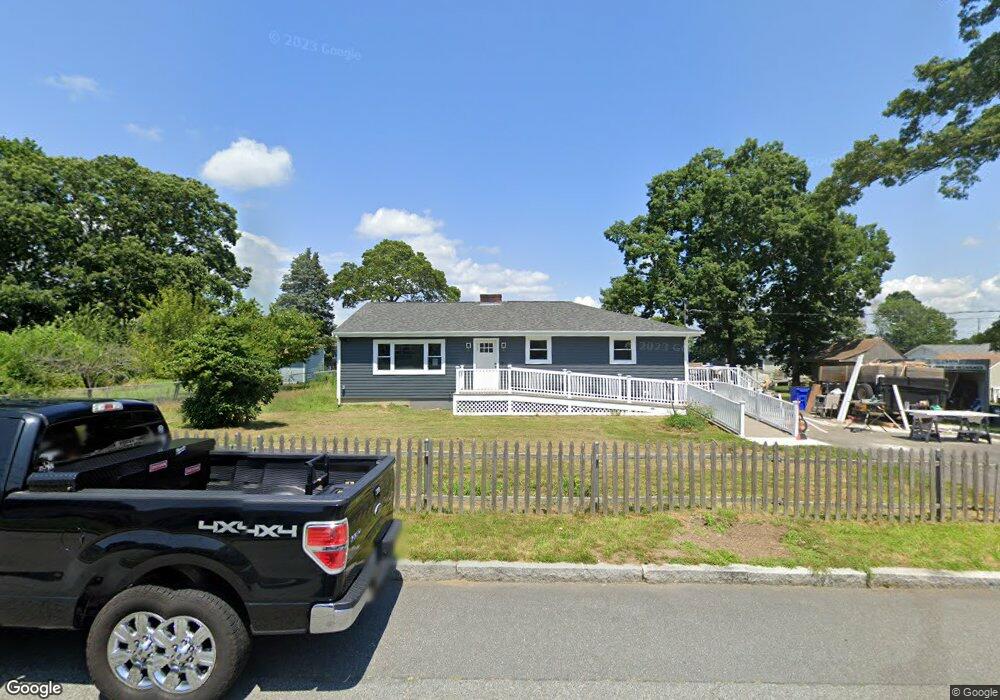
150 Wood St Fall River, MA 02721
Maplewood NeighborhoodEstimated Value: $337,000 - $420,000
3
Beds
1
Bath
1,064
Sq Ft
$366/Sq Ft
Est. Value
About This Home
This home is located at 150 Wood St, Fall River, MA 02721 and is currently estimated at $389,212, approximately $365 per square foot. 150 Wood St is a home located in Bristol County with nearby schools including Letourneau Elementary School, Matthew J. Kuss Middle School, and B M C Durfee High School.
Ownership History
Date
Name
Owned For
Owner Type
Purchase Details
Closed on
May 5, 2025
Sold by
Shovelton Sheila
Bought by
Shovelton Peter
Current Estimated Value
Home Financials for this Owner
Home Financials are based on the most recent Mortgage that was taken out on this home.
Original Mortgage
$106,000
Outstanding Balance
$105,433
Interest Rate
6.64%
Mortgage Type
New Conventional
Estimated Equity
$283,779
Purchase Details
Closed on
May 27, 1997
Sold by
Medeiros Nina
Bought by
Shovelton Peter and Shovelton Sheila
Create a Home Valuation Report for This Property
The Home Valuation Report is an in-depth analysis detailing your home's value as well as a comparison with similar homes in the area
Home Values in the Area
Average Home Value in this Area
Purchase History
| Date | Buyer | Sale Price | Title Company |
|---|---|---|---|
| Shovelton Peter | -- | Stewart Title | |
| Shovelton Peter | -- | Stewart Title | |
| Shovelton Peter | $111,000 | -- | |
| Shovelton Peter | $111,000 | -- |
Source: Public Records
Mortgage History
| Date | Status | Borrower | Loan Amount |
|---|---|---|---|
| Open | Shovelton Peter | $106,000 | |
| Previous Owner | Shovelton Peter | $136,000 | |
| Previous Owner | Shovelton Peter | $23,927 |
Source: Public Records
Tax History Compared to Growth
Tax History
| Year | Tax Paid | Tax Assessment Tax Assessment Total Assessment is a certain percentage of the fair market value that is determined by local assessors to be the total taxable value of land and additions on the property. | Land | Improvement |
|---|---|---|---|---|
| 2025 | $3,870 | $338,000 | $142,700 | $195,300 |
| 2024 | $3,625 | $315,500 | $137,300 | $178,200 |
| 2023 | $3,553 | $289,600 | $130,700 | $158,900 |
| 2022 | $3,139 | $248,700 | $121,000 | $127,700 |
| 2021 | $3,126 | $226,000 | $120,800 | $105,200 |
| 2020 | $3,006 | $208,000 | $114,100 | $93,900 |
| 2019 | $2,777 | $190,500 | $112,000 | $78,500 |
| 2018 | $2,746 | $187,800 | $112,000 | $75,800 |
| 2017 | $2,562 | $183,000 | $108,700 | $74,300 |
| 2016 | $2,440 | $179,000 | $108,700 | $70,300 |
| 2015 | $2,430 | $185,800 | $108,700 | $77,100 |
| 2014 | $2,337 | $185,800 | $108,700 | $77,100 |
Source: Public Records
Map
Nearby Homes
- 142 Norman St
- 0 Stafford Rd Unit 1393774
- 0 Stafford Rd Unit 73431501
- 228 Dickinson St
- 217 Napoleon St
- 1441 Stafford Rd
- 0 Hancock St
- 0 Wood St
- 38 Hummingbird Ln
- 18 Mockingbird Ln
- 185 Stafford Rd
- 415 Anthony St
- 871 Norman St
- 206 Songbird Ln
- 64 Robin Dr Unit 2-84
- 951 Dickinson St
- 961 Wood St
- 70 Robin Dr
- 84 Lark Ln
- 3 Blackbird St