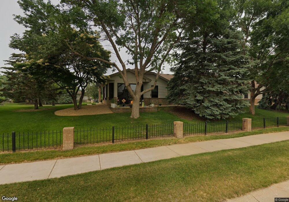
15015 Derby Cir Rosemount, MN 55068
Estimated Value: $318,000 - $345,000
2
Beds
2
Baths
1,481
Sq Ft
$227/Sq Ft
Est. Value
About This Home
This home is located at 15015 Derby Cir, Rosemount, MN 55068 and is currently estimated at $335,540, approximately $226 per square foot. 15015 Derby Cir is a home located in Dakota County with nearby schools including East Lake Elementary School, Rosemount Middle School, and Rosemount Senior High School.
Ownership History
Date
Name
Owned For
Owner Type
Purchase Details
Closed on
Oct 19, 2020
Sold by
Johnson Maria R and Johnson Dean
Bought by
Nystrom Calvin and Nystrom Priscilla
Current Estimated Value
Purchase Details
Closed on
Nov 16, 2016
Sold by
Narloch George T and Narloch Jane E
Bought by
Narloch Jane E
Purchase Details
Closed on
Aug 31, 2001
Sold by
Kammueller Lynn A and Kammueller Davie C
Bought by
Narloch Jane E and Narloch George T
Create a Home Valuation Report for This Property
The Home Valuation Report is an in-depth analysis detailing your home's value as well as a comparison with similar homes in the area
Home Values in the Area
Average Home Value in this Area
Purchase History
| Date | Buyer | Sale Price | Title Company |
|---|---|---|---|
| Nystrom Calvin | $276,000 | Burnet Title | |
| Narloch Jane E | -- | Attorney | |
| Narloch Jane E | $179,950 | -- | |
| Nystrom Calvin Calvin | $276,000 | -- |
Source: Public Records
Tax History Compared to Growth
Tax History
| Year | Tax Paid | Tax Assessment Tax Assessment Total Assessment is a certain percentage of the fair market value that is determined by local assessors to be the total taxable value of land and additions on the property. | Land | Improvement |
|---|---|---|---|---|
| 2024 | $3,262 | $302,600 | $53,500 | $249,100 |
| 2023 | $3,262 | $307,200 | $58,600 | $248,600 |
| 2022 | $2,710 | $289,200 | $58,400 | $230,800 |
| 2021 | $2,696 | $249,300 | $50,800 | $198,500 |
| 2020 | $2,604 | $243,100 | $48,300 | $194,800 |
| 2019 | $2,153 | $225,500 | $46,000 | $179,500 |
| 2018 | $2,038 | $198,800 | $39,500 | $159,300 |
| 2017 | $2,100 | $185,900 | $37,600 | $148,300 |
| 2016 | $1,959 | $183,600 | $36,500 | $147,100 |
| 2015 | $1,821 | $148,278 | $30,579 | $117,699 |
| 2014 | -- | $137,051 | $28,284 | $108,767 |
| 2013 | -- | $123,644 | $24,377 | $99,267 |
Source: Public Records
Map
Nearby Homes
- 15068 Derby Cir
- 15008 December Way
- 4265 Upper 149th St W
- 15109 Cimarron Way
- 14880 Delft Ave W
- 14896 Cimarron Ave W
- 15490 Darjeeling Path
- 14795 Cimarron Ave W
- Bristol Plan at Amber Fields - Landmark Collection
- Itasca Plan at Amber Fields - Landmark Collection
- Lewis Plan at Amber Fields - Landmark Collection
- 1065 Achilles Dr
- Sinclair Plan at Amber Fields - Landmark Collection
- Washburn Plan at Amber Fields - Landmark Collection
- 3657 155th St W
- 15078 Dunwood Trail Unit 33
- 3633 147th St W
- 3615 156th St W
- 3610 156th St W
- 3567 156th St W
- 15019 Derby Cir
- 15023 Derby Cir
- 15011 Derby Cir
- 15007 Derby Cir
- 15027 Derby Cir
- 15003 Derby Cir
- 15031 Derby Cir
- 15188 December Trail
- 15186 December Trail
- 15036 Derby Cir
- 15035 Derby Cir
- 15182 December Trail
- 15039 Derby Cir
- 15180 December Trail
- 15041 Derby Cir
- 15116 Derby Cir
- 15064 Derby Cir
- 15112 Derby Cir
- 15137 Derby Cir
- 15045 Derby Cir