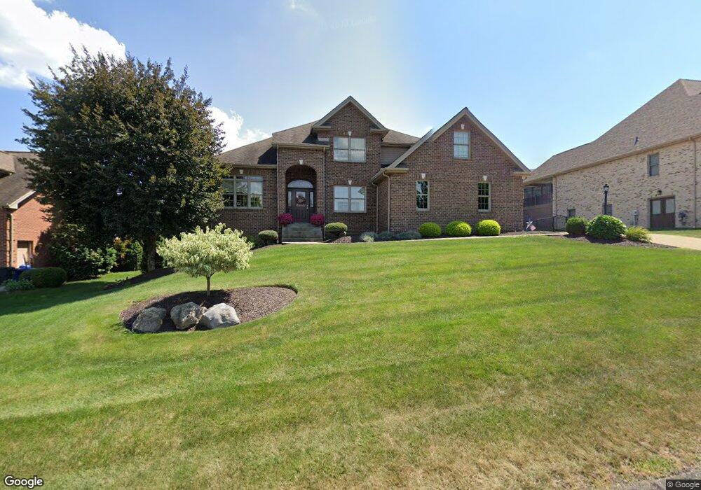
1508 Network Dr Canonsburg, PA 15317
Estimated Value: $662,408 - $882,000
4
Beds
4
Baths
2,627
Sq Ft
$296/Sq Ft
Est. Value
About This Home
This home is located at 1508 Network Dr, Canonsburg, PA 15317 and is currently estimated at $778,602, approximately $296 per square foot. 1508 Network Dr is a home located in Washington County with nearby schools including Canon-Mcmillan Senior High School.
Ownership History
Date
Name
Owned For
Owner Type
Purchase Details
Closed on
Mar 13, 2009
Sold by
Graziani William M
Bought by
Christoff Ryan M
Current Estimated Value
Home Financials for this Owner
Home Financials are based on the most recent Mortgage that was taken out on this home.
Original Mortgage
$45,500
Outstanding Balance
$28,947
Interest Rate
5.14%
Mortgage Type
Credit Line Revolving
Estimated Equity
$749,655
Create a Home Valuation Report for This Property
The Home Valuation Report is an in-depth analysis detailing your home's value as well as a comparison with similar homes in the area
Home Values in the Area
Average Home Value in this Area
Purchase History
| Date | Buyer | Sale Price | Title Company |
|---|---|---|---|
| Christoff Ryan M | $455,000 | -- |
Source: Public Records
Mortgage History
| Date | Status | Borrower | Loan Amount |
|---|---|---|---|
| Open | Christoff Ryan M | $45,500 |
Source: Public Records
Tax History Compared to Growth
Tax History
| Year | Tax Paid | Tax Assessment Tax Assessment Total Assessment is a certain percentage of the fair market value that is determined by local assessors to be the total taxable value of land and additions on the property. | Land | Improvement |
|---|---|---|---|---|
| 2025 | $7,423 | $440,800 | $100,200 | $340,600 |
| 2024 | $7,022 | $440,800 | $100,200 | $340,600 |
| 2023 | $7,022 | $440,800 | $100,200 | $340,600 |
| 2022 | $7,001 | $440,800 | $100,200 | $340,600 |
| 2021 | $7,001 | $440,800 | $100,200 | $340,600 |
| 2020 | $6,868 | $440,800 | $100,200 | $340,600 |
| 2019 | $6,680 | $440,800 | $100,200 | $340,600 |
| 2018 | $6,544 | $435,700 | $100,200 | $335,500 |
| 2017 | $961 | $435,700 | $100,200 | $335,500 |
| 2016 | $961 | $38,595 | $6,976 | $31,619 |
| 2015 | $632 | $38,595 | $6,976 | $31,619 |
| 2014 | $961 | $38,595 | $6,976 | $31,619 |
| 2013 | $961 | $38,595 | $6,976 | $31,619 |
Source: Public Records
Map
Nearby Homes
- 1041 Skyline Dr
- 1037 Skyline Dr
- 1033 Skyline Dr
- 1065 Skyline Dr
- 1272 Mcewen Rd
- 1582 Network Dr
- 214 Hooks Ln
- 1382 Lucia Dr
- 1163 Mcewen Ave
- 510 Panorama Dr
- 520 Panorama Dr
- 209 Joseph Dr
- 9 Puskar Ln
- 1116 Martin Dr
- 718 Gladden Rd
- 29 Virginia Ln
- 10 Muse-Bishop Rd
- 4084 Overview Dr
- 3016 Brookstone Dr
- 1137 1st St
- 1512 Network Dr
- 1516 Network Dr
- 1001 Buck Run Rd
- 1472 Network Dr
- 1492 Network Dr
- 504 Breezewood Dr
- 604 Breezewood Dr
- 522 Breezewood Dr
- 524 Breezewood Dr
- 606 Breezewood Dr
- 614 Breezewood Dr
- 602 Breezewood Dr
- 610 Breezewood Dr
- 608 Breezewood Dr
- 612 Breezewood Dr
- 618 Breezewood Dr
- 616 Breezewood Dr
- 1004 Breezewood Dr
- 1468 Network Dr
- 1424 Network Dr Unit Lot 820