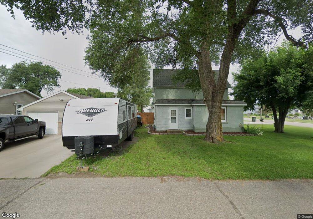
151 Fir Ave NW Richmond, MN 56368
Estimated Value: $159,573 - $239,000
3
Beds
1
Bath
1,048
Sq Ft
$180/Sq Ft
Est. Value
About This Home
This home is located at 151 Fir Ave NW, Richmond, MN 56368 and is currently estimated at $188,893, approximately $180 per square foot. 151 Fir Ave NW is a home located in Stearns County with nearby schools including Rocori Senior High School and Saints Peter & Paul Catholic School.
Ownership History
Date
Name
Owned For
Owner Type
Purchase Details
Closed on
Dec 22, 2017
Sold by
Rapaway Daniel and Rapaway Rebecca L
Bought by
Peterson Zachary D
Current Estimated Value
Purchase Details
Closed on
Apr 15, 2010
Sold by
Deutsche Bank National Trust Company
Bought by
Middendorf Donavon J
Purchase Details
Closed on
May 29, 1998
Sold by
Molitor
Bought by
Beckers
Purchase Details
Closed on
May 2, 1997
Sold by
Gssr Development Inc
Bought by
Watt
Purchase Details
Closed on
Apr 29, 1997
Sold by
Watt
Bought by
Molitor
Purchase Details
Closed on
Nov 1, 1994
Sold by
Gsr Development Inc
Bought by
Watt Jason
Create a Home Valuation Report for This Property
The Home Valuation Report is an in-depth analysis detailing your home's value as well as a comparison with similar homes in the area
Home Values in the Area
Average Home Value in this Area
Purchase History
| Date | Buyer | Sale Price | Title Company |
|---|---|---|---|
| Peterson Zachary D | $91,500 | -- | |
| Middendorf Donavon J | $37,000 | -- | |
| Beckers | $56,000 | -- | |
| Watt | -- | -- | |
| Molitor | $37,000 | -- | |
| Watt Jason | $30,000 | -- |
Source: Public Records
Tax History Compared to Growth
Tax History
| Year | Tax Paid | Tax Assessment Tax Assessment Total Assessment is a certain percentage of the fair market value that is determined by local assessors to be the total taxable value of land and additions on the property. | Land | Improvement |
|---|---|---|---|---|
| 2025 | $1,086 | $124,600 | $23,600 | $101,000 |
| 2024 | $1,086 | $115,000 | $23,600 | $91,400 |
| 2023 | $1,010 | $107,100 | $21,700 | $85,400 |
| 2022 | $918 | $87,500 | $19,800 | $67,700 |
| 2021 | $938 | $87,500 | $19,800 | $67,700 |
| 2020 | $980 | $87,500 | $19,800 | $67,700 |
| 2019 | $884 | $87,500 | $19,800 | $67,700 |
| 2018 | $1,312 | $77,600 | $18,600 | $59,000 |
| 2017 | $1,262 | $73,600 | $18,600 | $55,000 |
| 2016 | $1,264 | $0 | $0 | $0 |
| 2015 | $1,246 | $0 | $0 | $0 |
| 2014 | -- | $0 | $0 | $0 |
Source: Public Records
Map
Nearby Homes
- 148 Main St W
- 261 Main St W
- 577 Main St W
- 205 Grant Ave SW
- 153 Central Ave S
- 232 Main St E
- 101 Barry Loop NW
- 448 1st St NE
- 464 Main St E
- 22296 Hall Ave SW
- XXX Eastfield Dr
- 22579 Fordham Rd
- 21107 State Highway 23
- 20734 Black Cherry Dr
- 21312 State Highway 22 #4
- 21312 State Highway 22 Unit 20
- 21312 State Highway 22 Unit 25
- 22314 Mallard Ct
- 20554 Elkview Ct
- 20568 Elkview Ct