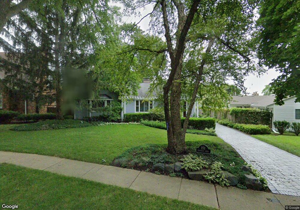
151 Homewood Ave Libertyville, IL 60048
Estimated Value: $628,000 - $717,000
--
Bed
2
Baths
2,138
Sq Ft
$315/Sq Ft
Est. Value
About This Home
This home is located at 151 Homewood Ave, Libertyville, IL 60048 and is currently estimated at $674,461, approximately $315 per square foot. 151 Homewood Ave is a home located in Lake County with nearby schools including Butterfield School, Highland Middle School, and Libertyville High School.
Ownership History
Date
Name
Owned For
Owner Type
Purchase Details
Closed on
Mar 28, 2025
Sold by
Peron Robert L and Fisher Sheila J
Bought by
Robert L Peron Living Trust and Sheila J Fisher Living Trust
Current Estimated Value
Purchase Details
Closed on
Oct 27, 1998
Sold by
Johnson Timothy L and Johnson Kimberly A
Bought by
Peron Robert L and Fisher Sheila J
Home Financials for this Owner
Home Financials are based on the most recent Mortgage that was taken out on this home.
Original Mortgage
$227,000
Interest Rate
6.59%
Create a Home Valuation Report for This Property
The Home Valuation Report is an in-depth analysis detailing your home's value as well as a comparison with similar homes in the area
Home Values in the Area
Average Home Value in this Area
Purchase History
| Date | Buyer | Sale Price | Title Company |
|---|---|---|---|
| Robert L Peron Living Trust | -- | None Listed On Document | |
| Peron Robert L | $285,000 | First American Title |
Source: Public Records
Mortgage History
| Date | Status | Borrower | Loan Amount |
|---|---|---|---|
| Previous Owner | Peron Robert L | $227,000 |
Source: Public Records
Tax History Compared to Growth
Tax History
| Year | Tax Paid | Tax Assessment Tax Assessment Total Assessment is a certain percentage of the fair market value that is determined by local assessors to be the total taxable value of land and additions on the property. | Land | Improvement |
|---|---|---|---|---|
| 2024 | $12,054 | $179,624 | $115,605 | $64,019 |
| 2023 | $13,783 | $165,674 | $106,627 | $59,047 |
| 2022 | $13,783 | $183,338 | $102,487 | $80,851 |
| 2021 | $13,262 | $179,392 | $100,281 | $79,111 |
| 2020 | $12,757 | $176,376 | $98,595 | $77,781 |
| 2019 | $12,816 | $174,698 | $97,657 | $77,041 |
| 2018 | $13,018 | $183,217 | $101,674 | $81,543 |
| 2017 | $12,838 | $177,433 | $98,464 | $78,969 |
| 2016 | $12,415 | $168,230 | $93,357 | $74,873 |
| 2015 | $12,307 | $157,239 | $87,258 | $69,981 |
| 2014 | $11,303 | $147,742 | $81,988 | $65,754 |
| 2012 | $10,597 | $143,291 | $79,518 | $63,773 |
Source: Public Records
Map
Nearby Homes
- 551 W Park Ave Unit E
- 420 W Cook Ave
- 505 Lange Ct
- 212 Elm Ct
- 308 Mckinley Ave
- 423 Ames St
- 1754 Glenmore Rd
- 0 Ames St
- 217 E Church St
- 533 Drake St
- 619 Parkside Ct
- 212 W Ellis Ave
- 426 S Milwaukee Ave
- 616 Parkside Ct
- 662 Parkside Ct
- 208 W Ellis Ave
- 694 Parkside Ct
- 204 W Ellis Ave
- 922 N Milwaukee Ave Unit A
- 224 Newberry Ave
- 145 Homewood Ave
- 503 Linden Ln
- 139 Homewood Ave
- 226 Sunset Dr
- 220 Sunset Dr
- 214 Sunset Dr
- 232 Sunset Dr
- 205 Homewood Ave
- 146 Homewood Ave
- 208 Sunset Dr
- 236 Sunset Dr
- 140 Homewood Ave
- 131 Homewood Ave
- 202 Sunset Dr
- 136 Homewood Ave
- 213 Homewood Ave
- 134 Sunset Dr
- 130 Homewood Ave
- 125 Homewood Ave
- 130 Sunset Dr