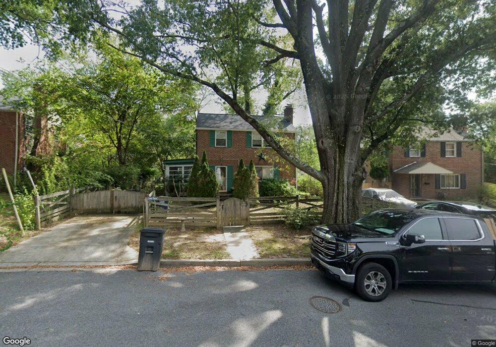
1511 Elson St Takoma Park, MD 20912
Lewisdale NeighborhoodEstimated Value: $435,412 - $510,000
--
Bed
2
Baths
1,196
Sq Ft
$396/Sq Ft
Est. Value
About This Home
This home is located at 1511 Elson St, Takoma Park, MD 20912 and is currently estimated at $473,353, approximately $395 per square foot. 1511 Elson St is a home located in Prince George's County with nearby schools including Carole Highlands Elementary School, Buck Lodge Middle School, and High Point High School.
Ownership History
Date
Name
Owned For
Owner Type
Purchase Details
Closed on
Jul 11, 2017
Sold by
Jones Frances E and Jones Frances E
Bought by
Brown Patricia Darnelle
Current Estimated Value
Purchase Details
Closed on
Aug 12, 1999
Sold by
Ones Raymond M Frances E
Bought by
Jonesfrances E Trustee
Purchase Details
Closed on
Sep 5, 1996
Sold by
Moyer James R
Bought by
Jones Raymond M Frances E
Purchase Details
Closed on
Dec 13, 1983
Sold by
Plante William H
Bought by
Moyer James R and Moyer Sherry C
Create a Home Valuation Report for This Property
The Home Valuation Report is an in-depth analysis detailing your home's value as well as a comparison with similar homes in the area
Home Values in the Area
Average Home Value in this Area
Purchase History
| Date | Buyer | Sale Price | Title Company |
|---|---|---|---|
| Brown Patricia Darnelle | -- | No Title Insurance | |
| Jonesfrances E Trustee | -- | -- | |
| Jones Raymond M Frances E | $129,000 | -- | |
| Moyer James R | $79,000 | -- |
Source: Public Records
Tax History Compared to Growth
Tax History
| Year | Tax Paid | Tax Assessment Tax Assessment Total Assessment is a certain percentage of the fair market value that is determined by local assessors to be the total taxable value of land and additions on the property. | Land | Improvement |
|---|---|---|---|---|
| 2025 | $5,257 | $375,667 | -- | -- |
| 2024 | $5,257 | $347,800 | $115,400 | $232,400 |
| 2023 | $5,129 | $340,733 | $0 | $0 |
| 2022 | $4,948 | $333,667 | $0 | $0 |
| 2021 | $4,775 | $326,600 | $100,200 | $226,400 |
| 2020 | $4,686 | $314,000 | $0 | $0 |
| 2019 | $4,570 | $301,400 | $0 | $0 |
| 2018 | $4,407 | $288,800 | $75,200 | $213,600 |
| 2017 | $4,228 | $257,733 | $0 | $0 |
| 2016 | -- | $226,667 | $0 | $0 |
| 2015 | $3,787 | $195,600 | $0 | $0 |
| 2014 | $3,787 | $195,600 | $0 | $0 |
Source: Public Records
Map
Nearby Homes
- 7308 15th Place
- 1505 Drexel St
- 7107 13th Ave
- 7333 New Hampshire Ave Unit 510
- 7333 New Hampshire Ave
- 7333 New Hampshire Ave Unit 1217
- 7333 New Hampshire Ave Unit 112
- 7333 New Hampshire Ave Unit 816
- 7333 New Hampshire Ave Unit 311
- 7606 15th Ave
- 7401 18th Ave Unit 208
- 7015 18th Ave
- 1011 Hopewell Ave
- 1112 Lancaster Rd
- 6813 10th Ave
- 7002 Riggs Rd
- 903 Heather Ave
- 6914 New Hampshire Ave
- 7605 Wildwood Dr
- 811 Sligo Creek Pkwy