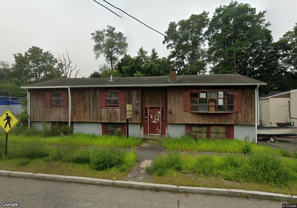
1512 N Main St Palmer, MA 01069
Estimated Value: $154,867
4
Beds
2
Baths
2,362
Sq Ft
$66/Sq Ft
Est. Value
About This Home
This home is located at 1512 N Main St, Palmer, MA 01069 and is currently estimated at $154,867, approximately $65 per square foot. 1512 N Main St is a home located in Hampden County with nearby schools including Old Mill Pond Elementary School, Converse Middle School, and Palmer High School.
Ownership History
Date
Name
Owned For
Owner Type
Purchase Details
Closed on
Feb 22, 2024
Sold by
Wicked Deals Llc
Bought by
Nsroma Multi Buses Corp
Current Estimated Value
Purchase Details
Closed on
Dec 29, 2021
Sold by
Palmer Town Of
Bought by
Wicked Deals Llc
Home Financials for this Owner
Home Financials are based on the most recent Mortgage that was taken out on this home.
Original Mortgage
$100,000
Interest Rate
3.11%
Mortgage Type
Purchase Money Mortgage
Purchase Details
Closed on
Apr 4, 1985
Bought by
Theriault Nancy J and Theriault Barbara A
Create a Home Valuation Report for This Property
The Home Valuation Report is an in-depth analysis detailing your home's value as well as a comparison with similar homes in the area
Home Values in the Area
Average Home Value in this Area
Purchase History
| Date | Buyer | Sale Price | Title Company |
|---|---|---|---|
| Nsroma Multi Buses Corp | $135,000 | None Available | |
| Wicked Deals Llc | $80,000 | None Available | |
| Theriault Nancy J | -- | -- |
Source: Public Records
Mortgage History
| Date | Status | Borrower | Loan Amount |
|---|---|---|---|
| Previous Owner | Wicked Deals Llc | $100,000 |
Source: Public Records
Tax History Compared to Growth
Tax History
| Year | Tax Paid | Tax Assessment Tax Assessment Total Assessment is a certain percentage of the fair market value that is determined by local assessors to be the total taxable value of land and additions on the property. | Land | Improvement |
|---|---|---|---|---|
| 2025 | $2,973 | $163,800 | $95,100 | $68,700 |
| 2024 | $2,786 | $149,200 | $86,400 | $62,800 |
| 2023 | $2,792 | $143,600 | $86,400 | $57,200 |
| 2022 | $2,874 | $134,300 | $80,800 | $53,500 |
| 2021 | $3,066 | $135,500 | $89,700 | $45,800 |
| 2020 | $3,089 | $135,500 | $89,700 | $45,800 |
| 2019 | $3,000 | $135,500 | $89,700 | $45,800 |
| 2018 | $2,976 | $134,800 | $87,000 | $47,800 |
| 2017 | $2,908 | $134,800 | $87,000 | $47,800 |
| 2016 | $2,823 | $132,700 | $84,500 | $48,200 |
| 2015 | $2,738 | $132,700 | $84,500 | $48,200 |
Source: Public Records
Map
Nearby Homes
- 1029 Wilson St
- 44 Converse St
- 1682 N Main St
- 1018-1020 Maple St
- Lot 0 Thorndike and Lawrence St
- 62-91 Lawrence St
- Lots 39-42 Lawrence
- 0 St Unit 73414881
- 2034 Pleasant St
- 72 Quaboag Valley Co Op St Unit 70
- L 65-35-1 Pine Hill Dr
- 1247 Calkins Rd
- 15 Quaboag Valley Co-Op St Unit 15
- 160 Breckenridge St
- 207 Breckenridge St
- 2077 Calkins Rd
- Lot 8 Breckenridge St
- 22 Pine View
- 0 Hovey Rd
- 187 Hovey Rd
- 1505 N Main St
- 1505 N Main St Unit 2nd floor
- 1505 N Main St
- 1525 N Main St Unit 2
- 1525 N Main St
- 1504 N Main St
- 8 Holbrook St
- 17 Rockview St Unit 19
- 1501 N Main St
- 10 Holbrook St
- 21 Rockview St
- 5 Holbrook St
- 14 Rockview St
- 1500 N Main St
- 1528 N Main St
- 1528 N Main St Unit 2nd Fl
- 1497 N Main St
- 9 Holbrook St
- 12 Holbrook St
- 25 Rockview St Unit 27