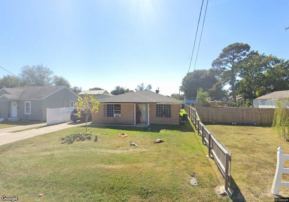
1515 Sabine Ave Port Arthur, TX 77642
Estimated Value: $59,000 - $102,484
--
Bed
--
Bath
1,105
Sq Ft
$76/Sq Ft
Est. Value
About This Home
This home is located at 1515 Sabine Ave, Port Arthur, TX 77642 and is currently estimated at $84,121, approximately $76 per square foot. 1515 Sabine Ave is a home located in Jefferson County with nearby schools including Travis Elementary School, Jefferson Middle School, and Memorial High School.
Ownership History
Date
Name
Owned For
Owner Type
Purchase Details
Closed on
Mar 30, 2010
Sold by
Maisonneuve Alain and Maisonneuve Bernadette
Bought by
Barajas Cuauhtemoc
Current Estimated Value
Home Financials for this Owner
Home Financials are based on the most recent Mortgage that was taken out on this home.
Original Mortgage
$58,814
Outstanding Balance
$39,172
Interest Rate
5%
Mortgage Type
FHA
Estimated Equity
$44,949
Purchase Details
Closed on
Apr 6, 2007
Sold by
Trow Gloria and Fischer Carl R
Bought by
Maisonneuve Alain and Maisonneuve Bernadette
Create a Home Valuation Report for This Property
The Home Valuation Report is an in-depth analysis detailing your home's value as well as a comparison with similar homes in the area
Home Values in the Area
Average Home Value in this Area
Purchase History
| Date | Buyer | Sale Price | Title Company |
|---|---|---|---|
| Barajas Cuauhtemoc | -- | None Available | |
| Maisonneuve Alain | -- | None Available |
Source: Public Records
Mortgage History
| Date | Status | Borrower | Loan Amount |
|---|---|---|---|
| Open | Barajas Cuauhtemoc | $58,814 |
Source: Public Records
Tax History Compared to Growth
Tax History
| Year | Tax Paid | Tax Assessment Tax Assessment Total Assessment is a certain percentage of the fair market value that is determined by local assessors to be the total taxable value of land and additions on the property. | Land | Improvement |
|---|---|---|---|---|
| 2025 | $956 | $84,999 | -- | -- |
| 2024 | $956 | $77,272 | -- | -- |
| 2023 | $956 | $70,247 | $0 | $0 |
| 2022 | $2,028 | $63,861 | $0 | $0 |
| 2021 | $1,924 | $71,226 | $2,475 | $68,751 |
| 2020 | $1,170 | $52,777 | $2,475 | $50,302 |
| 2019 | $1,588 | $49,820 | $2,480 | $47,340 |
| 2018 | $1,047 | $49,820 | $2,480 | $47,340 |
| 2017 | $1,122 | $53,770 | $2,480 | $51,290 |
| 2016 | $1,575 | $53,770 | $2,480 | $51,290 |
| 2015 | $1,331 | $57,710 | $2,480 | $55,230 |
| 2014 | $1,331 | $57,710 | $2,480 | $55,230 |
Source: Public Records
Map
Nearby Homes
- 4100 Dryden Rd
- 3945 12th St
- 1349 Jefferson Dr
- 2129 Neches Ave
- 2515 Glenwood Dr
- 2301 Glenwood Dr
- 0 5th St
- 2515 Date St
- 2325 Oaklawn Ave
- LOT 55 Royal Meadows Estate
- 2621 Evergreen Dr
- 3512 7th St
- 4015 Lakeshore Dr
- 3326 Thomas Blvd
- 4600 Lakeshore Dr
- 3737 Lakeshore Dr
- 4501 Springdale St
- 3439 5th St
- 3401 6th St
- 3300 9th St
- 1509 Sabine Ave
- 1535 Sabine Ave
- 1501 Sabine Ave
- 1516 Rosedale Dr
- 1508 Rosedale Dr
- 1524 Rosedale Dr
- 1447 Sabine Ave
- 1500 Rosedale Dr
- 1534 Rosedale Dr
- 1400 Rosedale Dr
- 1539 Sabine Ave
- 1538 Rosedale Dr
- 1448 Sabine Ave
- 1435 Sabine Ave
- 1548 Rosedale Dr
- 1607 Sabine Ave
- 4048 Brinkman Dr
- 1440 Sabine Ave
- 4049 Brinkman Dr
- 1411 Sabine Ave